Emergency crews battle two separate fires in Bend on Sunday

Gregory Deffenbaugh

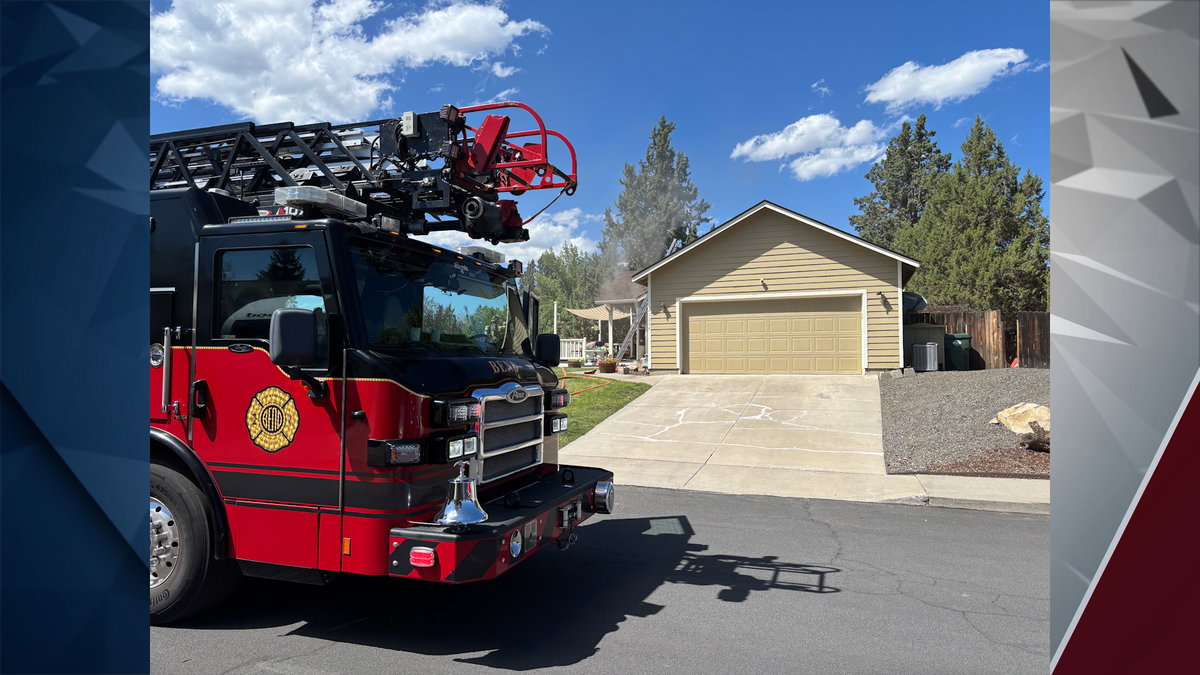
BEND, Ore. (KTVZ) — Two separate fires kept Bend emergency crews busy today, including a brush fire behind the Red Lion Hotel on Butler Market Road and a residential fire on Starling Drive. The brush fire, believed to have originated from an abandoned fire in a houseless encampment, burned slightly over one acre. The residential fire, caused by food left on a stove, resulted in an estimated $100,000 in damages.

The incidents occurred this afternoon, with emergency personnel responding to the brush fire at 1:46 p.m. and the house fire reported at 2:49 p.m.

Bend Fire & Rescue, with assistance from Bend Police and the US Forest Service, quickly contained the brush fire. The Red Lion Hotel was evacuated as a precaution, but occupants were allowed back inside within an hour. While crews managed the brush fire, a second call came in for a house fire on Bend’s east side.

The house fire on Starling Drive was initially dispatched to Redmond Fire because all Bend fire engines were occupied with the brush fire. First arriving crews found smoke coming from the house and confirmed no one was home. The fire and smoke caused damage throughout the entire home before being extinguished.

The residential fire was caused by the occupants accidentally leaving food on the stove. The owners had returned home earlier in the day and then left again, forgetting the food. Red Cross is assisting the homeowners with housing until their homeowner’s insurance can provide further help.

Click here to follow the original article.

Jefferson County School District cancels summer programs amid wildfire concerns

Tracee Tuesday

MADRAS, Ore. (KTVZ) — The Jefferson County School District has canceled all summer programming for Monday, July 27, citing rapidly changing wildfire conditions and ongoing evacuations in the area.

The closure affects all sites across the district, including Madras Elementary, Bridges High School and Madras High School. Summer meal services will also be unavailable for the day.

District leaders said the decision comes after the Bench and Beachcomb fires showed unpredictable behavior and significant growth overnight, impacting families throughout the region.

Many residents remain in evacuation zones, prompting concerns about safety and accessibility for students and staff.

School officials acknowledged the disruption for families and expressed appreciation for the community’s flexibility during the situation. They also shared support for those affected by the fires and gratitude for firefighters working to contain them.

The district plans to provide an update on Monday regarding the status of summer programs for the remainder of the week.

Click here to follow the original article.

Central Oregon faces extreme fire behavior as Brewer, Green Mountain, and Crosswhite wildfires impact Crook County

Claire Elmer

(Update: adding video)

PRINEVILLE, Ore. (KTVZ) — Fire crews are battling multiple wildfires across Central Oregon, with the Brewer Fire continuing to burn near Prineville and threatening hundreds of homes.

The Brewer, Green Mountain, and Crosswhite fires are burning across a mix of terrain and land ownership, stretching resources across Crook, Jefferson, and Wheeler counties. The response includes coordination between local, state, and federal agencies.

Officials say the fires are impacting land managed by the U.S. Forest Service, Bureau of Land Management, and Oregon Department of Forestry. Resources from the Oregon State Fire Marshal have also been deployed as flames threaten nearby homes and structures.

“We work in unified command to protect communities and to try to suppress the wildfires,” said Derek Gasperini, a public information officer with the Oregon Department of Forestry.

Firefighters are using aircraft to drop water and slow fire activity, allowing crews on the ground to build containment lines. However, steep and remote terrain is making access difficult in some areas.

Strong winds are also increasing the danger, carrying embers beyond containment lines and sparking new spot fires.

“With extreme fire behavior, we go as direct as possible,” Gasperini said. “Sometimes spot fires jump over that line. We have to fall back and start new indirect line.”

Structural protection teams are working ahead of the flames, clearing brush and setting up water systems around homes in the fire’s projected path.

Officials say at least 556 primary residences are currently threatened by the Brewer Fire, with additional homes at risk from the Crosswhite Fire.

“It’s a very dynamic fire, a lot of movement, and we’re trying to get every structure that could be in the predictive path prepped,” said Toni Brimmer with the Oregon State Fire Marshal’s Office.

Authorities say hot, dry, and windy conditions — combined with drought-stressed vegetation — are fueling extreme fire behavior across the region.

Evacuation levels are changing rapidly, and residents are urged to stay informed through their county sheriff’s office and be ready to act.

“It’s a very dynamic situation,” Gasperini said. “Be prepared, watch those evacuation levels, and be ready to act accordingly.”

Fire officials also remind the public to avoid activities that could spark new fires, as crews remain focused on containing the blazes already burning.

Click here to follow the original article.

FIRE ALERT: Little Buck Fire jumps Highway 218 near Clarno amid Red Flag Warning

Claire Elmer

CONDON, Ore. (KTVZ) — Yesterday, on Saturday, strong winds during a Red Flag Warning caused significant growth on the Little Buck Fire, part of the Hay Creek Complex, pushing the fire south across Oregon Highway 218 near Clarno.

Strong afternoon winds yesterday drove a six-mile flame front on the Little Buck Fire toward Highway 218. Crews and local ranchers had built approximately eight miles of dozer line to try to hold the fire, but it jumped a short section of the highway near Clarno and made a large run south.

County sheriffs ordered additional evacuations, including the nearby Washington Family Ranch, with ranchers working through the night with heavy equipment to build fire lines ahead of the blaze. On its east and north sides, the fire slowed as it backed into the footprint of the Porcupine Ridge Fire and last year’s Black Rock Fire scar, areas where little fuel remains to burn.

The Hay Creek Complex includes the Little Buck, Cottonwood, Hoag, Hopkin and Porcupine Ridge fires. The Hoag, Hopkin and Porcupine Ridge fires remain in patrol status after being contained. Air tankers supported ground crews yesterday, working the west edge of the Little Buck Fire for much of the day. They dropped retardant to slow the fire’s spread toward the communities of Shaniko and Antelope. Aircraft flew their maximum allowable hours.

On the Cottonwood Fire yesterday, helicopters dropped buckets of water in the morning to help crews secure a section that had crossed to the far side of the John Day River canyon on Friday. Crews successfully held control lines on this fire. Hot, dry and windy conditions are expected today, with temperatures reaching the upper 80s to around 90 degrees.

Afternoon relative humidity is forecast to be near 20%. West-to-northwest winds will intensify in the afternoon, with gusts reaching 20 to 30 mph. Gusty afternoon winds could continue to challenge firefighters over the coming days.

Level 1, 2, and 3 evacuations are in place for parts of Gilliam, Wasco, Wheeler and Sherman Counties. These conditions can change quickly, especially with today’s predicted weather. Road closures may occur at any time due to rapidly changing conditions.

The Bureau of Land Management has fire restrictions and temporary closures in effect. A Temporary Flight Restriction is active over the Hay Creek Complex for the safety of firefighters and aircraft, prohibiting the use of drones.

Drivers should use caution and slow down when traveling through areas with firefighting vehicles and equipment, including along U.S. Highway 97. Wildfire smoke can quickly change air quality.

Crews will reinforce and strengthen control lines across the entire complex today. On the Little Buck Fire, firefighters will continue efforts on the west edge, supported by available aircraft and prepare structures. Fire managers will adjust the plan for the fire’s southward push across Highway 218 and identify options for contingency lines.

As the Little Buck Fire grows toward the Crosswhite Fire footprint, both incident management teams are coordinating suppression efforts. On the Cottonwood Fire, firefighters will use infrared drones to pinpoint heat and extinguish hot spots to prevent the fire from establishing on the far side of the John Day River. Crews will also continue mop up operations, cooling and removing heat near the fire’s edge, as some heat persists in the sagebrush.

Click here to follow the original article.

Central Oregon Fire provides update on efforts and conditions for multiple wildfires in region

Claire Elmer

CENTRAL OREGON, Ore. (KTVZ) — As of Sunday, July 26th: Stage 2 public use fire restrictions are in effect today across all Central Oregon public lands.

The Ten Mile Fire, located 11 miles northeast of Madras, is listed at 4,809 acres and 36% contained due to improved mapping. The Jefferson and Wasco County Sheriff’s Offices have issued Level 1, 2, and 3 evacuations.

Gusty winds, low relative humidity, and hot temperatures persist across Central Oregon today. These conditions contribute to the ongoing fire risk in the region.

The Central Oregon Type 3 team is managing the Ten Mile Fire, which is located 7 miles south of the Highways 97 and 197 junction in rugged terrain.

The team is also managing Incident #586, just north of the Ten Mile Fire, which has been mapped at 191 acres and remains in its footprint.

The North Crooked Fire, located approximately 7 miles north of Paulina near Lightning Spring, is mapped at 31 acres.

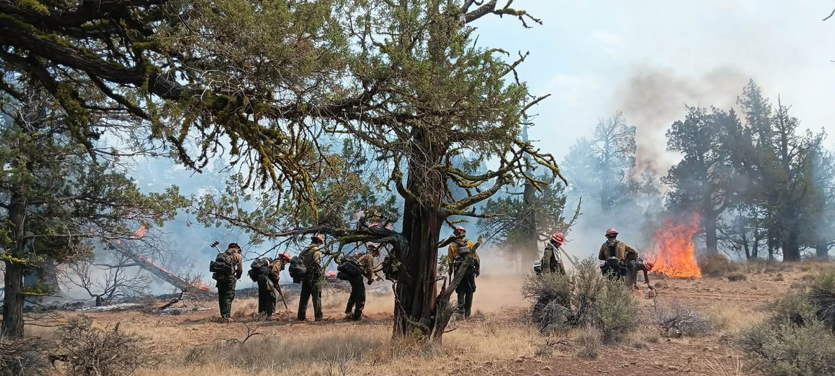
Firefighters continue to strengthen control lines around the perimeter of the Ten Mile Fire. Crews are increasing the amount of cooled ground between control lines and the interior portion of the fire, where juniper clumps continue to hold heat.

For Incident #586, firefighters continue to secure existing control lines around the perimeter.

On the North Crooked Fire, firefighters are making good progress by improving control lines and conducting mop-up operations by cooling hotspots around the perimeter.

Fires across Central Oregon are impacting roadways. Motorists should check the Oregon Department of Transportation’s tripcheck.com for current road statuses before traveling. The Bureau of Land Management and Forest Service have several closures in place for public safety during ongoing wildfire incidents.

Public drone activity occurred yesterday over the Green Mountain Fire, posing a serious safety risk to responding aircraft and firefighters and impacting their ability to effectively respond to the incident.

Air resource advisers are currently producing daily smoke forecasts that can be found on fire.airnow.gov. For wildfire updates and additional information, visit centraloregonfire.org or follow fire information on X/Twitter @CentralORfire. To report a wildfire, call 911.

Click here to follow the original article.

Crane High School opens for livestock evacuations in Harney County

Claire Elmer

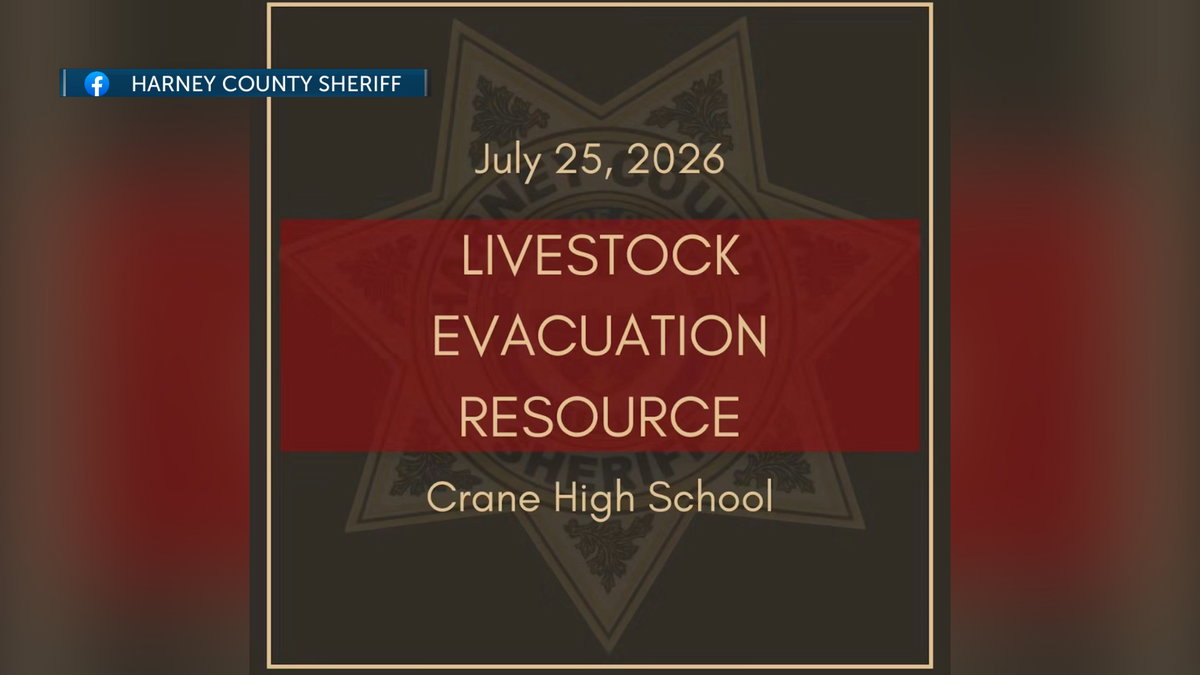
HARNEY COUNTY, Ore. (KTVZ) — Harney County Sheriff’s Office notified the public via social media that Crane High School has a half acre available for livestock evacuations due to wildfire. Water needs to be checked.

The school is located at 43277 Crane Venator Ln, Crane, Oregon 97732. Harney County Sheriff can be reached at 541-573-6156.

Click here to follow the original article.

FIRE ALERT: Deschutes County reduces evacuation levels for Akawa Butte Fire, Level 3 still in place for some areas

Claire Elmer

(Update: adding additional information from Akawa Butte fire official)

SISTERS, Ore. (KTVZ) — As of Sunday, July 26th: Fire crews are expected to establish full control lines around the Akawa Butte Fire near Sisters, Oregon, today. This follows their efforts last night to contain new spot fires through high winds and their preparations for continued hot, dry and windy conditions.

Operations personnel estimate that control lines will be fully in place later today to stop the fire’s progression, though this does not signify full containment of the fire.

Crews capitalized on the early morning hours by tying in control lines across the entire fire area. They are also preparing contingency lines along Wilt Road, Indian Ford Road and Forest Service Road 2052 in the southeast and southwest sectors, respectively.

Heavy equipment and ground crews will continue to strengthen these containment lines throughout the day. Helicopters are supporting these ground efforts by performing water drops around the fire.

An unburned pocket of vegetation on the west side of the fire will continue to burn today within the established control lines. Firing operations may be conducted to fully isolate this pocket by removing fuels that could threaten the control lines.

A localized Red Flag Warning is in effect for the fire area from 11 a.m. through 9 p.m. today due to continued hot, dry, windy conditions that can aid in the spread of fire. Weather conditions are expected to improve later this week as lower temperatures and lighter winds help moderate fire behavior.

Some Oregon State Fire Marshal structure protection resources are being reassigned to assist with other wildfires, including the nearby Bench Fire, as conditions and priorities evolve across the region. This strategic sharing aims to position firefighters where they are most needed while maintaining structural protection capabilities at the Akawa Butte Fire.

Resource levels are consistently evaluated based on current fire conditions, community risk and operational needs; additional resources can be requested if conditions change.

The public is asked to take caution and be aware while driving in the region due to increased fire activity and the presence of heavy fire equipment. Closed areas and evacuation orders are currently active to ensure public and firefighter safety.

Containment increases as mop-up efforts reach a depth of 200-300 feet. Evacuation orders are issued by the county sheriff’s offices. The Bureau of Land Management and U.S. Forest Service have implemented closures in and around the fire area.

Control lines are expected to be fully in place around the body of the fire later today. Weather conditions are predicted to improve later this week, bringing lower temperatures, and lighter winds.

SISTERS, Ore. (KTVZ) — Deschutes County officials reduced evacuation levels for several areas southwest of the Akawa Butte Fire on Sunday, July 26th. While Sisters High School was downgraded to Level 0, many other residential zones were moved to Level 1 or Level 2 status.

Despite these improvements, Level 3 Go Now orders remain active for Squaw Creek Canyon Estates and several forest regions.

Below is the full release from the Deschutes County Sheriff’s Office:

The Deschutes County Sheriff’s Office, in coordination with fire officials, has reduced evacuation levels to some areas on the Southwest and South sides of the Akawa Butte Fire effective at 11:30 a.m. on Sunday, July 26th. One zone, which includes Sisters High School, has been downgraded to normal from Level 1 (Be Ready).

Please drive carefully and respect the roadblocks as they have also moved. Firefighting personnel and equipment are causing significant traffic in the area as they move around to extinguish hot spots near the fire lines. Power may still be out in some areas. CEC is in the process today of inspecting all power lines in the area and will re-energize as it’s deemed safe.

Fire conditions can change rapidly, so it’s important to stay alert to changing conditions. The Sheriff’s Office recommends people use the Genasys Protect Map for updated evacuation areas: deschutes.org/emergency or protect.genasys.com

THESE ARE THE CURRENT EVACUATION NOTICES AS OF SUNDAY, JULY 26, 11:30AM:

Road Closures in Effect:

Wilt Road, North of and including Stardust Ln

Pine Street at Indian Ford Rd

Indian Ford Road between Forest Service 700 Road and Meadow View Lane

Special note.  Homes on the West end of Indian Ford Rd need to be accessed via Hwy 20 and Forest Service 11 Road.

DOWNGRADING FROM Level 3 (Go Now) to Level 2 (Be Set)

Private Lands on Indian Ford between Hwy 20/Forest Service 11 Road and the Indian Ford Rd and FS 700 Rd intersection.

Indian Ford Road MP1 and Camp Polk Rd to include Meadowview Lane, Fox Ridge Circle, and Pine Ridge Subdivisions

USFS lands north of Cascade Meadows Ranch to Indian Ford Creek and west of North Pine Street, including the Zimmerman Butte area.

Area of Old Wagon Road, West Meadow Parkway, and Tumbleweed Turn

Area surrounding Camp Polk Cemetery

Fair Mile Road, South side of Wilt Road, including Suntree Lane

DOWNGRADING FROM Level 2 (Be Set) to Level 1 (Be Ready)

Cascade Meadow Ranch and Windigo Trail Road

Areas North of Sisters, including Trapper Point, Crooked Horseshoe

West of Camp Polk Rd. And north of the Sisters airport, including Pilot Drive and Kittyhawk Ln. 

Areas Northeast of Sisters, including Upper and Lower Cattle Dr, Old Juniper Rd & Deer Ridge Rd.

Old Military Drive

DOWNGRADING FROM Level 1 (Be Ready) to Level 0 (Normal)

West Sisters, including Sisters High School, Sisters Middle School, McKenzie Meadows & area south of Tollgate

Remaining Level 3 (Go Now) evacuation notices

Squaw Creek Canyon Estates to include areas off Mt. View Road between Appaloosa Drive and Buffalo Drive

Henkle Butte area, Vista Ridge Drive, Stardust Lane, and Annie’s Drive

Meadow View Road area between Indian Ford Road and Indian Ford Creek

Northern end of Mt. View Road

Wilt Road north of Buffalo Drive to Big Buck Road

Freemont Canyon area east of Wilt Road and north of Big Buck Road, to include Rimrock Ranch

Forest land (USFS and private) east of Stevens Canyon Road and south of a line from Stevens Canyon Road and FS 2050/390 spur, east approximately 4 miles to the National Forest Boundary, and South to Wilt Rd. Commonly referred to as the southern portion of Sage Flat. Excluding Fox Ridge Circle and Pine Ridge Road

Remaining Level 2 (Be Set) evacuation notices:

National Forest areas north of Sisters and south of Cascade Meadow Ranch

Areas Northeast of Sisters, including Upper and Lower Cattle Dr, Old Juniper Rd & Deer Ridge Rd.

North side of Goodrich Road up to Whychus Creek, including Goodrich Lane and Whychus Canyon Preserve

Lower Holmes Road area, north of milepost 5 to Lower Bridge Road

Area between Whychus Creek and Panoramic Estates, including the north end of Lake Drive.

Remaining Level 1 (Be Ready) evacuation notices:

West of Highway 20 and East of Black Butte Ranch, Glaze Meadow Area

National Forest area between the Brooks-Scanlon Logging Road and Highway 20, north of Tollgate Subdivision, south of FS Road 1012.

Tollgate Subdivision

West Sisters, including the commercial area and Village at Cold Springs, The Pines at Sisters & the East Portal Interpretive Site

North Sisters, including part of downtown, the industrial park, Sun Ranch, and Clear Pine

Areas Northeast of Sisters, including the airport & Barclay Meadows

East Sisters, including areas East of Locust Street and Timber Creek 

Areas East of Sisters between Whychus Creek and Hwy 126

Areas Northeast of Sisters, including McKinney Butte & Wild Horse Ridge

East of Sisters Between Whychus Creek & Camp Polk Rd, North of Hwy 126, including Junipine Ln, Bradley Rd & Hawks Flight Dr 

Aspen Lakes

Panoramic Estates, and Emerald Valley Rd/Sisters View Dr

Both sides of Edmundson Rd between Goodrich Rd and Holmes Rd, Northern Cloverdale area

Both sides of Holmes Road from milepost 2.5 to milepost 5, including Wanona Road, Gold Coach Road, and McSwain Drive

Lower Holmes Road area, north of milepost 5 to Lower Bridge Rd

EVACUTION NOTICE LEVELS

Level 3 means GO NOW! Residents in this area should leave immediately. Do not take time to gather belongings or attempt to protect property. Drive carefully, use headlights, and follow traffic safety instructions. Do not return until officials announce it is safe.

Level 2 BE SET means residents should be prepared to evacuate at a moment’s notice. Conditions may change quickly, and residents should stay alert and keep essential items ready.

Level 1 BE READY means residents should remain aware of the fire situation and be prepared if evacuation levels increase.

ADDITIONAL RESOURCES

Akawa Fire information can be found at https://facebook.com/akawabuttefire

The Red Cross continues to support evacuees with a shelter at Sisters High School: 1700 W. McKinney Butte Rd.

For Pet OR Large Animal Evacuation:

The Pet Evacuation Team is available to support animal-related evacuation needs. They can be reached at 541-610-6628.

For Large Animal Evacuation

Mustangs to the Rescue is available by call or text at 541-350-2406. An alternate number for Mustangs to the Rescue is 541-948-9535 (call or text).

Community members are encouraged to sign up for Deschutes Alerts to receive timely emergency notifications: https://deschutesalerts.org

For a live map of evacuation areas, visit deschutes.org/emergency or protect.genasys.com

For additional fire information and regional updates, visit: https://centraloregonfire.org

Click here to follow the original article.

Extreme Fire Danger Across Central Oregon: Here’s How You Can Help

Lance Campbell

Hot, dry weather, low humidity, and occasional gusty winds continue to keep fire danger very high across Central Oregon. With several active wildfires already burning, it only takes one spark to start another.

Here are a few simple ways you can help protect our communities:

Prevent human-caused sparks. Avoid mowing dry grass during the hottest part of the day, parking or driving on dry vegetation, or using equipment that can create sparks. Always check local fire restrictions before burning or having a campfire.Never fly drones near wildfires. If a drone is spotted, firefighting aircraft must stop flying immediately for safety. That delays water drops and other firefighting efforts. If you fly, they can’t.Stay away from active fires. Please don’t drive to wildfire areas to watch or take photos. Extra traffic can slow emergency responders and make firefighting more difficult.Drive carefully in smoke. If you encounter heavy smoke, slow down, turn on your headlights, and leave extra following distance.

Stay Informed

As always, we’ll continue keeping you updated on the latest weather, fire conditions, and air quality here on KTVZ. Thank you for doing your part to help protect Central Oregon, our firefighters, and our communities.

Click here to follow the original article.
Volunteers support wildfire evacuees at Sisters High School

Spencer Sacks

Sisters High School has served as an evacuation site for the Akawa fire for almost a week, providing shelter and resources to approximately 100 people.

The Red Cross and Salvation Army are supporting evacuees, with the Red Cross operating five shelters across Central and Eastern Oregon to assist those displaced by wildfires.

The Red Cross works in coordination with county emergency management to establish these sites, ensuring affected individuals have access to safe shelter, meals and other community resources.

Morgan Schmidt, executive director for the Red Cross for Central and Eastern Oregon, stated, “It’s an honor for us to be able to open these at the request of county emergency management. When we set up to make sure that folks have a safe place to go for shelter and for meals and other community resources when these fires are happening.”

The Salvation Army has been a crucial partner at the Sisters High School evacuation site, serving more than 50 meals every lunch and dinner since Thursday.

Alfonso Juarez, a ministry leader for the Salvation Army, highlighted the organization’s commitment to displaced families. “We are here to serve,” Juarez said. “And, and we are just so honored to be here and especially, you know, to serve families that are being displaced and this situation. We want to provide them a hot meal and a bottled water or juice and just to let them know that they’re not alone, that we are here to support them and and that we here to give them a hot meal.”

This effort has amounted to approximately 450 meals provided by the Salvation Army.

Schmidt also praised the dedication of volunteers supporting these critical operations. “We’re really lucky at the Red Cross to have a volunteer team that is dedicated and generous with their time,” Schmidt said. She noted that about 1,000 volunteers are deployed nationwide for various disasters, including floods, wildfires and typhoons. These volunteers are community members assisting their neighbors.

While the Red Cross does not currently accept physical donations, the Salvation Army has requested donations of water bottles and juice boxes for children at the shelter.

Click here to follow the original article.

Blood drive honors fallen Redmond firefighter-paramedic Michael Kienzle

Lance Campbell

REDMOND, Ore. (KTVZ) — Community members rolled up their sleeves Friday to honor the life and legacy of Redmond firefighter-paramedic Michael Kienzle by donating blood during a special American Red Cross blood drive.

The event brought together family, friends, fellow firefighters, first responders and community members to continue Kienzle’s lifelong commitment to helping others. Organizers said each blood donation has the potential to save multiple lives, making the blood drive a fitting tribute to someone who spent his career serving the community.

The American Red Cross says blood donations are needed every day to help patients undergoing surgeries, cancer treatments, trauma care and other medical emergencies. Because blood cannot be manufactured, hospitals rely on volunteer donors to maintain a safe and stable blood supply.

For those who knew Kienzle, organizers said the event is about more than donating blood—it’s about carrying forward a legacy of compassion, service and selflessness.

The Red Cross encourages eligible donors to give blood throughout the year, as the need for lifesaving donations remains constant.

Watch the video above for more from Friday’s blood drive and hear why organizers say donating blood is one of the most meaningful ways to honor Kienzle’s legacy.

Click here to follow the original article.