Rainfall totals up to 1-2 inches so far this week for some, with more to come
John Ross
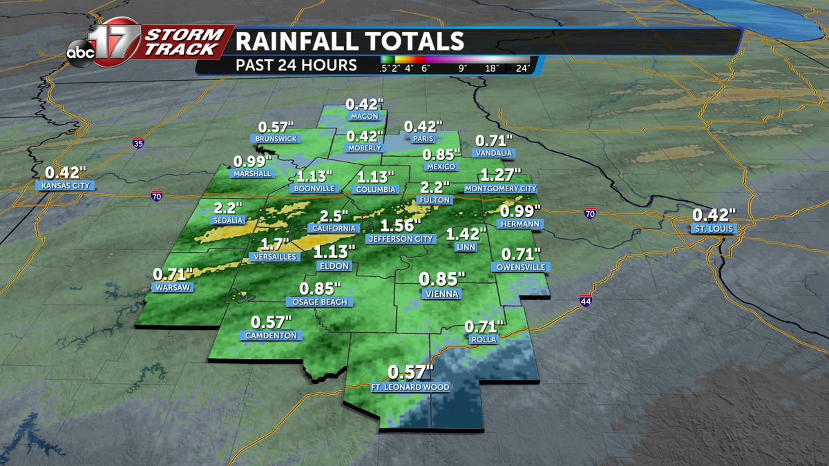
Rainfall on Tuesday marked the beginning of an active weather pattern for mid-Missouri.
Since its onset Tuesday morning, rain totals have steadily risen through several rounds of showers and storms that have already passed.

Radar estimated rain total maps illustrate streaking patterns of localized higher amounts, with one notably stretching from Warsaw through Versailles, California, Ashland, Fulton, and nearly to Montgomery City. This band is a remnant from very slow-moving, training thunderstorms that developed on Tuesday around mid-to-late morning. This has since been added to by scattered showers and storms that have been better at evenly distributing rainfall across the entire region.


More rain is expected with several rounds of thunderstorms still expected between now and Saturday morning.