Rosa Fire: 1671 acres, 95% contained, all evacuation orders lifted
Jesus Reyes
UPDATE 8/11/25 10:30 am – CAL FIRE reports the fire has been mapped at 1671 acres and is now 95% contained. Two structures were destroyed.
UPDATE 8/9/25 9:13 pm – CAL FIRE reports the fire has been mapped at 1671 acres and is now 80% contained.
Highway 74 open for travel.
All Evacuation Orders lifted.
Evacuation Warnings are issued for the following zones:
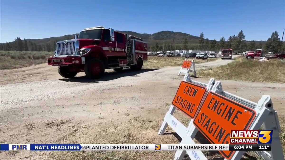
RVC-Rosa Fire
North of Santa Rosa Truck Trail
East of Santa Rosa Road
South of Saint Pierre Road
West of Palm Canyon Drive
UPTATE 8/8/25 7:00 PM – CAL FIRE reports the fire has been mapped at 1671 acres and is now 50% contained.
“The fire is 1671 acres and 50% contained. Crews experienced minimal fire activity today and firefighters continued to build and reinforce containment lines. Fire Suppression Repair remains ongoing. Weather will remain typical for the fire area with poor humidity recovery overnight. Please continue to drive carefully as emergency personnel are still working in the area.”
EVACUATION ORDERS: RVC-1983-C, RVC-2121-A, and RVC-2122-B
EVACUATION WARNINGS: RVC-1983-A, RVC-1984, RVC-2051, RVC-2052, RVC-2121-B, and RVC-2122-C
Areas for Evacuation Orders and Evacuation Warnings can be found at protect.genasys.com.
ROAD CLOSURES:
Highway 74 at Santa Rosa Pit Stop
Highway 74 at Palm Canon Drive
UPDATE 8/8/25 11:00 AM – The fire remains at 1690 acres and 40% contained. Some evacuation orders were reduced to warnings. Most previous evacuation warnings have been lifted.
“As you return home, you may see smoke or fire due to unburned pockets of fuel within the fire’s perimeter. If at any time you see smoke or fire that is outside the fire line, or you feel unsafe, call 911 immediately. For information regarding domestic water and domestic water wells please refer to the Department of Environmental Health County of Riverside,”
EVACUATION ORDERS: RVC – 2122A, RVC – 1983A, RVC – 2121A• North of Santa Rosa Truck Trail• East of Santa Rosa Road• South of Saint Pierre Road• West of Palm Canyon Drive
EVACUATION WARNINGS: RVC – 2122B, RVC – 2051, RVC – 2052,
RVC – 1984, RVC – 1983B• East of Palm Canyon Drive• North of Toro Peak• West of Scenic Drive• South of Skyland Drive
ROAD CLOSURES:
• Highway 74 and Palm Canyon Drive• Highway 74 at Santa Rosa Pit Stop

UPDATE 8/7/25 9:00 PM – The fire remains at 1690 acres and 30% contained.
Note from CAL FIRE:
“Firefighters remain actively engaged in maintaining containment lines as fire activity remains minimal. Crews continue mopping up the fire’s edge as well as extinguishing hot spots within the interior. Hot, dry, and windy conditions remain challenging for firefighters.
The area of the Rosa fire will remain in a heat advisory throughout the rest of the week.”
UPDATE 8/7/25 5:35 PM – The fire is 30% contained
UPDATE 8/7/25 3:15 PM – Evacuation warnings have been lifted in several areas, according to CAL FIRE.


Additionally, the road closure is now at Highway 74 and Scenic Drive, as well as Highway 74 at Santa Rosa Pit Shop.
CAL FIRE NOTE:
“As you return home, you may see smoke or fire due to unburned pockets of fuel within the fire’s perimeter. If at any time you see smoke or fire that is outside the fire line, or you feel unsafe, call 911 immediately. For information regarding domestic water wells please refer to the Department of Environmental Health County of Riverside. SAFETY MESSAGE – The public is reminded to stay vigilant on current fire conditions. Please continue to adhere to road closures and any Evacuation Warnings or Evacuation Orders. A reminder to drive slowly and yield to emergency personnel in the area.
To learn more about wildfire preparedness visit: http://readyforwildfire.org“
UPDATE 8/7/25 10:30 AM – The fire remains at 1690 acres with 25% containment
UPDATE 8/6/25 6:15 PM – The fire has been mapped at 1690 acres. Containment has grown to 21%.
UPDATE 8/6/25 3:25 PM – Residents of evacuation warning zones will be able to travel through Highway 74 and Art Smith Trailhead at 6 p.m. on Wednesday. Residents will need their ID to be let through a checkpoint.

UPDATE 8/6/25 5:44 AM – Containment now at 18%
UPDATE 8/5/25 6:25 PM – Containment now at 15%
UPDATE 8/5/25 3:30 PM – The fire has been mapped at 1,658.2 acres by Intel Aircraft. Highway 74 is expected to remain closed through Satuday, Aug. 8.
UPDATE 8/5/25 11:35 AM – The fire has been mapped at 1,535.7 acres by Intel Aircraft
UPDATE 8/5/25 10:45 AM – Highway 74 will remain closed until at least Wednesday, according to CHP. People are not being let up on Tuesday due to high wind warnings.
UPDATE 8/5/25 6:00 AM – Containment now at 5%. The remains are at 1,200 acres.
ANZA, Calif. (KESQ) – Highway 74 remains shut down as a vegetation fire has burned around 1,200 acres between Anza and Pinyon Pines, with zero percent containment.
Evacuation orders include these areas: RVC-1983-A, RVC-1984, RVC-2051, RVC-2052, RVC-2121, RVC-2122-A, RVC-2122-B. These zones are in the area of Alpine Village and Pinyon Pines. See Genasys Protect for exact parameters.
Evacuation warnings have been issued for these areas: RVC-1915, RVC-1916, RVC-2123.
CAL FIRE reports on social media that Care and Reception and Animal Evacuation sites are located at:
Desert Community Center, 43900 San Pablo Ave., Palm Desert
Anza Community Center, 56630 Highway 371, Anza
Animal evacuations at San Jacinto Animal Shelter, 581 S. Grand Ave., San Jacinto
Animal evacuations at Coachella Valley Animal Campus, 72050 Pet Land Place, Thousand Palms
The fire was first reported just before 12:30 p.m., on Highway 74 east of Santa Rosa Truck Trail.
“Firefighters are on scene of 10 acres of vegetation burning at a rapid rate of spread. Additional air and ground resources have been requested,” CAL FIRE wrote on social media.
By 4:30 p.m., the fire has burned approximately 1,200 acres, according to incident command.
Evacuation orders were issued for scattered properties on the west side of Pinyon Pines.

Click here to search evacuation areas
Care and reception centers opened at the Anza Community Hall and Palm Desert Community Center, Supervisor Manuel Perez announced on social media.
The following animal evacuation shelters are open:
San Jacinto Animal Shelter – 581 S. Grand Avenue, San Jacinto
Coachella Valley Animal Campus – 72050 Pet Land Place, Thousand Palms
The California Highway Patrol shut down both sides of the two-lane highway between the junction at Highway 371 and Big Horn in Palm Desert.


#AIRQUALITY ADVISORY: WILDFIRE SMOKE (Monday, August 4th – Tuesday, August 5th):Smoke from the #GiffordFire, #RosaFire and #GoldFire is expected to impact parts of the South Coast Air Basin and Coachella Valley: https://t.co/Y158OoPtBX pic.twitter.com/wffdYY2EE0
— South Coast AQMD (@SouthCoastAQMD) August 5, 2025
We have a crew at the scene gathering the latest information. Stay with News Channel 3 for continuing updates.