First Alert Weather Alert: Summer Sizzle Holds On
Katie Boer
It’s another scorcher in the Coachella Valley today, though not quite as extreme as yesterday.
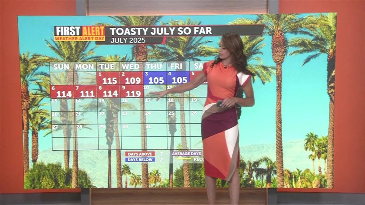
Thermal and Indio broke daily high temp records yesterday–reaching 120°F. Palm Springs came close to tying a record, with a high of 119°F.
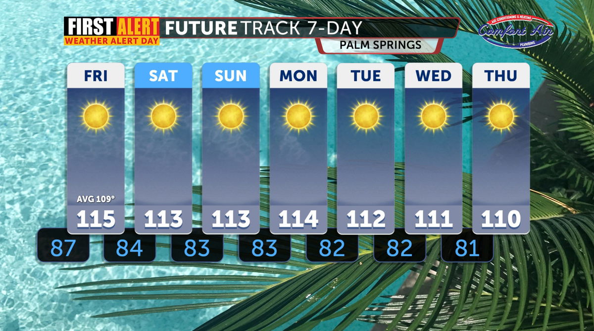
Temperatures remain dangerously hot about 10 degrees above average, with extreme heat warnings and heat advisories still in effect through sunset.
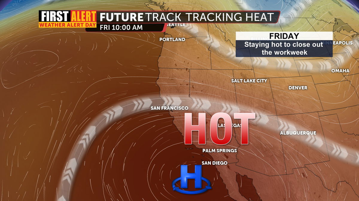
The strong ridge of high pressure that’s been fueling our intense heat, is expected to weaken slightly by Friday. That means a very minor cooldown is on the way, though highs across the desert will still run several degrees above normal for this time of year.
By the weekend and into early next week, expect minor day-to-day changes—hot, but not record-breaking. Temperatures will hover just above mid-July averages across the lower deserts. Normal temp for today through the end of the month sits right at 109 degrees.
Some moisture from the Gulf is creeping in, which could bring a tiny bit relief and potentially raise humidity levels slightly.
Looking further ahead at the extended forecast, there’s a slight hint of monsoon moisture returning mid to late next week, which could mean a very slim chance of isolated showers or thunderstorms by Wednesday or Thursday. At this point it’s still to far out and too slim to include in the forecast.Stay hydrated and cool—we have a lot of hot summer days yet to go.