Crane High School opens for livestock evacuations in Harney County

Claire Elmer

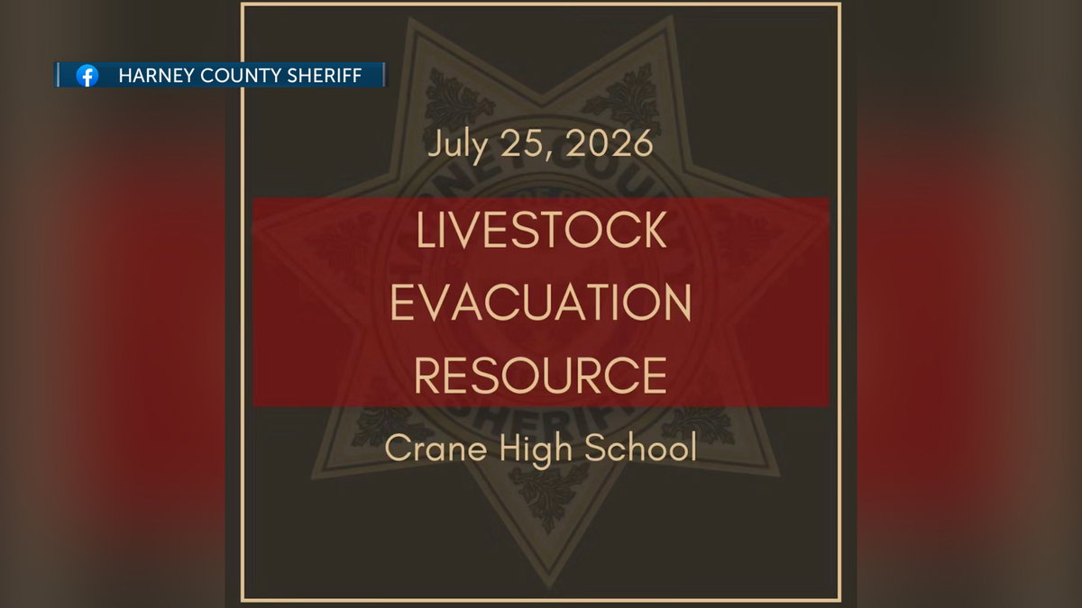
HARNEY COUNTY, Ore. (KTVZ) — Harney County Sheriff’s Office notified the public via social media that Crane High School has a half acre available for livestock evacuations due to wildfire. Water needs to be checked.

The school is located at 43277 Crane Venator Ln, Crane, Oregon 97732. Harney County Sheriff can be reached at 541-573-6156.

Click here to follow the original article.

Foresters mercy-rule second straight opponent to advance to knockout round at NBC World Series

Mike Klan

WICHITA, Kansas. (KEYT) – For the second consecutive game, the Santa Barbara Foresters mercy-ruled their opponent in pool play at the NBC World Series, taking down the BTL Hornets 13-0. It looked like the ‘Sters would finish this one in just five innings, but the offense slowed just a tad, adding an extra inning of game time. With the win, Santa Barbara has secured a spot in the knockout rounds.

It was an instant onslaught from the Santa Barbara offense in the top of the first. After Donovan Lasalle reached via an error, Sawyer Farr walked (what he does best), and Chris Newstrom singled Lasalle home to open the floodgates. Cole Chamberlain and Kurt Ippolito picked up RBIs on successive at-bats before Ippolito and Brady Janusek came home on consecutive wild pitches. Once Zane Becker drew a walk, BTL was forced to make a pitching change, but it couldn’t stop the ‘Sters.

Coming up for the second time, Lasalle punched a ball into center field to bring home the sixth run of the inning for the Foresters. Santa Barbara had four walks and four steals in the lopsided inning.

Tanner Grove was tasked with the start, looking to cruise behind the big offensive performance. And cruise he did. While he got into a bit of trouble in the first with two runners reaching, that was about all the Hornets could muster, as the next three innings only saw two runners reach. In his four innings of work, Grove struck out nine on his way to holding BTL scoreless.

Santa Barbara casually added two more, one in the second and one in the third, but was unable to get to the required 10 after five to end the game extremely early.

Carter Speights was next out for the Foresters, and he did his job, working through an inning while keeping the shutout intact and helping the ‘Sters get some extra hours of sleep.

Carter Rutenbar pulled his best Becker impression in the fifth, giving Speights a hand when he backpicked a Hornets runner to escape a first-and-third situation.

Rutenbar was involved on the other side, too, adding a two-RBI single to get Santa Barbara into double digits after a lengthy at-bat.

With Grady Westphal taking over and holding the shutout, the mercy rule was kept intact and enacted at the culmination of the sixth.

The Foresters are off until Tuesday, when they will take on the Liberal Bee Jays in the final game of group play at 8:30 pm CST.

(Courtesy of Foresters)

Click here to follow the original article.

FIRE ALERT: Deschutes County reduces evacuation levels for Akawa Butte Fire, Level 3 still in place for some areas

Claire Elmer

(Update: adding additional information from Akawa Butte fire official)

SISTERS, Ore. (KTVZ) — As of Sunday, July 26th: Fire crews are expected to establish full control lines around the Akawa Butte Fire near Sisters, Oregon, today. This follows their efforts last night to contain new spot fires through high winds and their preparations for continued hot, dry and windy conditions.

Operations personnel estimate that control lines will be fully in place later today to stop the fire’s progression, though this does not signify full containment of the fire.

Crews capitalized on the early morning hours by tying in control lines across the entire fire area. They are also preparing contingency lines along Wilt Road, Indian Ford Road and Forest Service Road 2052 in the southeast and southwest sectors, respectively.

Heavy equipment and ground crews will continue to strengthen these containment lines throughout the day. Helicopters are supporting these ground efforts by performing water drops around the fire.

An unburned pocket of vegetation on the west side of the fire will continue to burn today within the established control lines. Firing operations may be conducted to fully isolate this pocket by removing fuels that could threaten the control lines.

A localized Red Flag Warning is in effect for the fire area from 11 a.m. through 9 p.m. today due to continued hot, dry, windy conditions that can aid in the spread of fire. Weather conditions are expected to improve later this week as lower temperatures and lighter winds help moderate fire behavior.

Some Oregon State Fire Marshal structure protection resources are being reassigned to assist with other wildfires, including the nearby Bench Fire, as conditions and priorities evolve across the region. This strategic sharing aims to position firefighters where they are most needed while maintaining structural protection capabilities at the Akawa Butte Fire.

Resource levels are consistently evaluated based on current fire conditions, community risk and operational needs; additional resources can be requested if conditions change.

The public is asked to take caution and be aware while driving in the region due to increased fire activity and the presence of heavy fire equipment. Closed areas and evacuation orders are currently active to ensure public and firefighter safety.

Containment increases as mop-up efforts reach a depth of 200-300 feet. Evacuation orders are issued by the county sheriff’s offices. The Bureau of Land Management and U.S. Forest Service have implemented closures in and around the fire area.

Control lines are expected to be fully in place around the body of the fire later today. Weather conditions are predicted to improve later this week, bringing lower temperatures, and lighter winds.

SISTERS, Ore. (KTVZ) — Deschutes County officials reduced evacuation levels for several areas southwest of the Akawa Butte Fire on Sunday, July 26th. While Sisters High School was downgraded to Level 0, many other residential zones were moved to Level 1 or Level 2 status.

Despite these improvements, Level 3 Go Now orders remain active for Squaw Creek Canyon Estates and several forest regions.

Below is the full release from the Deschutes County Sheriff’s Office:

The Deschutes County Sheriff’s Office, in coordination with fire officials, has reduced evacuation levels to some areas on the Southwest and South sides of the Akawa Butte Fire effective at 11:30 a.m. on Sunday, July 26th. One zone, which includes Sisters High School, has been downgraded to normal from Level 1 (Be Ready).

Please drive carefully and respect the roadblocks as they have also moved. Firefighting personnel and equipment are causing significant traffic in the area as they move around to extinguish hot spots near the fire lines. Power may still be out in some areas. CEC is in the process today of inspecting all power lines in the area and will re-energize as it’s deemed safe.

Fire conditions can change rapidly, so it’s important to stay alert to changing conditions. The Sheriff’s Office recommends people use the Genasys Protect Map for updated evacuation areas: deschutes.org/emergency or protect.genasys.com

THESE ARE THE CURRENT EVACUATION NOTICES AS OF SUNDAY, JULY 26, 11:30AM:

Road Closures in Effect:

Wilt Road, North of and including Stardust Ln

Pine Street at Indian Ford Rd

Indian Ford Road between Forest Service 700 Road and Meadow View Lane

Special note.  Homes on the West end of Indian Ford Rd need to be accessed via Hwy 20 and Forest Service 11 Road.

DOWNGRADING FROM Level 3 (Go Now) to Level 2 (Be Set)

Private Lands on Indian Ford between Hwy 20/Forest Service 11 Road and the Indian Ford Rd and FS 700 Rd intersection.

Indian Ford Road MP1 and Camp Polk Rd to include Meadowview Lane, Fox Ridge Circle, and Pine Ridge Subdivisions

USFS lands north of Cascade Meadows Ranch to Indian Ford Creek and west of North Pine Street, including the Zimmerman Butte area.

Area of Old Wagon Road, West Meadow Parkway, and Tumbleweed Turn

Area surrounding Camp Polk Cemetery

Fair Mile Road, South side of Wilt Road, including Suntree Lane

DOWNGRADING FROM Level 2 (Be Set) to Level 1 (Be Ready)

Cascade Meadow Ranch and Windigo Trail Road

Areas North of Sisters, including Trapper Point, Crooked Horseshoe

West of Camp Polk Rd. And north of the Sisters airport, including Pilot Drive and Kittyhawk Ln. 

Areas Northeast of Sisters, including Upper and Lower Cattle Dr, Old Juniper Rd & Deer Ridge Rd.

Old Military Drive

DOWNGRADING FROM Level 1 (Be Ready) to Level 0 (Normal)

West Sisters, including Sisters High School, Sisters Middle School, McKenzie Meadows & area south of Tollgate

Remaining Level 3 (Go Now) evacuation notices

Squaw Creek Canyon Estates to include areas off Mt. View Road between Appaloosa Drive and Buffalo Drive

Henkle Butte area, Vista Ridge Drive, Stardust Lane, and Annie’s Drive

Meadow View Road area between Indian Ford Road and Indian Ford Creek

Northern end of Mt. View Road

Wilt Road north of Buffalo Drive to Big Buck Road

Freemont Canyon area east of Wilt Road and north of Big Buck Road, to include Rimrock Ranch

Forest land (USFS and private) east of Stevens Canyon Road and south of a line from Stevens Canyon Road and FS 2050/390 spur, east approximately 4 miles to the National Forest Boundary, and South to Wilt Rd. Commonly referred to as the southern portion of Sage Flat. Excluding Fox Ridge Circle and Pine Ridge Road

Remaining Level 2 (Be Set) evacuation notices:

National Forest areas north of Sisters and south of Cascade Meadow Ranch

Areas Northeast of Sisters, including Upper and Lower Cattle Dr, Old Juniper Rd & Deer Ridge Rd.

North side of Goodrich Road up to Whychus Creek, including Goodrich Lane and Whychus Canyon Preserve

Lower Holmes Road area, north of milepost 5 to Lower Bridge Road

Area between Whychus Creek and Panoramic Estates, including the north end of Lake Drive.

Remaining Level 1 (Be Ready) evacuation notices:

West of Highway 20 and East of Black Butte Ranch, Glaze Meadow Area

National Forest area between the Brooks-Scanlon Logging Road and Highway 20, north of Tollgate Subdivision, south of FS Road 1012.

Tollgate Subdivision

West Sisters, including the commercial area and Village at Cold Springs, The Pines at Sisters & the East Portal Interpretive Site

North Sisters, including part of downtown, the industrial park, Sun Ranch, and Clear Pine

Areas Northeast of Sisters, including the airport & Barclay Meadows

East Sisters, including areas East of Locust Street and Timber Creek 

Areas East of Sisters between Whychus Creek and Hwy 126

Areas Northeast of Sisters, including McKinney Butte & Wild Horse Ridge

East of Sisters Between Whychus Creek & Camp Polk Rd, North of Hwy 126, including Junipine Ln, Bradley Rd & Hawks Flight Dr 

Aspen Lakes

Panoramic Estates, and Emerald Valley Rd/Sisters View Dr

Both sides of Edmundson Rd between Goodrich Rd and Holmes Rd, Northern Cloverdale area

Both sides of Holmes Road from milepost 2.5 to milepost 5, including Wanona Road, Gold Coach Road, and McSwain Drive

Lower Holmes Road area, north of milepost 5 to Lower Bridge Rd

EVACUTION NOTICE LEVELS

Level 3 means GO NOW! Residents in this area should leave immediately. Do not take time to gather belongings or attempt to protect property. Drive carefully, use headlights, and follow traffic safety instructions. Do not return until officials announce it is safe.

Level 2 BE SET means residents should be prepared to evacuate at a moment’s notice. Conditions may change quickly, and residents should stay alert and keep essential items ready.

Level 1 BE READY means residents should remain aware of the fire situation and be prepared if evacuation levels increase.

ADDITIONAL RESOURCES

Akawa Fire information can be found at https://facebook.com/akawabuttefire

The Red Cross continues to support evacuees with a shelter at Sisters High School: 1700 W. McKinney Butte Rd.

For Pet OR Large Animal Evacuation:

The Pet Evacuation Team is available to support animal-related evacuation needs. They can be reached at 541-610-6628.

For Large Animal Evacuation

Mustangs to the Rescue is available by call or text at 541-350-2406. An alternate number for Mustangs to the Rescue is 541-948-9535 (call or text).

Community members are encouraged to sign up for Deschutes Alerts to receive timely emergency notifications: https://deschutesalerts.org

For a live map of evacuation areas, visit deschutes.org/emergency or protect.genasys.com

For additional fire information and regional updates, visit: https://centraloregonfire.org

Click here to follow the original article.

Lottery jackpots continue to grow

NBC News

(NBC, KYMA) – The jackpots for the Mega Millions and Powerball lotteries are continuing to grow.

There was no big winner in Friday’s Mega Millions draw.

That means the estimated jackpot for Tuesday’s drawing soars to an amazing $800 million dollars. With a cash option of about $344-million.

If someone does win it, that jackpot would be the tenth largest in Mega Millions history.

There was also no winner in last night’s Powerball lottery drawing.

So the estimated jackpot for that one has jumped up to $633 million for the next drawing Monday night, with a cash option of $277 million if someone wins.

Click here to follow the original article.
Body found positively identified as elderly missing man

Isaiah Mora

UPDATE 7/29/26

Palm Springs police announced today that a body discovered Sunday near the Desert Hot Springs area was confirmed to be a 70-year-old man who went missing in Rancho Mirage.

According to the Palm Springs Police Department, the Riverside County Sheriff’s Department’s Coroner’s Bureau positively identified the body as Daniel “Dan” Michael Mulcahey.

The circumstances behind his death were unclear, and the case is being treated as a suspicious death until investigators determine if foul play or criminal conduct contributed to his death.

UPDATE 7/27/26

Daniel “Dan” Michael Mulcahey is believed to have been found dead on Sunday near the Desert Hot Springs area, police said.

The Riverside County Sheriff’s Office Coroner’s Bureau responded and will conduct the official identification, as well as determine the cause and manner of death.

“As is standard practice, the circumstances surrounding the death are being investigated. At this time, the case is being treated as a suspicious death investigation until investigators are able to determine whether foul play or criminal conduct contributed to the death,” reads a news release by the Palm Springs Police Department.

Original Report 7/26/26

PALM SPRINGS, Calif. (KESQ) — The Palm Springs Police Department is calling on the community’s help in locating 70-year-old Daniel “Dan” Michael Mulcahey.

Palm Springs Police say Mulcahey was last seen on Friday, July 24, around 2:30 p.m. in Rancho Mirage. He was last seen wearing beige shorts and gray shoes and is believed to be traveling on foot.

Mulcahey is described as a White male, approximately 6 feet 1 inch tall and weighing approximately 190 pounds with gray hair and blue eyes. His vehicle was also subsequently located unoccupied in Desert Hot Springs.

Police say due to a recent medical issue and concerns that he may require medical assistance, Mulcahey is considered critically missing.

Law enforcement personnel have conducted an extensive investigation and search but have not located him. A Silver Alert has been activated to assist with efforts to find him.

Anyone who has seen Mulcahey or has information regarding his whereabouts is asked to immediately contact the Palm Springs Police Department at 760-323-8116.

Anyone who sees him should not delay in calling, as he may need medical assistance. For an emergency or an immediate sighting, call 9-1-1.

Stay with News Channel 3 for any updates on this story.

Click here to follow the original article.

Community gathers for pet adoption event where families meet furry friends

Matthew Pearce

PALM DESERT, Calif. (KESQ) — BG Plaza will host an adoption event from 10 a.m. to 3 p.m. Sunday, giving the community a chance to help cats and dogs find forever homes.

Multiple rescue organizations will bring a variety of animals, including puppies, adult dogs and cats. Organizers hope the event will find homes for the animals and free up space in local shelters for other animals in need.

News Channel 3 is talking with organizers and attendees to learn more about the event and the animals available for adoption.

Click here to follow the original article.

Firefighters Battle 700-Acre Gaston Fire Near Aberdeen

Seth Ratliff

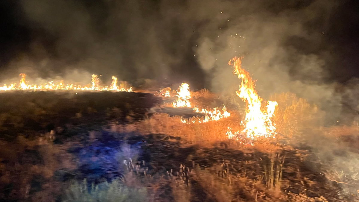
ABERDEEN, Idaho (KIFI) — Wildland fire crews are actively battling the fast-moving Gaston Fire, which exploded to an estimated 700 acres overnight in eastern Idaho.

The fire was first detected around 8:42 p.m. Saturday via satellite hotspots on NOAA’s Wildland Fire Data Portal. It is burning approximately seven miles southwest of Coffee Point and 12 miles northwest of Aberdeen.

As of midnight, the fire remains active in high-grass and brush, according to the U.S. Wildland Fire Service (USWFS). Firefighting efforts have been hindered by gusty winds and rugged terrain.

Firefighters from the USWFS Great Basin Unit 3 (East Idaho/Idaho Falls) are on scene alongside multiple partner agencies, including the U.S. Forest Service (Caribou-Targhee National Forest) and Aberdeen Fire Department. Both ground and overhead personnel are actively on the scene.

Fire crews currently estimate full containment by 10 p.m. Sunday. A timeline for full control of the fire remains unknown.

Wildland Fire Crews emphasize that public and firefighter safety is their top priority, urging people to stay clear of the area to allow crews room to work. Authorities also issued a strong warning against operating personal drones in the area.

“IF YOU FLY, WE CAN’T. Remember that if you fly a drone over a fire, critical operations get suspended,” states the post.

Click here to follow the original article.
Ways to stay cool during Extreme Heat Warning in Mid-Missouri

Alison Patton

COLUMBIA, Mo. (KMIZ)

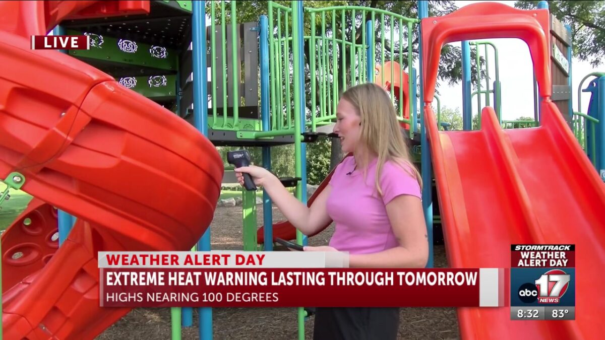
The National Weather Service issued an Extreme Heat Warning for portions of Mid-Missouri early Sunday morning lasting until 9 p.m. Monday.

The ABC 17 Stormtrack Weather Team has issued a stretch of Weather Alert Days through Tuesday for heat and is tracking temperatures in the upper 90s with feel-like temperatures around 110 degrees.

Columbia has three cooling centers open across the city on Sunday, with more opening during the week.

Sunday:

Columbia Public Library, 100 W. Broadway: 1-5 p.m.

Salvation Army Harbor House, 602 N. Ann St.: 6 a.m. to 4 p.m., and 7-10 p.m.

Activity and Recreation Center, 1701 W. Ash St.: 9 a.m. to 6 p.m.

Weekday cooling centers:

City Hall, 701 E. Broadway: 8 a.m. to 5 p.m.

Columbia/Boone County Public Health and Human Services, 1005 W. Worley St.: 8 a.m. to 5 p.m.

Salvation Army, 1108 W. Ash St.: 9 a.m. to noon and 1–4 p.m.

Click here to follow the original article.

How rising gas prices impact business at Chandler Driving School and tips they’re passing onto students

By Molly Hudson

Click here for updates on this story

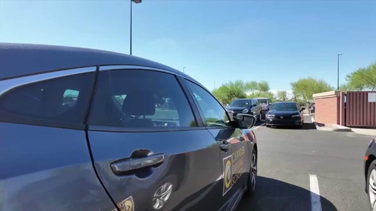
    CHANDLER, Arizona (KNXV) — Even though gas prices are on the rise again, Chandler Driving School has no choice but to fill up and be on the road.

Getting a driver’s license is exciting, but it can also be nerve-wracking. Chandler Driving School says for some students, that worry now extends to gas prices and other costs.

And the pressure of rising prices extends beyond students. Owner Bryon Houy says the school also has to navigate the increases.

“As a business owner, like every raise, or every increase in price, we are going to feel it,” Houy said.

Houy says that means being more thoughtful about routes and possibly holding off on adding newer vehicles to the fleet.

Your Chandler Reporter Molly Hudson spoke with those who operate the driving school about what increased costs mean for their business and what they are teaching students to save on fuel.

Please note: This story was provided to CNN Wire by an affiliate and does not contain original CNN reporting. This content carries a strict local market embargo. If you share the same market as the contributor of this article, you may not use it on any platform.

Ride along with Salvation Army’s Mobile Hydration Unit during extreme heat warning

By Lillian Donahue

Click here for updates on this story

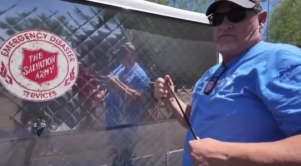
    PHOENIX (KNXV) — When temperatures soar in Phoenix, the Salvation Army’s extreme heat team said it’s critical to go out and meet people where they are.

During warnings, the organization dispatches its mobile hydration units and opens emergency heat relief stations across the Valley, in addition to the area’s existing Heat Relief Network of cooling and respite centers, which are open daily in the summer.

ABC15’s Lillian Donahue went out with the mobile hydration team on one of the hottest days of the year as they handed out water, electrolytes, and other essential needs.

Please note: This story was provided to CNN Wire by an affiliate and does not contain original CNN reporting. This content carries a strict local market embargo. If you share the same market as the contributor of this article, you may not use it on any platform.