Barney Lerten
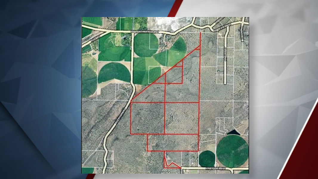
TERREBONNE, Ore. (KTVZ) — The Oregon Court of Appeals has affirmed the long-debated rezoning of 710 acres west of Redmond for 10-acre rural homesites, but the fight still may not be over.
The court’s 34-page ruling (see below) affirmed the Oregon Land Use Board of Appeals decision to uphold Deschutes County’s approval of the rezoning from exclusive farm use to residential zoning.
Since the initial land-use process in 2022, the plans actually have come before county commissioners twice, the second time on a LUBA remand, and Commissioners Tony DeBone and Patti Adair have voted in favor, with colleague Phil Chang opposed.
One key issue has been poor-quality soil in that location: “It grows rocks,” Adair said before last year’s vote.
Land-use watchdog groups Central Oregon LandWatch and 1000 Friends of Oregon have been fighting the plans from the start, along with area farmers and ranchers and several state agencies concerned about conversion of farmland to rural housing. Issues have ranged from water supplies to loss of wildlife habitat.
Below are a news release from the project developers, a statement from Central Oregon LandWatch and the ruling itself:
Oregon Court of Appeals Affirms Deschutes County’s Approval of Rural Residential Rezoning for 710-Acre Property
Redmond, OR, October 22, 2025 — The Oregon Court of Appeals (COA) has issued a final ruling affirming the decision of the Oregon Land Use Board of Appeals (LUBA) to affirm Deschutes County’s decision to rezone a 710-acre parcel northwest of Redmond from Exclusive Farm Use (EFU) to Rural Residential (RR-10).
Dale Stockamp, the lead investor in 710 Properties, LLC, the applicant that sought approval of the zone change, commented: “We are thankful that, based on the science, evidence, and land use law, the Oregon Court of Appeals affirmed both Deschutes County’s and the LUBA’s affirmations of our zone change application. As the majority owner of the project, and with my commitment to give all my profits to the great work that non-profits here in Central Oregon and beyond are doing, I hope this is the end to land use appeals, the cost of which will only reduce the financial resources that will be earned by the project to benefit tens of thousands of people.”
This COA affirmation is another successful milestone for 710 Properties in a lengthy legal process involving appeals challenging the County’s initial 2022 approval. The case before the COA involved multiple petitions and unsuccessful arguments challenging LUBA’s order. The Court addressed various assignments of error raised by petitioners: Redside Restoration Project One, LLC; 1000 Friends of Oregon, Central Oregon LandWatch, and neighbors of 710 Properties. Key issues revolved around interpretations of land use regulations, the definition of agricultural land, and adherence to procedural requirements. The court rejected all challenges and affirmed LUBA’s final order and decision.
LUBA affirmed the County’s determination that the land is not suitable for farm use due to poor soil quality, lack of irrigation water rights, and challenging topography. The COA also found that LUBA and the County sufficiently evaluated potential impacts on nearby agricultural operations and determined that rezoning would not interfere with ongoing farm practices.
Over the past few years, though no profit has yet been made, 710 Properties, LLC, the legal entity behind The Peaks 360 rural residential housing community, has demonstrated its long-term commitment to investing in Central Oregon’s communities through consistent financial contributions to key nonprofit organizations. Donating over $300,000, including $25,000 annually to Furnish Hope, NeighborImpact, and The Giving Plate reinforces its role as more than just a real estate development—it’s a sustainable means for strengthening the region’s social and environmental fabric.
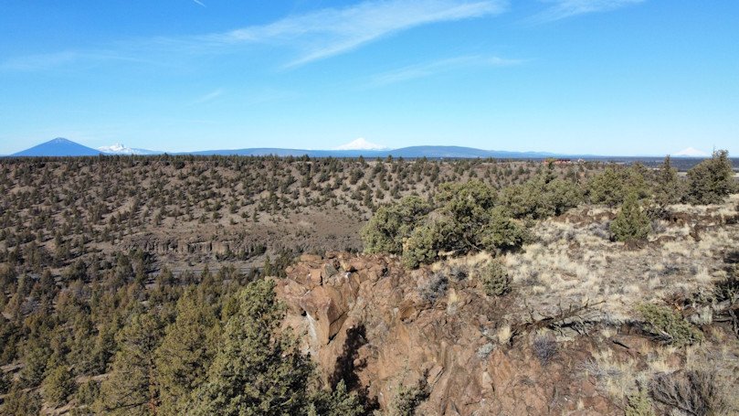
The subject property—largely undeveloped—had been designated for agricultural use for decades but has no history of agricultural use as it lacks the infrastructure, water rights, and productive soil necessary to support successful agricultural operations. The approved rezoning allows for a thoughtfully planned, low-density rural residential development while maintaining Deschutes County’s oversight of environmental and community impacts.
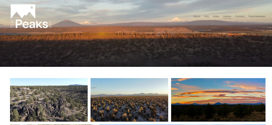
About The Peaks 360
The Peaks 360 is a 710-acre rural residential housing community located northwest of Redmond, Oregon. Designed to meet the changing needs of homebuyers while ensuring long-term environmental sustainability, it stands apart by dedicating the majority of its proceeds, including the majority owner’s commitment to give all their profits to nonprofits, including many local nonprofit organizations that strengthen the Central Oregon community.
For more information about The Peaks 360 and its community-driven initiatives, visit www.thepeaks360.com.
Statement from Central Oregon LandWatch:
COLW is disappointed that Deschutes County’s decision to rezone these 710 acres has been affirmed.
Together with our co-appellants, we are considering next steps.
This land is native sagebrush-juniper rangeland that neighboring ranchers were ready and willing to utilize to support their livelihoods.
This land also serves as winter refuge for our region’s imperiled mule deer herds.
Commissioners Patti Adair and Tony DeBone voted to remove this land from the exclusive farm use zone, while Commissioner Phil Chang opposed.
The Oregon Department of Agriculture (ODA), the Oregon Department of Fish and Wildlife (ODFW), and the Oregon Department of Land Conservation and Development (DLCD) had all submitted a joint, three-agency letter opposing the development as contrary to law and noting the risks to the agricultural land base, the aquifer, and wildlife habitat.
Carol Macbeth, Staff Attorney for Central Oregon LandWatch, said:
“This land is precisely the type of agricultural land that our state’s land use system was created to protect from sprawl. Nevertheless, two out of three Deschutes County Board of County Commissioners chose to disregard community needs and interests, ignore the concerns raised by agriculturalists, wildlife biologists and land use experts, and instead grant the wishes of luxury developers. LandWatch’s work to safeguard the working lands that make our region one-of-a-kind continues, and this disappointing decision strengthens our resolve.”
Oregon Court of Appoeals rulingDownload
Click here to follow the original article.

 Street lights in downtown lose power.
 A store in downtown Bend, operates in the dark.
 Downtown Bend patrons head indoors after strong gusts.
 A tree topples in Drake Park from gusts.
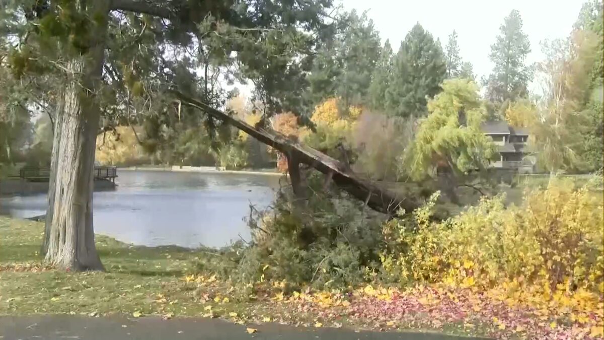
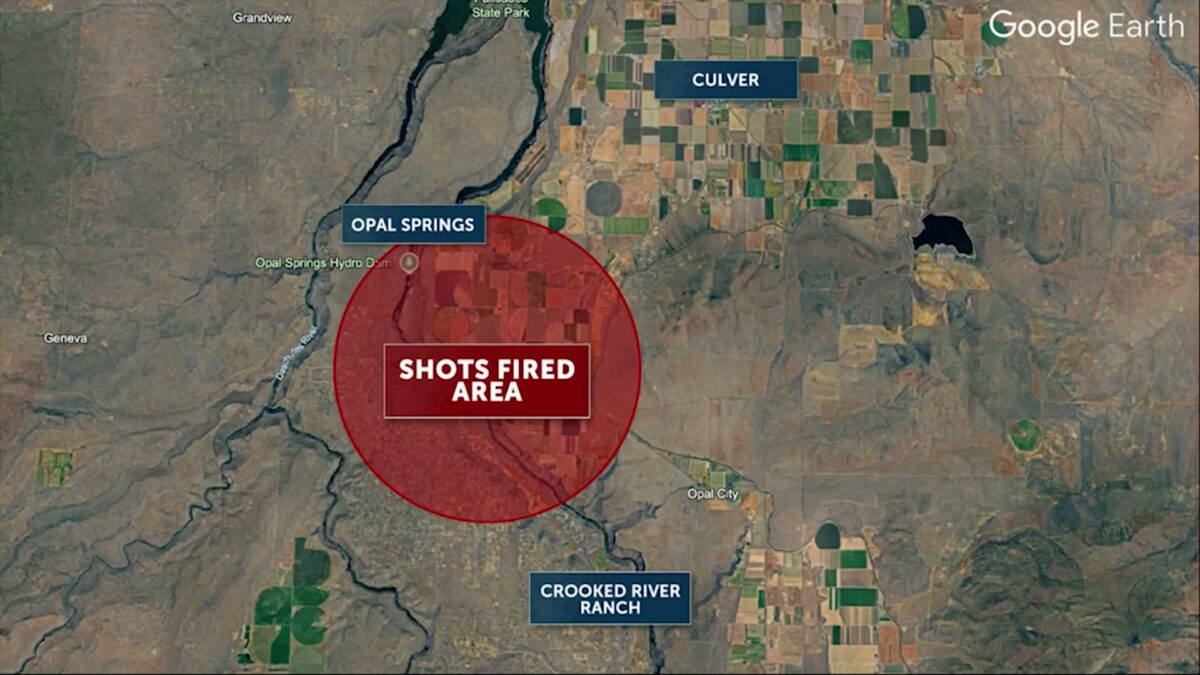
 Map of shots fired investigation.