Isabella Warren
(Update: Adding video, details, comments by lawmakers)
SALEM, Ore. (KTVZ)– With only two weeks remaining in this year’s session, Democrats have proposed the state’s new transportation package, and it comes with major tax increases.
House Bill 2025, or the Oregon Transportation Reinvestment Package (TRIP), would include a 15-cent increase to the state’s gas tax, already at 40 cents. It includes a 10-cent increase in January 2026 and another 5-cent increase in 2028.
It also would create a new tax on car sales and add a new per-mile fee for electric and hybrid vehicles.
We spoke with local leaders earlier this year, when legislators were first discussing transportation, on what needs to be funded in Central Oregon.
State Senator Anthony Broadman, D-Bend, said, “We’re just seeing a lot more need, with the amount of housing that is developing. We’re one of the fastest-growing regions, and it’s really important that our street system matches the growth and the need for safety that we have throughout Sisters, Redmond, Bend, and all of Deschutes County.”
State Rep. Emerson Levy, D-Bend, said last month, “We would love to see funding at 35th and (Highway) 126 (in Redmond). We would like a four-way light there. Right now, people are making unsafe turns, and we’ve even heard from our kids at the local high school saying that that turn is not a great place.”
According to the state Department of Transportation, only a small share of the funding that comes into ODIT can be used to maintain the state’s transportation system and run the agency.
Almost half of the state highway fund must be allocated to cities and counties. Half of what is left is dedicated to paying back bonds for past projects, and to investing in new projects.
That leaves about 20 cents of every dollar available for state highway maintenance.
The new package also proposes audits of ODOT after many complaints over major spending, like Bend’s Highway 97 renovations.
KTVZ News reached out to state Rep. Vikki Breese-Iverson but did not hear back.
It’s unclear yet how much exactly could be raised from taxes and fees in the proposed package. It’s set to be discussed in the coming days.
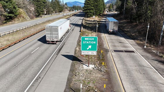
It comes as ODOT continues to struggle with a funding gap. It is facing shortfalls to meet the needs that are so severe, non-interstate routes like U.S. Highways 97, 20, and 26 could see little to no paving after 2027.
Below is the Joint Committee on Transportation Reinvestment’s press release, issued Monday:
Today, the co-chairs of the Joint Committee on Transportation Reinvestment introduced the Oregon Transportation Reinvestment Package (Oregon TRIP) to keep Oregon’s roads and bridges safe, support city and county transportation needs, and provide needed oversight of the Oregon Department of Transportation.
The bill (House Bill 2025) is based on more than a year of public engagement, stakeholder conversations, and legislative work groups that balances the various needs and perspectives brought before the committee.
“Every conversation we’ve had has helped make this bill stronger,” said Sen. Chris Gorsek (D-Gresham), co-chair of the Joint Committee on Transportation Reinvestment. “We’ve sought input from legislators across the political spectrum, and from people on the front lines: county leaders, transit providers, road crews, and Oregon families. That collaboration has led to a final package that strikes a balance while staying focused on the problems we need to solve.”
Oregon’s transportation systems are in crisis. More than 90 state-owned bridges across the state have major structural defects, potholes are going months without repair, many streets are dangerous for pedestrians and bicyclists, and promised major projects are still unfinished.
Oregon TRIP addresses these challenges by investing in Oregon’s roads and bridges at the city, county, and state levels; funding programs that are proven to improve pedestrian and bicyclist safety; and stabilizing funding for Oregon’s multimodal transportation systems for years to come.
It also establishes new legislative and executive oversight of ODOT, including frequent performance audits of the agency, quarterly reporting requirements, and a new major projects legislative oversight committee to review progress and limit scope creep.
“Maintaining Oregon’s roads and bridges is a shared priority, and must be a shared responsibility,” said Rep. Susan McLain (D-Hillsboro), co-chair of the Joint Committee on Transportation Reinvestment. “We’ve worked collaboratively across the aisle and with our stakeholders, community advocates, and constituents to develop this package. We remain committed to finding common ground as we move forward.”
The hearing schedule for HB 2025 includes:
Monday, June 9, 5 p.m.
Informational Hearing: House Bill 2025 walkthrough
Tuesday, June 10, 5 p.m.
Public Hearing: Anchor projects and ODOT accountability
Wednesday, June 11, 4 p.m.
Public Hearing: Transit, rail, bike, and pedestrian safety
Thursday, June 12, 4 p.m.
Public Hearing: Operations, maintenance, and preservation
Below are two drafts of TRIP:
Oregon TRIP 2025_starting point (002)Download
308125Download
Click here to follow the original article.