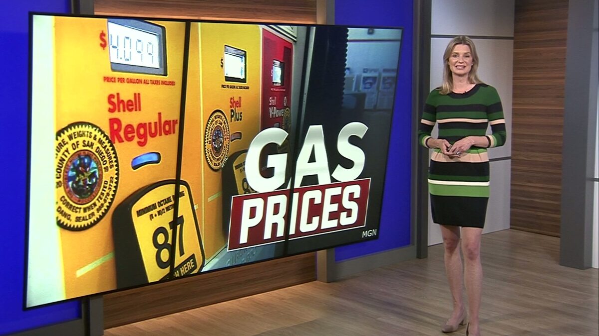
‘Health Care For All Oregon’ hopes to bring the idea of universal health care to all Oregonians

Triton Notary

BEND, Ore. (KTVZ) — Central Oregon residents gathered in a pub Tuesday night to talk about something that seems impossible for the average American: universal health care. Health Care for All Oregon is working to create legislation for free coverage for Oregonians.

Not only do members feel it’s possible, they think the stage is set for it to happen, specifically here in Oregon. That’s because Oregon’s state Constitution includes the right to affordable health care.

Nick Campbell from Health Care for All Oregon told KTVZ News, “We’re organizing now to make sure people are educated about this, know that it is real and it is possible, and you know that’s what Health Care for All Oregon is all about.

“We are doing this because it is very real here in Oregon, in a way that it is not in any other state in the nation. Oregon can lead the nation, make history, and be the first state in the country to accomplish this.”

Health Care for All Oregon expects there to be strong resistance to its efforts from the many people who benefit from privatized health care. The group will have more events locally and will try to get more people involved. For now, they’re pointing people to their website HCAO.org.

Click here to follow the original article.

Packing up: Vehicles towed as homeless rush to move from China Hat Road under Forest Service order

Isabella Warren

BEND, Ore. (KTVZ)– After nearly five years, J. Smith is leaving China Hat Road. His van was towed away on Tuesday, in hopes of being repaired, as he looks for his next home.

“This is the face of a handicapped senior citizen with a clean record who deserves better than what he’s gotten from our public servants,” Smith told KTVZ News.

In just over 24 hours, hundreds of homeless people like Smith must be gone. The Forest Service is beginning work in the area just south of Bend for forest mitigation, called the Cabin Butte Vegetation Management Project.

Some advocates and residents sued the Forest Service in federal court this month in a bid to delay or stop the year-long closure, but a judge denied the plea Tuesday.

“What must be done has to be done,” Smith said while packing his van Tuesday. “But there are ways of doing things that are more efficient, and compassionate at the same time.”

Jennifer Noske is struggling to pick up what’s left of her home, due to her disability.

“I have fibromyalgia and rheumatoid arthritis and spinal stenosis and myopathy. I have had no help. I don’t even know if I have much hope,” she said.

As the clock ticks to the midnight deadline Thursday, Noske says she worries fleeing might be the only option, if she’s not packed in time.

“The only thing you can control in your life is what’s around you, to a certain extent. When you lose that, it’s just, it’s kind of pretty unbearable and heartbreaking.”

KTVZ News will have live coverage of the closure on Thursday, beginning on our Sunrise newscasts.

Click here to follow the original article.

In Darlene 3’s wake, campfires banned on BLM lands in the La Pine area to curb danger of human-caused wildfires

Barney Lerten

PRINEVILLE, Ore. (KTVZ) — “To enhance public safety and reduce the risk of wildfires,” the Bureau of Land Management said Tuesday it’s prohibiting campfires on BLM-administered lands in the La Pine area from May 1 to October 31.

“This decision is part of an effort to reduce human-caused wildfires that have threatened lives, property, and essential utility infrastructure that have increased over the past several seasons,” the agency said.

The restrictions are new this year, as a result of several human-caused fires that originated from escaped campfires, BLM Prineville District Public Affairs Specialist Suzannah Burke told KTVZ News.

During recent years, the BLM said, the La Pine area has experienced devastating fires, including one that damaged restoration efforts from a previous wildfire.

“Escaped campfires are a significant contributor to these wildfires,” the BLM said.

The human-caused Darlene 3 Fire broke out last June 25 just east of La Pine and burned over 3,000 acres, threatening the community for a time. The BLM said decades of extensive fuel treatments in the area helped firefighters keep it from reaching town.

This summer, the BLM said, campfires, charcoal fires and any type of open flame will be prohibited on BLM lands in the La Pine area.

Properly commercially manufactured portable propane campfires, metal camp stoves used for cooking, and shielded lanterns fueled by bottled propane or liquid fuel are the only exceptions. All cooking stoves, portable propane campfires, or lanterns must meet UL/CSA safety standards.

These restrictions will apply to BLM-administered lands within the following boundaries: South Century Drive on the north, the Fremont-Winema National Forest boundary on the south, and the Deschutes National Forest on the east and west.

“Public use restrictions are one tool that we use to address repeated human-caused wildfires, particularly when we can identify one specific cause, like escaped campfires,” said Lisa Clark, Deschutes Field Manager.

The BLM urged all visitors to respect these restrictions to help protect the natural landscape and ensure the safety of everyone who enjoys the beauty of the La Pine area.

For further information, please contact the BLM Central Oregon Field Office or visit the BLM website at https://www.blm.gov/programs/public-safety-and-fire/fire-and-aviation/regional-info/oregon-washington/fire-restrictions.  

Click here to follow the original article.

Allergy season hitting High Desert sufferers especially hard this year

Barney Lerten

BEND, Ore. (KTVZ) — It’s a rough spring for Central Oregon allergy sufferers, and Dr. Ripdeep Mangat of Allergy and Asthma Care Center tells us he’s been very busy helping many struggling with severe symptoms.

So that’s our KTVZ.COM Poll question:

Click here to follow the original article.

64-acre prescribed burn conducted south of Sisters

Barney Lerten

(Update: Burn completed)

SISTERS, Ore. (KTVZ) — Firefighters with the Sisters Ranger District ignited 64 acres in a prescribed fire Wednesday on Sisters Area Fuels Reduction Unit 4 four miles south of Sisters along Forest Service Road 1505.  

A test firing was successful Wednesday morning, officials said. Smoke was visible from Sisters, Highway 20 and the surrounding area.

Firefighters later transitioned to mopping up and securing the perimeter.

Residents in Sisters and the surrounding area are encouraged to keep doors and windows closed to minimize smoke impacts. Smoke impacts are most likely overnight and in the early morning hours. 

While no road or trail closures are expected, the public is asked to avoid the Peterson Burn Horse Trail.  

Firefighters implement understory prescribed burning to reduce wildfire risk to communities. Prescribed burning reintroduces and maintains fire within our fire-dependent ecosystem by removing concentrations of vegetation and restoring forest health while increasing public and firefighter safety. 

Fire management officials work with Oregon Department of Forestry smoke specialists to plan prescribed burns. Prescribed burns are conducted when weather is most likely to move smoke up and away from our communities. While prescribed fire managers take significant preventive measures, it’s likely that communities may experience some smoke during or immediately after a prescribed burn.  

What does this mean for you? 

During prescribed burns, smoke may settle in low-lying areas overnight and in the early morning hours.  

All residents are encouraged to close doors and windows at night to avoid smoke impacts. 

If available, use a portable air cleaner. Air cleaners work best running with doors and windows closed. You can also create a DIY air cleaner

If you have a central air system, use it to filter air. Use high-efficiency filters if possible. 

When driving in smoky areas, drivers should slow down, turn on headlights and turn air to recirculating. 

If you have heart or lung disease, asthma, or other chronic conditions, pay attention to how you feel and if symptoms of heart or lung disease worsen, consider contacting your health care professional. 

Go to centraloregonfire.org to learn more about smoke safety and prescribed burning in Central Oregon and visit When Smoke is in the Air for more smoke preparedness resources. 

For more information on prescribed burning in Central Oregon, visit centraloregonfire.org/ and for information specific to the Deschutes National Forest, visit fs.usda.gov/r06/deschutes. Follow us on X/Twitter @CentralORFire. Text “COFIRE” to 888-777 to receive wildfire and prescribed fire text alerts. 

Click here to follow the original article.

Long-term impacts of next Cascadia subduction zone earthquake could be even worse than feared

NBC News

By Evan Bush, NBC News

EUGENE, Ore. (NBC) — When an earthquake rips along the Cascadia Subduction Zone fault, much of the U.S. West Coast could shake violently for five minutes, and tsunami waves as tall as 100 feet could barrel toward shore. But that’s just the start of the expected horrors.

Even if coastal towns in Northern California, Oregon and Washington withstand that seismic onslaught, new research suggests, floodwaters could seep into many of these vulnerable communities for good. That’s because entire coastal shorelines are expected to drop by as much as 6½ feet when the earthquake strikes, according to new research published Monday in the Proceedings of the National Academy of Sciences.

Researchers analyzed seismic and flood modeling to produce some of the most detailed estimates of how the Cascadia earthquake would drop — or subside — coastal shorelines and found that it could affect more than double the number of people, structures and roads currently at risk. The effect will also worsen over time, as intensifying climate change raises sea levels further.

“This lesser talked about hazard is going to persist for decades or centuries after the earthquake,” said Tina Dura, the study’s lead author. “The tsunami will come in and wash away and it’s going to have big impacts, don’t get me wrong, but the lasting change of the frequency of flooding … that’s going to have to be dealt with.”

Dura said geologic fossil evidence shows that previous Cascadia earthquakes immediately dropped the land level and turned dry ground into tidal mudflats in estuaries along the Pacific Northwest.

“That’s going to happen again and we’ve built up a lot of those areas,” said Dura, who is an assistant professor of geosciences at Virginia Tech. “That’s how we have ports there … and that’s where we built towns, and all that area is going to drop down maybe over a meter, up to two meters.”

The Cascadia Subduction Zone fault, which runs offshore along North America’s West Coast from Northern California to northern Vancouver Island, represents a looming threat. The fault has the capability to produce a magnitude-9.0 earthquake, and a large temblor is expected there at least once every 450-500 years, on average. The last of those major quakes occurred in 1700.

The National Seismic Hazard Model suggests there is a 15% chance a magnitude-8.0 earthquake or stronger will rupture along the zone’s margin within the next 50 years.

When the fault rips, experts have said, it will precipitate the worst natural disaster in the nation’s history. A 2022 state and federal planning exercise for a Cascadia earthquake predicted about 14,000 fatalities, more than 100,000 injuries and the collapse of about 620,000 buildings in the Pacific Northwest, including 100 hospitals and 2,000 schools.

The new research suggests that coastal planners must seriously reckon not only for the threat of intense shaking and tsunami waves, but also for the long-term reshaping and rapid sinking of the coastline itself.

“There’s the flood itself and then there’s the basically permanent change to land level at the coast, and that has a big impact for what those communities have to plan for,” said Harold Tobin, the director of the Pacific Northwest Seismic Network and a professor at the University of Washington, who was not involved in the new research. “Where are you going to put your school or hospital? Where are you going to build your transportation network? I think it’s important to take the long view.”

After the earthquake, Dura’s research suggests, large portions of towns along the Pacific Northwest coastline, such as Seaside, Oregon; Westport, Washington; and Aberdeen, Washington, would be expected to flood at least once every 100 years, if not more often.

The study also points out that sea level rise is accelerating as climate change intensifies, and the effects of post-earthquake flooding could worsen in the future.

Global mean sea levels have risen by about 8 to 9 inches since 1880, according to the National Oceanic and Atmospheric Administration. Sea level rise is expected to dramatically accelerate in coming decades because of global warming, with NOAA predicting another 10 to 12 inches on average by midcentury.

Where you live could determine how dramatic sea level rise appears, and how it affects the coastline.

While land in some regions of the U.S., like the Chesapeake Bay in Virginia, is slowly sinking in a process called subsidence, parts of the Pacific Northwest have been rising because of continental uplift. That rise in land level has offset some of the sea level rise to date.

The uplift is the result of stress building up within the tectonic plates that form the Cascadia subduction zone offshore. At the subduction zone, the Juan de Fuca plate is being forced beneath the continental North American plate. This causes the North American plate to bow upward slightly, pushing the land level higher.

Right now, the subduction zone fault is quiet and building stress. When the fault ruptures, the bowing of the plate will release and cause a rapid subsidence of the land level, essentially erasing centuries of uplift in an instant.

“That happens in minutes, and it can be on the order of meters,” Dura said. “The land persists down, and that can be for, like I said, decades and centuries. And so any areas that are kind of on the cusp of the floodplain are now in it.”

University of Oregon news release:

Flood risk increasing in Pacific Northwest

April 28, 2025 — The next great earthquake isn’t the only threat to the Pacific Northwest.

A powerful earthquake, combined with rising sea levels, could significantly increase flood risks in the Pacific Northwest, impacting thousands of residents and properties in northern California, Oregon, and Washington, according to new Virginia Tech research.

A study published this week in the Proceedings of the National Academy of Sciences found that a major earthquake could cause coastal land to sink up to 6.5 feet, expanding the federally designated 1 percent coastal floodplain, an area with a 1-in-100 chance of flooding each year, by 35 to 116 square miles.

“The expansion of the coastal floodplain following a Cascadia subduction zone earthquake has not been previously quantified, and the impacts to land use could significantly increase the timeline to recovery,” said researcher Tina Dura, lead author of the study and assistant professor of geosciences in the College of Science.

The research shows the most severe effects would hit southern Washington, northern Oregon, and northern California, densely populated areas in the region.

Dura’s team generated tens of thousands of earthquake models to estimate the potential range of earthquake-driven subsidence — sinking land — that can be expected from the next large Cascadia earthquake. Then, using geospatial analysis, the team quantified the earthquake-driven expansion of the 1 percent floodplain at 24 estuaries and communities along the Cascadia subduction zone. Because the timing of the next large earthquake is uncertain, the team modeled the impacts of an earthquake striking today or in 2100, when climate-driven sea-level rise will further amplify the impacts of earthquake-driven subsidence.  

The study estimates that following an earthquake today, an additional 14,350 residents, 22,500 structures, and 777 miles of roadway would fall within the post-earthquake floodplain, more than doubling flood exposure. Potential flooding would affect five airports; 18 critical facilities, including public schools, hospitals, police stations, and fire stations; eight wastewater treatment plants; one electric substation; and 57 potential contaminant sources, including animal feeding operations, gas stations, and solid waste facilities.

By 2100, the Intergovernmental Panel on Climate Change (IPCC) localized relative sea-level rise projections show that sea levels along the Cascadia subduction zone could be up to 3 feet higher than today. This climate-driven sea-level rise will amplify the impacts of future earthquake-driven subsidence, more than tripling the flood exposure of residents, structures, and roads.

“Today, and more so in 2100 as background sea levels rise, the immediate effect of earthquake-driven subsidence will be a delay in response and recovery from the earthquake due to compromised assets. Long-term effects could render many coastal communities uninhabitable,” said Dura, an affiliate with the Global Change Center.

Current low-lying land developed for cattle grazing and farming through diking and draining will experience heavy economic loss as increased tidal inundation will cause over salinization of soils and render them unusable. Additional impacts include erosion of natural systems, particularly coastal estuaries, intertidal wetlands and protective dunes and beaches. These act as buffers against storm surges and help to dissipate wave energy to prevent sediment erosion and protect property damage. According to Dura, the loss of these ecosystems may not be recoverable, and inland movement may be constrained by topography and human development.

“The loss of intertidal wetlands directly impacts ecosystem services such as water filtration, habitat for fisheries and shorebirds, and carbon storage capacity,” said Dura, an affiliate with the Fralin Life Sciences Institute. “Intertidal wetlands function as natural carbon sinks, and their erosion or conversion to tidal flats significantly reduces their ability to sequester carbon.”

The Cascadia subduction zone is one of many regions in the “Ring of Fire,” where the Pacific Plate meets another tectonic plate, causing the strongest earthquakes in the world and the majority of volcanic eruptions. However, a great earthquake — those with a seismic magnitude over 8.0 — has not occurred along the Cascadia subduction zone since Jan. 26, 1700, making coastal geologic records of past earthquakes and associated subsidence critical for understanding this hazard.

Dura and her team are documenting geologic evidence of past earthquake-driven subsidence as the Paleoseismology Working Group Lead within the Cascadia Region Earthquake Science Center (CRESCENT), a center at the University of Oregon funded by the National Science Foundation that is providing a collaborative framework to tackle multidisciplinary scientific and societal challenges at the Cascadia subduction zone.

Their research of geologic evidence from the last six to seven thousand years indicates that 11 great earthquakes have happened approximately every 200 to 800 years in the Pacific Northwest. The last earthquake in the region resulted in between 1.5 to 6.5 feet of land along the coastline immediately sinking.

“Cascadia is a unique place. It’s not super heavily populated, but most estuaries have a community in them, and they’re all right in the zone of subsidence,” said Dura. “This is honestly where I think the subsidence could have bigger impacts than it has during other recent large earthquakes around the world.”

Global relevance

Subduction zones, which can also be found off the coasts of Alaska, Russia, Japan, Indonesia, New Zealand, and South America, are all similar in that one tectonic plate slides beneath another. Along portions of these subduction zones, there is an initial uplift in the top plate. Pressure between the two plates gradually builds over centuries. The resultant earthquake is created when the plate above become unstuck. Offshore, the plate rises, forcing an upward water surge that leads to a tsunami. Onshore, the plate subsides, immediately dropping the coastline up to 6.5 feet. 

The earthquake shaking begins the process. For a magnitude 9 earthquake or over, that takes about four to six minutes. While the shaking is occurring the land is dropping, and, depending on tidal conditions, low-lying areas may experience immediate flooding. Within 15 to 20 minutes the tsunami hits with further flooding. The entire process takes no longer than 30 minutes, and multiple tsunami waves may occur over one to two hours. However, the sinking of the land will persist for decades to centuries after the earthquake.

According to Dura, the 1960 Chile earthquake submerged a pine forest and farms, converting them to tidal marshes, and it flooded coastal towns, forcing residents to abandon their homes; the 1964 Alaska earthquake forced the relocation of communities and airstrips to higher ground; the 2004 Sumatra-Andaman earthquake destroyed waterfront aquaculture and caused coastal erosion; and the 2011 earthquake in Japan caused erosion, disrupted ports, and contributed to a nuclear disaster.

“Given the global prevalence of subduction zones, these insights hold relevance beyond Cascadia, informing hazard assessments and mitigation strategies for tectonically active regions worldwide,” Dura said.

Click here to follow the original article.

Bend resident’s bid to scare off rock chucks with a smoke bomb under the house sparked a fire instead

Barney Lerten

BEND, Ore. (KTVZ) — A Bend homeowner’s attempt to use a smoke bomb to drive rock chucks out from under his house didn’t go too well Wednesday evening.

But thanks to a quick call to 911, Bend Fire & Rescue crews kept it from getting a lot worse.

Firefighters responded shortly after 5 p.m. to the reported fire in the crawl space under a manufactured home at Rock Arbor Villa Mobile Home Park on Northeast Highway 20, Deputy Fire Marshal Dan Darlacki said.

The crews arrived to find black smoke coming from under the house.

Fortunately, Derlacki said, the fire had not spread inside and was put out quickly, with everyone already out of the home.

An investigation found that the homeowner and a neighbor were attempting to drive away rock chucks from under the house, Derlacki said.

A commercially available rodent smoke bomb was used as a means to drive them away — but it caught the plastic vapor barrier on fire under the home.

Still, the fire official said they did something right: “By calling 911 immediately, they helped limit the damage to under the house and very little smoke damage inside.”

However, the damage was estimated at $10,000.

“Bend Fire & Rescue reminds everyone to keep fire-producing devices away from and under your house,” Derlacki wrote in a news release.

“Weed burners are the most common cause of these types of fires, where a flame is used to remove a nuisance weed, but the house is accidentally ignited. But these smoke bombs pose the same danger,” the fire official advised.

“This type of smoke bomb is designed to be used in fields and large open areas as a means to remove rodents. Ten feet of separation to all structures (decks, fences, houses, sheds, etc.) shall be maintained for any open-flame use, including rodent smoke bombs, to prevent these types of fire from happening,” he said.

And Derlacki offered one more piece of advice: “Never use any of these products during fire season”.

Click here to follow the original article.

Federal judge rejects plea to cancel or delay Forest Service project; China Hat homeless must move

Barney Lerten

(Update: Judge’s ruling)

BEND, Ore. (KTVZ) — A federal judge in Eugene on Tuesday rejected a plea by homeless people living in the woods south of Bend to delay Thursday’s deadline to move out for a large, year-long area closure for a fuels reduction project.

U.S. District Judge Michael McShane denied the request in a lawsuit filed by four disabled homeless people and two service providers for a temporary restraining order to block the nearly 36,000-acre closure for the Cabin Butte Vegetation Management Project.

“Because the Cabin Butte Vegetation Management Project is slated to begin in two days, the Court wanted to alert the parties it would not be granting injunctive relief,” McShane said in a brief court filing, adding that his written opinion will follow.

Dozens of people who have lived in the Deschutes National Forest south of Bend, some for years, are dealing with Thursday’s deadline to move out and make way for a large area fuels-reduction project.

In a 28-page response filed Monday in U.S. District Court in Eugene, federal attorneys said the judge should deny the request in a lawsuit filed by four homeless individuals and two service providers, seeking a temporary restraining order to halt or delay the nearly 36,000-acre public closure tied to the Cabin Butte Vegetation Management Project.

The “plaintiffs … have not carried their necessary burden to obtain the drastic remedy of a TRO” against the Thursday, May 1 area closure, the attorneys told U.S. District Judge Michael McShane, assigned to the case.

They argued that the project opponents “fail to show a likelihood of success, or serious questions, regarding the merits of their claims. They also fail to show a likelihood of irreparable harm.”

The plaintiffs filed their own 24-page reply Tuesday morning, to “renew their claim that they have carried the necessary burden to obtain the drastic remedy” of a temporary restraining order against Thursday’s public closure of the area.

They claim the Forest Service failed “to take into account the adverse impact on the human environment” as required by the National Environmental Policy Act in the Cabin Butte environmental assessment. (You can read both sides’ filings below).

The Forest Service disputed that the four named homeless can speak on behalf of others living there. They also argued that “self-represented homeless service providers” Eric Garrity and Chuck Hemingway have no valid third-party standing, not being homeless or living in the area.

Summarizing the 26,000-acre project to conduct thinning, prescribed burning and other steps to lower the threat of wildfires, the agency noted that “no environmental advocacy groups have objected to the project and none have challenged the project in court.”

The attorneys also pointed to “a steady increase of human-caused fire starts in the area that correlates with the increase in the population in the (homeless) encampments,” submitting photos of trash and encampments, among other evidence to back their stance.

The project was approved in January 2023 after a years-long environmental review “process in which none of the Plaintiffs participated,” they wrote.

This year, they said, “Forest Service personnel have made early in-person notifications to homeless individuals in the China Hat (Road) area to provide individuals ample time to find more suitable living situations.”

“The Forest Service also has worked with local service providers regarding outreach and an appropriate strategy to implement the area closure,” the federal attorneys stated, often referring to “sovereign immunity” on related matters.

They also said the claim of “irreparable harm” if the project proceeds as planned “is undermined by their delay in seeking extraordinary equity” in the form of a court order.

The attorneys point to a news article in which one plaintiff said she plans to get help hauling her fifth-wheel RV to her mother’s property in Bend. Another had been moving her belongings to a supportive housing unit in Bend.

Meanwhile, in a letter to Forest Service officials from Hemingway dated April 18 and filed in federal court late last week, the plaintiffs offered to drop their lawsuit and withdraw their 80 disability complaints “if USDA and the Forest Service is willing to agree to a ‘rolling closure’ over the course of the summer and early fall while the weather is good to allow all those remaining on the land to relocate.”

Here’s the complete federal attorney’s response filing:

show_temp.plDownload

Here’s the plaintiff’s response, filed Tuesday:

show_temp.pl (1)Download

Click here to follow the original article.

Problem Solvers: Oregon family farm seeks changes to federal protections after lone wolf kills several calves

Harley Coldiron

Wolf conservationists call case ‘outlier,’ say changes to Endangered Species Act could be catastrophic

LAKE COUNTY, Ore. (KTVZ) — Despite the presence of U.S. Fish and Wildlife at the Flynn family farm for nearly a month, Oregon Wolf 158 continued to wreak havoc, killing multiple calves and resulting in tens of thousands of dollars in damages. The family is now advocating for reforms to the Endangered Species Act.

The Flynn family farm in Southern Oregon has been in operation for three generations. The property in Valley Falls, Oregon sits just a short drive from the California and Nevada state lines, a prime location for America’s growing wolf population.

After Oregon Wolf 158 went on a killing spree as he traveled through Northern California, and even prompted a public safety emergency, he came face to face with Tom Flynn on his farm.

“That wolf had killed the calf,” Flynn recalled, telling Problem Solvers about how he approached the wolf and captured the entire encounter on camera.

His video shows the wolf standing for minutes and looking at Flynn as the calf’s mother sits just feet away, watching the wolf in terror.

“I mean, he had his back turned towards me. There was zero feeling of a threat,” he said as he rewatched the video.

Flynn grabbed his gun, ready to defend his family and his livelihood, the hundreds and hundreds of cattle on his farm.

“He just killed one. He has no fear of me. There’s more babies out here just, you know, within a couple hundred yards of him.”

Tom called to his wife and veterinarian, Elise, so she could contact ODFW.

She recalled, “They said that in self-defense, we could shoot him, but they made it also made it clear that he had to be actively lunging at you.”

Tom Flynn, who was worried about facing federal prison, chose not to kill the wolf, a decision that would prove costly.

For the next three weeks, Wolf 158 would attack and kill at least eight more cattle, according to the Flynns, all while Fish and Wildlife officers were embedded on the family’s property.

Video taken during the operation shows the wolf roaming the farm, just feet away from several cattle – “right below my barn,” Tom says as he records the predator.

U.S. Fish and Wildlife’s goal (with Oregon Department of Fish and Wildlife also on scene) was to try and use every non-lethal method to move the wolf due to the Endangered Species Act — “and they had no success,” exclaimed Elyse.

Her husband added, “They (Fish and Wildlife) would be in our feed grounds at night – and then that next morning, we’d have a kill.”

Each animal lost cost at least $2,000, plus the hundreds of hours of labor spent on protecting the farm with fencing and wire.

After three weeks of trying to humanely move the wolf, Fish and Wildlife officers made the decision to euthanize the animal, drawing outrage from the Flynns.

“After a three-week period, it finally came back to what I could have done in the first five minutes of, of encountering that wolf,” he told the Problem Solvers.

The Flynns’ experience is now empowering them to change the Endangered Species Act. They want local control.

But conservation advocates like Bethany Cotton who works as Conservation Director for Cascadia Wildlands says that change could be catastrophic for the species.

Cotton, who’s from rural Southern Oregon, says Oregon Wolf 158 is an outlier, and the methods Fish and Wildlife use to relocate wild animals work.

“I’ve never seen anything like this before in all the years I’ve done this work,” she told the Problem Solvers. “All the peer-reviewed science says that those tools are really effective, and in the vast majority of cases, they work really well.”

So what’s the answer?

Cotton believes there needs to be education.

“We work with ranchers and talk to ranchers who have used them (non-lethal methods) for years and have never had a predation occur on their property and successfully coexist,” she said.

For the Flynns, they want to be able to protect their way of life: “There’s just a huge misconception, disconnect from urban and rural lifestyles.”

The Problem Solvers reached out to both the Oregon and U.S. Fish and Wildlife concerning the Flynns’ experiences, but they declined to comment. In light of this, we submitted a Freedom of Information Act request concerning the case and information about Oregon Wolf 158.

Due to backlog and short-staffing, Fish and Wildlife say they plan to have a response and provide the needed documents to us in June.

The Problem Solvers have reached out to lawmakers both at the state and federal levels concerning the couple’s troubles, asking what conversations need to happen to protect families like the Flynns while preserving wild animals like the wolf population.

We’ll have an update on this story as soon as possible.

Click here to follow the original article.

Hayden Homes celebrates fifth anniversary of Bend amphitheater’s naming with concert package giveaways

Barney Lerten

BEND, Ore. (KTVZ) — Hayden Homes is thrilled to celebrate the fifth anniversary of the Hayden Homes Amphitheater’s naming rights partnership with a giveaway for five lucky winners to experience a night of live music in style.

“The Hayden Homes Amphitheater is an iconic community gathering place that unites people from all over the region — and indeed the country — to enjoy great live music together along the beautiful banks of the Deschutes River,” said Katy Wooderson, Hayden Homes vice president of marketing. “We’re so grateful to our partners at the Old Mill District and Live Nation for supporting our commitment to building a strong community — it’s about so much more than just building homes.”  

Five years ago, the Amphitheater became known as the Hayden Homes Amphitheater as part of the company’s Give As You Go™ philosophy, which is rooted in community partnerships and creating opportunities for everyone to lead fulfilled lives. The Hayden Homes Amphitheater offers just that: a place to join together, create memories, and enjoy unforgettable live music experiences.

“This partnership has been everything we’ve hoped for and more,” said Marney Smith, the longtime general manager of the Amphitheater and president of The Bend Company, which developed and owns the venue with its partnership group, River Bend Limited Partnership.

“Since we’ve partnered with Hayden Homes, we’ve hosted more than 150 shows on our stage and welcomed hundreds of thousands of fans through our gates. Hayden Homes has always been a supporter of arts, culture, and community. What they’ve done with their support of the Amphitheater has helped elevate live music not just in Bend or Central Oregon, but the state as a whole.”

To celebrate and kick off the concert season, Hayden Homes is giving away concert packages to five lucky winners, including all the very best that Bend and the Old Mill District have to offer. Packages include:

Two VIP Deschutes Deck Tickets

Choose your concert (subject to availability)

Includes two drinks and one food item per person

One-Night Stay at a Local Hotel

Relax in Bend after a night of live music

Tumalo Creek Kayak & Canoe Rental

Enjoy time on the Deschutes River with a rental for some outdoor fun

$100 Old Mill District Gift Card

Shop, dine, and explore Bend’s vibrant community

“There’s nothing like live music on a summer night in Bend — and for the past five years, Hayden Homes Amphitheater has set the stage for those unforgettable moments,” said Rob Scolaro, senior vice president and head of venue sales at Live Nation. “We’re proud to partner with Hayden Homes and the Old Mill District to make those moments possible — and now, Hayden Homes is giving fans an incredible opportunity to be part of the magic in an even bigger way.”

View the 2025 Hayden Homes Amphitheater concert lineup and enter to win the giveaways on the Hayden Homes website. Follow the link provided and submit an entry form between Monday, April 28 and Friday, May 16, 2025 to be considered to win.

Click here to follow the original article.