Barney Lerten
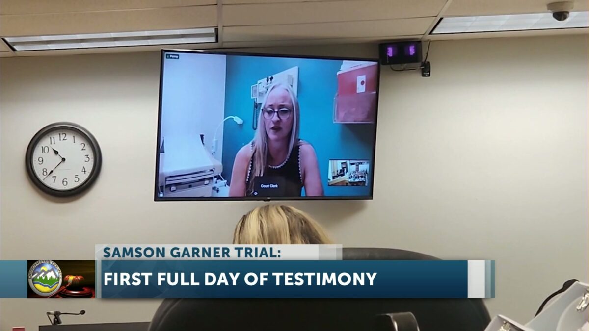
BEND, Ore. (KTVZ) — The first full day of testimony in the trial of a Portland man accused of plotting to commit a mass shooting at a Smith Rock climbing event turned emotional when Samson Garner’s ex-girlfriend spoke about finding a bag of climbing gear on her porch when she returned home from a trip – and feared he had killed himself.
Samson Garner, now 41, was still alive, but the thoughts he shared with her and close friends – not just about suicide, but violence toward others – had caused rising concern among those friends he had withdrawn from, prompting them to contact police.
That led to his arrest in October 2023 at a mountain-biking trailhead campsite, about 30 minutes away and the day before the Craggin’ Classic was to begin at Smith Rock.
Garner is now on trial for 26 charges, including four counts of attempted murder.
Penny Gneiting, a physician assistant in Portland, testified by video about her relationship with Garner, whom she met in January 2023 at the Mazamas climbing club both belonged to. They began dating in late February, as Garner’s now-ex-wife and two children had moved to another state.
“We had a really lovely time together,” Gneiting said, speaking of skiing, biking and kayaking trips and him teaching her about rock climbing, but “it was over at the end of May.”
Deschutes County Deputy District Attorney Stacy Neil asked Gneiting what she’d learned of his dissolving marriage, and she said Garner was upset about not being able to see his children. But asked about custody, she said he told her he “felt it was better for the girls to be with their mom than with him.”
Gneiting said Garner told her he was taking a year off work and living on his savings, able to buy items such as a camping refrigerator that she said “seemed like a luxury.” She said he expressed frustration from his years of marriage when “he felt like she never let him spend any money.”
“I remember being really impressed how strong he was,” often sore from ju-jitsu, Gneiting said, and “he loved to cook,” several times sending her home with a whole week of leftovers for the work week.
Gneiting also said he spoke of how he wanted to stop drinking alcohol, which was affecting his quality of sleep and giving him hangovers. He also eventually shared with her his use of a vape marijuana pen: “It was something that made him more relaxed. He was very funny when he was vaping. It didn’t seem like a bad thing to me.”
Prosecutor Neil asked if she was aware of any guns in his home, and he showed her a “gun cabinet” in the basement, but not the weapons themselves.
“He asked me once if I wanted to go target shooting,” she said, but “I didn’t want to do that.”
Asked if Garner shared his views about guns, Gneiting testified that he “said he needed to have them before they would not be available. I think he said we’d at some point not have access to guns.”
As for encountering family members, Gneiting said he was “pretty estranged from them,” but spoke of being raised by his mom: “She sounded lovely,” having taken care of Garner and his two sisters.
The turning point in the relationship came on the morning of Memorial Day 2023, when she slept over at Garner’s house, with their plans to go mountain biking.
Garner was sleeping facing away from her, so at one point she touched his shoulder, and he jerked.
“I looked over and saw a look of terror on his face – a really frightened ‘deer in the headlights’ look. I had never seen that look on anyone’s face before.”
Garner was on his cellphone and wouldn’t talk to Gneiting, so she headed home, calling the situation “very awkward.”
In an email exchange, she said Garner explained by saying, “Sometimes I just need coffee,” but in her view, “that wasn’t true.”
“I didn’t trust him after that,” Gneiting said. “You can’t have a relationship with someone who wouldn’t talk to you about something that horrible.”
She spoke of one other unsettling incident, while they jogged at Mount Tabor in Portland. They were deciding which way to go and “bumped shoulders.” She said she laughed, but he told her: “’Don’t get under my feet, or you’ll get kicked like my dog.’ It was very weird. It was the only other time when I thought, ‘I don’t know this person.’”
She said she tried to talk to him several times after that, to no success, and after a “pretty uncomfortable” outing to a performance, when he “looked miserable,” she told Garner, “We need to talk. He said ‘no.’ I said, ‘Okay, this is it, we’re not together any more.”
He later texted her, while she was on a climbing trip to Canata, and said, ‘Let’s not break up.’ By that time, I was way beyond that,” Gneiting said, so she told him no: “You need to focus on your mental health.”
In late August, a mutual friend, “Jamie” (James Wende), reached out and asked for help, saying Garner “was being suicidal and not responding.”
She eventually did reach out to Garner about a concert they had planned to go to, saying in part, “I don’t know what you’re going through. Please don’t forget that your friends want you to get back up on your feet.” He wrote back, saying, “Yeah, I’m good,” among other things. She replied, “I am so glad to hear from you,” and that she hoped they could remain friends: “Water under the bridge. You’ve got this.”
“I believed he was suicidal,” and she, Jamie and another close friend of Garner’s, Ben Larson, were trying to keep in touch and be supportive: “We thought of it as a suicide intervention.” (Wende and Larson are listed among the 35 potential prosecution witnesses in the trial.)
Gneiting also consulted a psychologist where she works, who suggested that the three friends visit Garner’s home with a six-pack of beer, but they didn’t feel comfortable doing so. She said of Wende and Larson, “They knew him much longer, had seen a longer decline in his mental health.”
At the end of September, after a climbing trip with friends to Canada, she returned to find a large bag of Garner’s camping gear on her front porch.
“I thought Samson was dead,” Gneiting said, emotionally. “I thought he committed suicide.”
She said she tried to get some sleep, and “knew I needed to call police.” She did, but not right away.
“I am a sworn reporter,” Gneiting said. “When someone tells me suicidal ideations, it’s my duty to report” them.
And then Gneiting received the much-discussed email from Garner, despondent over their breakup, in which he wrote his thoughts about mass shootings at Mt. Hood Meadows and Smith Rock. She was not asked to read that email for the jury, as a sheriff’s sergeant had already done so.
But she became emotional as she talked of how the email was “pretty traumatizing,” pausing before adding: “It’s just gruesome.”
Gneiting wrote back to Garner, even though she was unsure if he had carried out what he’d spoken of, going to the mountains and killing himself to prevent him from hurting others.
She broke down while recounting how she spoke in that reply of the “so wonderful memories we shared together,” and called Garner “my dear friend.”
The prosecutor asked Gneiting if she wanted to take a break before more questioning. “I just want to get it over with,” she said.
And so, asked if she was then worried about others getting, if he had not ended his life, she replied, “Yes.”
Earlier Wednesday, Deschutes County sheriff’s Sergeant David Turkington completed his testimony. He said the potential threat Garner posed in Portland became a “credible threat and imminent threat to the community” when he left his home, and a ping of Garner’s cellphone revealed he was indeed in Central Oregon, within “striking distance” of Smith Rock.
Click here to follow the original article.


 43-year-old Rosellyn Thayer of Prineville’s car, after she left the roadway.


 Sarah and her son go into their motel after arriving in Madras.
 Jennifer takes a selfie with her husband and their daughter.
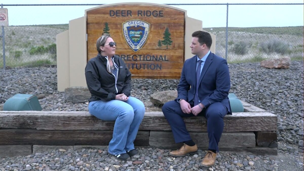
 Sarah talks about her experiences at Deer Ridge.
 View of Deer Ridge’s visitation room, which is about half the size of other state prisons.