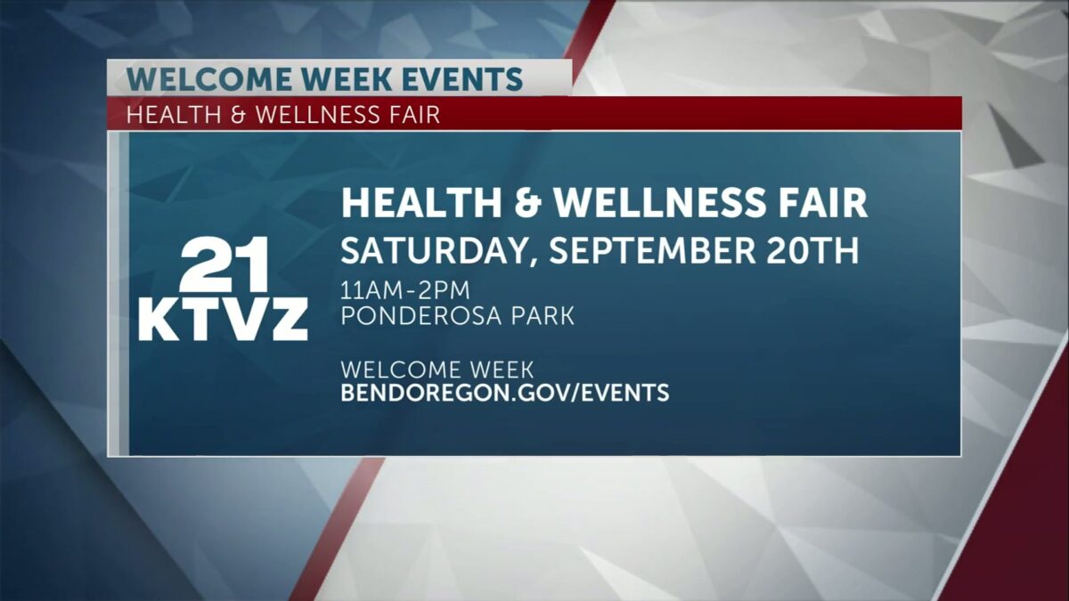
All are welcome at third annual Health and Wellness Fair, taking place Saturday at Bend’s Ponderosa Park
KTVZ
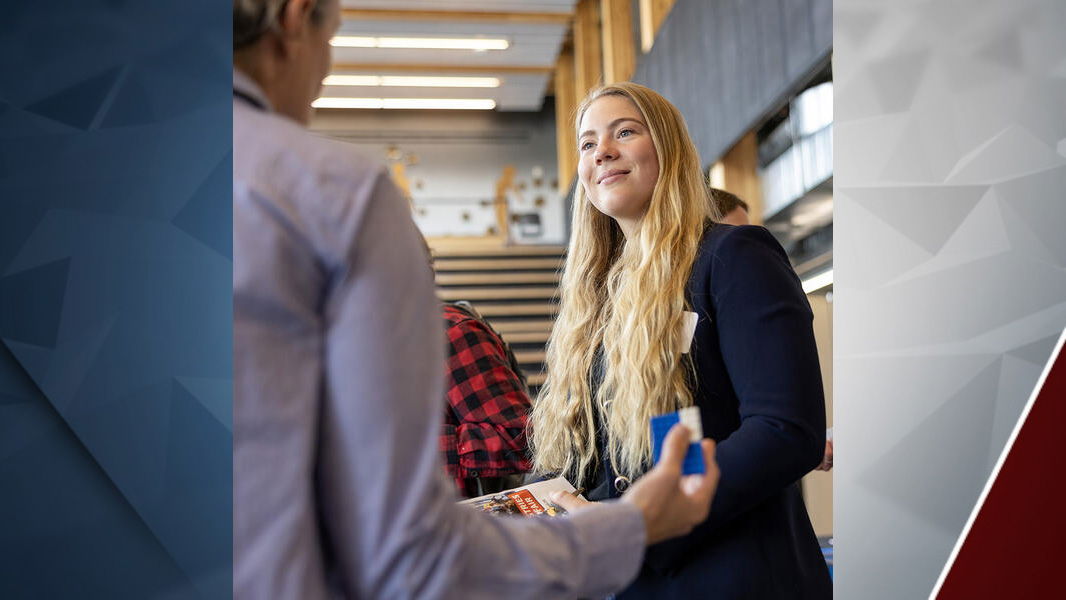
BEND, Ore. (KTVZ) – In celebration of Welcoming Week 2025, three local organizations are bringing back the popular Health and Wellness Fair to be held Saturday, Sept. 20 from 11 a.m. – 2 p.m. at Ponderosa Park (225 SE 15th St.) in Bend.
Mosaic Community Health, Deschutes County Health Services and Volunteers in Medicine Clinic of the Cascades are co-hosting the third annual outdoor event to welcome immigrant, refugee, Latino and other community members and provide easy access to useful information for improving health and well-being.
“We aim to improve the health and wellness of community members who are most affected by health disparities and inequities,” said Shana Falb, Community Partnerships and Engagement, Deschutes County Health Services. “This year, the event convenes vetted healthcare providers and social service organizations to provide on-site services—improving community access and ultimately reducing those health inequities.”
Welcoming Week takes place Sept. 12-21 citywide, with events that celebrate inclusivity and belonging in Bend. The City of Bend became a Welcoming City in 2017 and participates in this national event every year. Welcoming Cities are guided by the principles of inclusion and creating communities that prosper because everyone feels welcome, including immigrants and refugees. This year’s national Welcoming Week theme is Stories We Share—recognizing and celebrating voices in our community who are actively building welcoming spaces by practicing belonging and resilience.
The Health and Wellness Fair increases awareness of where community members can receive medical and dental care, mental health and wellness services, social services, vaccine education and other care addressing social determinants of health. In addition, the event will provide on-site health services such as emergency dental care, blood pressure checks and education on hypertension, skin health screenings and education, diabetes wellness and more.
“This year we’re expanding access to on-site health services, including oral health screenings, and making sure Latino families receive information in their language about where and how to get care,” said Jason Villanueva, Mosaic Spanish Communications Coordinator. “Beyond connecting people with the resources they need, we also want the fair to be a time for the community to come together, celebrate and have fun.”
The event will also offer activities such as group fitness classes facilitated in Spanish, free nutritious food from a local vendor and fun health education activities for children and families. Interpretation services in multiple languages will be provided for any community member to access, and most participating vendors will have bilingual staff available.
This year, the event organizers received sponsorships to increase the number of on-site health services at the event. Sponsors include Pacific Source Community Solutions, St. Charles Health System, City of Bend, Deschutes County Health Services, Central Oregon Health Quality Alliance, Central Oregon Health Council, Central Oregon Independent Practice Association and Northwest Credit Union, plus a grant from First Interstate Bank.
“Thanks to generous support from sponsors, we are glad to host this community event again,” said Courtney Gallant, Director of Philanthropy and Community Outreach at VIM Cascades. “Especially now, with policy changes and subsequent shifts in care delivery, it is important that community members know where and how they can access the healthcare and social care service providers they need.”
About Welcoming Week
Welcoming Week is a national campaign and celebration held annually to bring together neighbors of all backgrounds to build strong connections and affirm the importance of welcoming and inclusive places in achieving collective prosperity. Launched in 2012 by Welcoming America and its members, Welcoming Week provides individuals and organizations the opportunity to showcase their values through events and initiatives that foster connections and collaboration between immigrants and non-immigrants, as well as belonging for all. Learn more about the national campaign at welcomingweek.org. Learn more about the City of Bend’s Welcoming Week at https://www.bendoregon.gov/events/welcoming-week