First Alert Weather Alert: Tracking rain and flooding in the valley
Gavin Nguyen
COACHELLA VALLEY, Calif. (KESQ) – It has been a wet day here in the Coachella Valley. A few bands of heavier precipitation have entered the mix this afternoon. Several Areal Flood Advisories have been issued as the National Weather Service monitors this rain. There was quite the downpour at our station in Thousand Palms right around 3:00!

So far, the Palm Springs Int’l airport has received 1.08 inches of rain. Other parts of the valley, like Palm Desert, have seen close to nine tenths of an inch of rain.

As a result of flooding across the deserts today, we have seen some roads close. All roads through the wash are currently closed as of 3:21 p.m.

As of 5:45 AM, a Flood watch remains in effect for nearly all of Southern California. At this time, there are even a number of flash flood warnings in place across parts of Los Angeles and Ventura Counties. The Weather Prediction Center has us under a slight risk (yellow shading) for flash flooding. This means we have at least a 15% chance of a flash flood occurring. A moderate risk (red shading) extends from Santa Barbara County all the way to Orange County and the San Gorgonio Pass. A moderate risk represents at least a 40% chance of flash flooding.

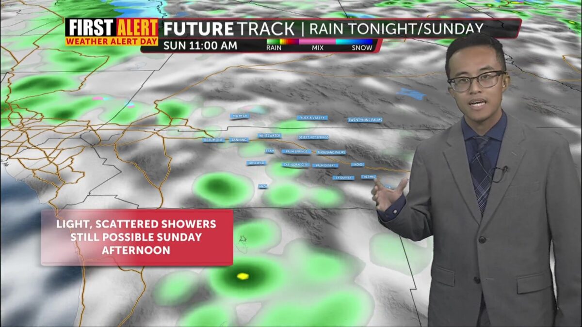
There are still some lingering rain chances for the rest of the evening and into Sunday. Tonight’s rainfall appears to taper off into scattered showers/drizzles, though the chances return early Sunday morning. Chances for the heaviest rainfall appear in the early morning hours, beginning around 4:00 a.m. Sunday, before light, occasional showers could occur through the rest of the day.

Another system will move through on Monday. This will bring the chance for another round of precipitation, including snow for our local mountains. There remains a slight chance of rain into Tuesday as well. Yet another system will move through for the end of the workweek!

Looking ahead, this week will be quite different from the previous few. Highs will stay in the low 70s or upper 60s this entire workweek! This is because of a string of systems moving through in the days ahead. One will move through early in the workweek, and the other will come toward the end. Given the cooler air in place, some snow is more likely on the mountains. We may see the first inch of snow at the Tram as early as today. Back here on the valley floor, we may see some extra precipitation from these systems, so stay with us for extra details!
