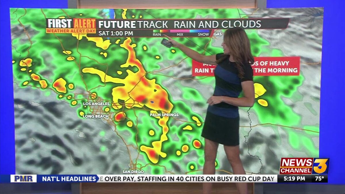
Storm Set to Soak Coachella Valley Through Saturday
Katie Boer
Happy Friday! We’re about to experience “weather whiplash” as we transition from 90s and sunshine to a very wet and active stretch over the Coachella Valley, with the pace picking up noticeably tonight.We’re under a First Alert Weather Alert for rain leading to possible flooding across the region today and all day tomorrow.
Light, spotty showers we’ve been seeing today (especially this morning) will increase late as a stronger surge of moisture moves inland, all associated with a powerful low-pressure system moving across Southern California.
By late tonight and especially Saturday morning, rainfall becomes more widespread and much heavier, with some bursts of quick and constant rain possible when one of these bands pops up. There is an elevated amount of CAPE or instability moving through our region with this push overnight and Saturday so I’m not ruling out an chance of thunderstorms.
For the Valley, storm totals are expected to land near an inch, though models have ranged anywhere from about 0.75″-1.50″. Even on the lowest end, this would be significant rainfall for us. Obviously pockets under those heavier bands of rain could see much higher accumulation in a short period of time.

A Flood Watch remains in effect because of the potential for excessive runoff, reduced visibility, and brief, intense downpours. This will be especially problematic near recent burn scars and there are a number of evacuation orders around some of these spots.

Winds are also expected to pick up as the front pushes through, gusts 30-40 mph in desert slopes and breezier conditions into the lower Valley, but this remains of lesser concern than the impact the rain will have.
It’s possible we’ll still see some lingering showers into Saturday evening before gradually tapering off. Sunday looks better with some dry breaks–but a slight chance of rain still remains.
Brace yourself, we’re not out of the woods on this after this weekend. Another storm system is lining up for Monday and Tuesday, along with dramatically cooler temperatures–highs dropping into the upper 60s! Showers may linger into Saturday evening before gradually tapering late. Sunday should offer some breaks, but we’re not done yet—another storm is lining up for Monday into Tuesday, with cooler temperatures and additional rain chances returning. If this were a boxing match, we’re looking at going several rounds here… with a third system possibly arriving toward the end of next week. So we’re locked into a pretty active pattern here for a few days.
