Foley Ridge Fire prompts ODOT to close a 21-mile stretch of nearby state Highway 242
Barney Lerten
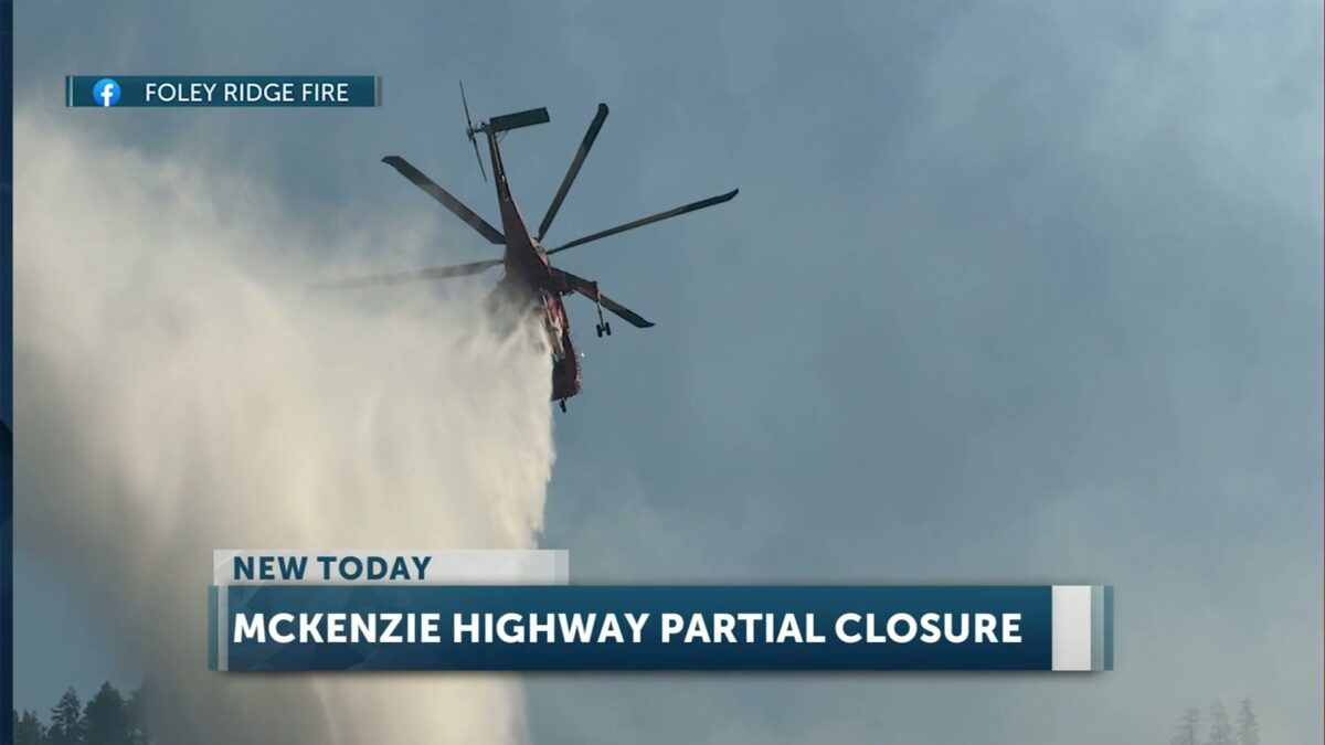
McKENZIE BRIDGE, Ore. (KTVZ) — The Foley Ridge Fire that broke out 10 days ago on the Willamette National Forest east of McKenzie Bridge has burned nearly 450 acres and prompted the closure Tuesday of a 21-mile stretch of state Highway 242, at fire officials’ request.
The Oregon Department of Transportation said the highway was closed Tuesday morning between mileposts 55 (the Highway 126 intersection) and 76 due to the lightning-sparked fire. ODOT urged travelers to use alternate routes and avoid the area. There is no estimated time for reopening.
This is the first full closure of the highway since the fire began, ODOT Public Information Officer Mindy McCartt confirmed to KTVZ News. Previously, there had been one-lane reductions with pilot cars for daytime hours since Saturday.
“The request to close the highway came directly from Incident Command this morning, in consultation with fire officials about the impacts to safety,” McCart told us.
Foley Ridge Fire officials said in a post to the fire’s Facebook page: “HWY 242 is now closed at the intersection of HWY 126 to MP 76 until further notice due to firefighter and public safety. Please use an alternate route and expect delays.”
Here is the Foley Ridge Fire Tuesday morning update from fire officials:
Start Date: 09/06/2025
Percent Containment: 0%
Size: 437 Acres
Cause: Lightning
Personnel: 319
Helicopters: 1
Heavy Equipment: 25
Engines: 9
Crews: 8
Cost to date: $3.3 million (from NIFC Daily Situation Report-PDF)
The Foley Ridge Fire has been mapped at approximately 437 acres, with most of the fire activity along the western edge of Foley Ridge. With continued warm and dry conditions, increased fire activity is expected. The fire is anticipated to stay active overnight, with roll out and isolated single tree torching likely.
Full suppression efforts are progressing, with firefighters on the southern and eastern flanks, patrolling and securing hot spots where direct handline and dozer line have been constructed. To date, crews have constructed over three miles of dozer line and 1.25 miles of handline and deployed more than 30 miles of hose.
Fire operations are scouting for opportunities to construct contingency handline and conduct burnouts with strategic firing operations. Carried along established containment lines, firing operations aim to eliminate ground fuels and create a buffer zone. This strategy employs a lower-intensity fire that can help secure the perimeter in terrain too hazardous for direct engagement.
Structure protection activities continue around Yale Camp, the Foley Seed Orchard, and White Branch Youth Camp. The shaded fuel break along Highway 242 is well-established, and fire operations are actively scouting opportunities to add depth to these indirect containment lines.
Closures- Road closures include Foley Ridge Road (Forest Service Road 2643), White Branch Youth Camp will remain open. Closed recreation sites include Rainbow Falls Trailhead and Separation Lake Trailhead. Foley Ridge Trailhead will be inaccessible due to the closure. For the complete Foley Ridge Fire closure order, including a map, visit our website at https://www.fs.usda.gov/r06/willamette/alerts/foley-ridge-fire-closure-order.
Weather- Mostly sunny skies are forecast early this week. Temperatures are expected to rise with low, “near critical” relative humidity for Tuesday and moderate, gusty southeast winds.
McKenzie River Highway (HWY 242) (Earlier info, highway now closed) – Please be advised the highway will be reduced to one lane with a pilot car between the hours of 6:00 AM and 8:00 PM due to suppression activities along the corridor. Visit the Oregon Department of Transportation’s webpage for the latest information https://tripcheck.com.
For more information, visit the incident website: https://inciweb.wildfire.gov/incident-information/orwif-foley-ridge-fire.