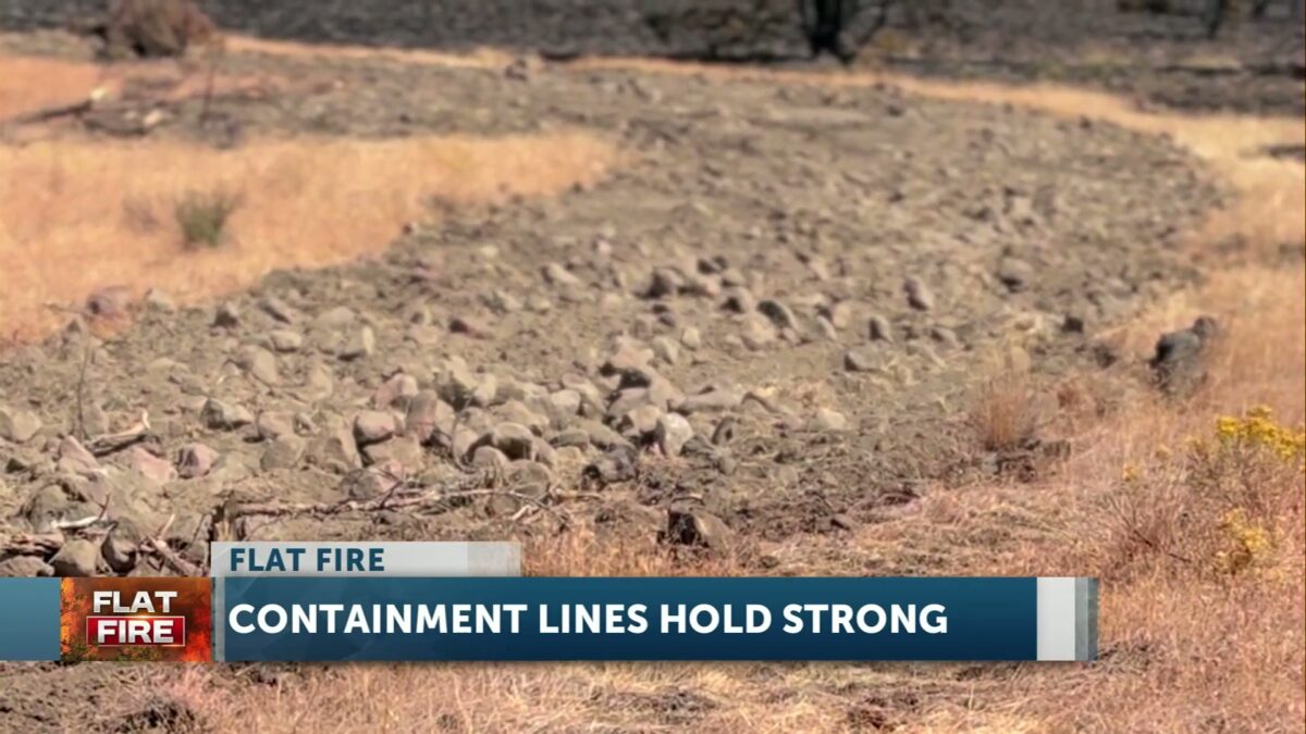
FIRE ALERT: Containment increases to 67% on the Flat Fire, evacuation orders lifted or downgraded
KTVZ – News Team
SISTERS, Ore. — The Flat Fire, approximately two miles northeast of Sisters, Oregon, is estimated at 23,346 acres and is 67% contained. At this time (September 2nd), the Deschutes County Sheriff’s Office has lifted some and downgraded other evacuation zones to Level 1 (Be Ready).
Level 1 orders in place:
Wilt Rd from Big Buck Ln to the County Line, including Blazer Ln and Maria Ln
Whychus Canyon Estates and Mountain View Rd to the end.
Panoramic Estates and Emerald Valley Rd area.
The area North of Edmundson Rd between Panoramic Estates and Holmes Rd, north to Wychus Creek.
Area North along both sides of Holmes Road from Edmundson Rd to Lower Bridge Rd. Including Wanona Rd, Goldcoach Rd, Crawford Trl, McSwain Dr, and Running Horse Ct.
Earlier reporting:
Despite critical fire weather, established fire lines have remained secure and suppression repair objectives continue across the incident. The Red Flag Warning is no longer in effect due to a lower chance of strong gusty winds. Hot, dry conditions persist.
Today, firefighters will focus on restoring areas impacted by fire response efforts, such as repairing dozer lines and reducing erosion risks. These initiatives strengthen containment and protect the landscape to support long-term recovery. With a unified mission across the fire line, crews continue to make steady progress, bringing the incident closer to full suppression.
Oregon State Fire Marshal (OSFM) resources have demobilized from the Flat Fire. Cooperative firefighting efforts from structural, wildland, and air resources protected homes through extreme fire activity and critical weather conditions. 17 OSFM task forces and strike teams, made up of 261 firefighters from all over Oregon, responded to help local agencies protect the community. Their efforts, in conjunction with the progress by wildland firefighters, have helped mitigate the risk to structures and allowed residents to safely return to their homes.
Wildland resources remain on the fire, continuing mop-up and are available to assist local resources if needed. OSFM is available to return if an imminent threat to structures exceeds capabilities of existing resources. OSFM would like to extend their appreciation to the local communities and agencies for their incredible support and cooperation throughout this challenging time.
“We are thankful for all the hard work firefighters have put in and hope everyone has a safe Labor Day,” says Eric Perkins, Deputy Incident Commander for Oregon Department of Forestry CIMT Team 3.
Firefighter Safety: We ask everyone to remain mindful that fire crews are still working in the area. Please drive carefully, watch for firefighting equipment on the roads, and allow crews space to do their jobs safely.
Wildfire Prevention: If your weekend plans take you outside, please be aware of the fire risks and recreate safely. Hot temperatures and low humidity persist in the area, increasing fire risk and contributing to potential fire growth; help prevent the next wildfire by following all local regulations:
Oregon Dept. of Forestry: https://gisapps.odf.oregon.gov/firerestrictions/PFR.html
Deschutes National Forest: https://www.fs.usda.gov/…/info/public-use-restrictions
Ochoco National Forest and Crooked River National Grasslands: https://www.fs.usda.gov/r06/ochoco/alerts
Oregon/Washington BLM: https://www.blm.gov/orwafire
Evacuations: Evacuations are managed by the Deschutes and Jefferson County Sheriff’s Offices.
Level 1 and 2 evacuations remain in effect under the direction of the Deschutes County Sheriff’s Office and the Jefferson County Sheriff’s Office. Follow their Facebook pages for the latest information and updates. They can also be reached by phone: Deschutes County Sheriff’s Office at (541) 388-6655, and Jefferson County Sheriff’s Office (541) 475-6520.
Local Area closures: To help fire operations and firefighter safety, the Bureau of Land Management and U.S. Forest Service ask that people stay out of the fire area.
The Prineville BLM reduced the emergency closure on public lands around the fire. Steamboat Rock and Buckhorn OHV areas, as well as trails around Crooked River Ranch like Steelhead Falls, are open again.
Remaining closures can be found under the Prineville tab on the following page:
https://www.blm.gov/programs/public-safety-and-fire/fire-and-aviation/regional-info/oregon-washington/fire-restrictions
The U.S. Forest Service removed closures on the Deschutes National Forest.
As a reminder, drone use near fires is both illegal and extremely dangerous to pilots working on incidents. If you fly, we can’t. FAA Temporary Flight Restrictions are in place for the fire area. All illegal drone use will be reported to law enforcement.
Smoke Report: The current smoke outlook for Central Oregon can be found on the following page: https://outlooks.wildlandfiresmoke.net/outlook/6436a95d
Sunday Update:
FIRE AT A GLANCEStart Date: August 21, 2025 | Estimated Size: 23,346 | Total Containment: 39% | Cause: Under Investigation
Containment Increases on the Flat Fire
SISTERS, Ore. (August 31, 2025) — The Flat Fire, approximately two miles northeast of Sisters, Oregon, is estimated at 23,346 acres and is now 39% contained. Decreased acreage is a result of more accurate mapping of the fire footprint. After several days of challenging weather, established primary control lines have held strong. High winds are expected today in the fire area as crews continue to focus on increasing containment.
Yesterday, crews utilized infrared cameras to detect and extinguish hot spots within the fire perimeter. On the southwestern side of the fire, resources worked to secure unburned vegetation inside the line, as suppression repair efforts progressed on the northern edge of the fire.
Today, resources will expand suppression repair work, flattening berms and diverting water off constructed dozer lines to decrease potential soil erosion. Firefighters will also be going door to door to assist landowners with land repair work if needed, as structural crews carefully check mop-up work near homes. Seamless integration between structural and wildland resources, and effective coordination between all agencies, has helped firefighters quickly meet incident objectives.
As conditions on the Flat Fire continue to stabilize, Oregon State Fire Marshal (OSFM) task forces are returning to their communities. Fire officials are confident in the progress made, allowing firefighters from Lincoln, Washington, and Lane Counties to be released today, with the remainder of OSFM resources returning to their home agencies tomorrow morning.
Firefighter Safety:
As weekend traffic increases and more residents return to affected communities, we ask everyone to remain mindful that fire crews are still working in the area. Please drive carefully, watch for firefighting equipment on the roads, and allow crews space to do their jobs safely. If your weekend plans take you outside, please be aware of the fire risks and recreate safely. Hot temperatures, low humidity, and gusty wind conditions persist in the area, naturally increasing fire risk and contributing to potential fire growth; help prevent the next wildfire by following all local regulations:
Oregon Dept. of Forestry: https://gisapps.odf.oregon.gov/firerestrictions/PFR.htmlDeschutes National Forest: https://www.fs.usda.gov/r06/deschutes/fire/info/public-use-restrictionsOchoco National Forest and Crooked River National Grasslands: https://www.fs.usda.gov/r06/ochoco/alertsOregon/Washington BLM: https://www.blm.gov/orwafire
Evacuations: Evacuations are managed by the Deschutes County Sheriff’s Office and the Jefferson County Sheriff’s Office.
Level 1 and 2 evacuations remain in effect under the direction of the Deschutes County Sheriff’s Office and the Jefferson County Sheriff’s Office. Follow their Facebook pages for the latest information and updates. They can also be reached by phone: Deschutes County Sheriff’s Office at (541) 388-6655, and Jefferson County Sheriff’s Office (541) 475-6520.
A 24-hour evacuation shelter has been set up by the Red Cross at Highland Baptist Church located at: 3100 SW Highland Ave, Redmond, OR. Jefferson County Fairgrounds in Madras and Kerley Horse Center in Powell Butte are available for large animals.
Local Area closures: To help fire operations and firefighter safety, the Bureau of Land Management and U.S. Forest Service ask that people stay out of the fire area.
The BLM has implemented closures, which can be found under the Prineville tab on the following page: https://www.blm.gov/programs/public-safety-and-fire/fire-and-aviation/regional-info/oregon-washington/fire-restrictions.
The U.S. Forest Service has implemented closures, which can be found on the following page: https://www.fs.usda.gov/r06/deschutes/alerts
As a reminder, drone use near fires is both illegal and extremely dangerous to pilots working on incidents. If you fly, we can’t. FAA Temporary Flight Restrictions are in place for the fire area. All illegal drone use will be reported to law enforcement.
Smoke Report: The current smoke outlook for Central Oregon can be found on the following page: https://outlooks.wildlandfiresmoke.net/outlook/6436a95d
Incident Information:Email: flatfireinformation2025@gmail.comPhone: 503-383-9647Facebook: https://www.facebook.com/FlatFireLinktree: https://linktr.ee/flatfireinformation2025
Thursday morning update from Central Oregon Fire:
FIRE AT A GLANCEStart Date: August 21, 2025 | Estimated Size: 23,380 acres | Total Containment: 7% | Cause: Under Investigation
Total Incident ResourcesHand Crews: 39 | Engines: 84 | Water Tenders: 42 | Bulldozers: 17 | Helicopters: 8 | Total Personnel: 1,394
SISTERS, Ore. (August 28, 2025) —
Overnight, crews used IR technology to detect heat and locate hotspots up to 150 feet from the perimeter, allowing firefighters to continue targeted mop-up operations. In some areas, mop-up was extended up to 300 feet from control lines toward the interior. Near Whychus Creek Canyon, IR scans showed only minimal hotspots around homes, a direct result from work completed by both structural and wildland crews in anticipation of today and Friday’s critical fire weather.
Today, firefighters will face hot, dry conditions and gusty afternoon winds. These weather conditions will challenge the work already in place and test established lines.
Wildland crews along the south end of the fire are working inside the canyon, while structural crews are positioned to protect homes along the rim. Later today, west winds are expected to increase, bringing downslope gusts that will create hotter, drier, and more challenging conditions. West-northwest winds will reveal hidden hotspots and may revive the flames for some of the spots. In anticipation of this expected wind shift, additional resources have been moved to the south and southeastern perimeter. Structural and wildland crews are in position, ready to defend homes and at-risk areas. Firefighters remain focused on protecting the community and holding the line through this period of heightened fire weather.
Homeowners returning to the area should expect to see ongoing firefighting activity, including smoke from the fire’s interior. Smoke plumes will continue to be visible within the entire interior of the fire footprint. Structural and wildland crews are on the line 24 hours a day, focusing on strengthening containment lines and reducing hazards.
Local Road closures: The Deschutes County Sheriff is managing several local road closures.
Holmes Road closed north of Fadjur Lane
Wilt Road is open from Camp Polk to Buffalo Drive
Wilt Road is closed at Buffalo Drive
Mountain View Drive is closed beyond the 17700 block
Panoramic Drive is closed at Camp Polk Road
Goodrich Road closed north of Hwy 126
SISTERS, Ore. (KTVZ) — Another day of favorable weather and substantial firefighting progress has allowed the Deschutes County Sheriff’s Office, in consultation with incident commanders, to reduce evacuation levels further.
During today’s assessments, the Sheriff’s Office confirmed one additional property with destroyed buildings, which includes a residence and an outbuilding. This brings the total number of homes lost in Deschutes County to five. Three are primary residences and two are secondary residences.
If you choose to return home, Be Set to leave again should conditions change. Heavy fire equipment remains in the area, and smoky conditions may impact travel and visibility.
FIRE AT A GLANCEStart Date: August 21, 2025 | Estimated Size: 23,261 acres | Total Containment: 7% | Cause: Under Investigation
Total Incident ResourcesHand Crews: 41 | Engines: 91 | Water Tenders: 42 | Bulldozers: 24 | Helicopters: 8 | Total Personnel: 1,481
Overnight, firefighters expanded upon progress made during the day. Crews improved the established dozer and hand line; extended hose installations; and expanded mop-up inside the fire perimeter. Infrared (IR) was utilized by structural and wildland resources to identify and extinguish hidden hot spots near homes and around the fire perimeter.
Firefighters have been working around the clock to secure lines and prepare for hotter, drier, and windier conditions. Crews have made steady progress, strengthening established line, mopping up heat near structures, and completing miles of handline and dozer line. That work has put firefighters in a stronger position going into a period of critical fire weather. However, much remains to be done.
Warm weather, thunderstorms, and erratic winds will begin to test lines today. Gusts from the north and northwest are expected to challenge the eastern and southeastern fire line starting tomorrow.
On the eastern perimeter of the fire, foot patrols between the Flat Fire and Alder Springs burn scar continue to improve areas of line. The Lower Bridge Rangeland Fire Protection Association (RFPA) will help bolster resources along the eastern edge. RFPAs are volunteer organizations of local landowners trained to fight wildfires in rangeland areas. Structural crews will be working near Goodrich Road, extinguishing hot spots where winds have stirred up smoldering embers around homes.
On the southeastern perimeter, wildland crews continue working to complete hose lays ahead of wind that will challenge area lines. On the southwestern edge, structural and wildland resources are coordinating efforts to shore up protection of homes along the canyon rim. Along the western perimeter, crews have progressed to mopping up 150 feet inside the fire and are addressing overhead hazards caused by fire-damaged trees. Air support is available and is being utilized when needed, as weather allows.
Evacuation Changes – Effective 5:00 p.m. today
The following areas have been downgraded from Level 3 (Go Now) to Level 2 (Be Set):
Whychus Canyon Estates from Wilt Road north to the 17700 Block of Mountain View Road
Henkle Butte area, including Stardust Lane, Canyon Crest Drive, and Vista Ridge Drive
Wilt Road from Buffalo Drive to Big Buck Lane
Current Evacuation Levels
LEVEL 3 (GO NOW):
Both sides of Edmundson Rd between Holmes Rd and Goodrich Rd
Between Wilt Rd MP 4 west to Stevens Canyon north to the County line
Residences on the north end of Mountain View Rd, north of the 17700 Block
Both sides of Wilt Road from Big Buck Ln north to the Deschutes/Jefferson County line
Areas north and west of Holmes Road, north of MP 5 to Lower Bridge Rd
Upper (southern) portion of McKenzie Canyon
Panoramic Estates off Camp Polk Road
LEVEL 2 (BE SET):
Whychus Canyon Estates from Wilt Rd north to the 17700 Block of Mountain View Rd
Henkle Butte area, including Stardust Ln, Canyon Crest Dr, and Vista Ridge Dr
Wilt Rd from Buffalo Dr to Big Buck Ln
Old Military Rd
Camp Polk Meadow and Cemetery area
Junipine Acres on Fair Mile Rd, including Wren Ln and Suntree Ln
Residences off Wilt Rd between Camp Polk and Stardust
Lower (northern) portion of McKenzie Canyon
Stevens Canyon area
Aspen Lakes subdivision and golf course
Hurtley Ranch Rd south of Emerald Valley Rd
Area between Camp Polk Rd west along Hwy 126 to Junipine Ln, and north to Old Military Rd
Area north and east of Lower Bridge Rd to the Deschutes River
Areas north of Hwy 126, including Goodrich Rd, Holmes Rd, and Fadjur Ln
LEVEL 1 (BE READY):
Areas on the north side of East Indian Ford Rd, from Wilt Rd to FS Road 2050, including Stevens Canyon Rd to MP 1.5, Fox Ridge Circle, and Pine Ridge Rd
Dry Canyon area between Lower Bridge Rd, south to Hwy 126
Area between Indian Ford Creek and Whychus Creek, north of Hwy 126 to the Camp Polk Rd/Wilt Rd intersection (including Indian Ford Ranch, Deer Ridge, Pine Ridge Loop, and McKinney Butte subdivisions)
Tuesday Evening Update
SISTERS, Ore. (KTVZ) — Fire officials say progress is being made on the Flat Fire, now 7% contained. Crews have built a secure perimeter and spent the day dousing hot spots and flare-ups. The human-caused wildfire has scorched nearly 22,000 acres and destroyed 4 homes, about two miles northeast of Sisters.
Crews have saved over 800 homes from the blaze, but unfortunately, 4 homes and 6 structures have been destroyed. As of Tuesday evening, the Flat Fire is threatening more than 2,500 homes, according to the Deschutes County Sheriff’s Office.
During KTVZ’s series of live reports, Oregon State Fire Marshall Gert Zoutendijk said, “We’ve got trees torching a little bit across the canyon, but, along the road and around the houses are the big flame fronts, like we’ve seen the last couple of days are not present.”
While spending the day at the fire camp in Sisters and in the downtown area, residents and visitors expressed their sincere gratitude to the over 1,400 personnel battling the blaze.
Sister resident Stuary Scofield said, “Just a thank you to all the firefighters and all the emergency personnel, and the level of collaboration that they have, and it’s just fantastic.”
Susan Strong, who was visiting Sisters from Australia, told KTVZ News, “I think they put their lives on the line every shift that they do, and I’m so grateful to them.”
Tony Atkinson, who owns Coral Candy in Sisters, added, “I’ve seen them around town and tried to thank every one of them that has been in.”
Wednesday morning update from Flat Fire Officials:
FIRE AT A GLANCEStart Date: August 21, 2025 | Estimated Size: 23,2261 acres | Total Containment: 7% | Cause: Under Investigation
Total Incident ResourcesHand Crews: 41 | Engines: 91 | Water Tenders: 42 | Bulldozers: 24 | Air Resources: 8 | Total Personnel: 1,481
Below is the Monday morning update from Flat Fire officials:
FIRE AT A GLANCEStart Date: August 21, 2025 | Estimated Size: 21,971 acres | Total Containment: 7% | Cause: Under Investigation
Total Incident ResourcesHand Crews: 34 | Engines: 96 | Water Tenders: 39 | Bulldozers: 22 | Helicopters: 9 | Total Personnel: 1,336
Containment Increases on the Flat Fire as Firefighters Expand Mop-Up Operations
SISTERS, Ore. (August 26, 2025) — The Flat Fire is estimated at 21,971 acres with 7% containment. The fire is burning approximately two miles northeast of Sisters, Oregon. Infrared (IR) flights have not been possible due to weather conditions, and updated acreage will be provided once flights can occur.
Overnight, firefighters continued to make good progress on securing fire lines. Structural crews extinguished hot spots and conducted mop-up around homes throughout the night. Dozer operators worked to improve established line, and hand crews extended mop-up operations to 50 feet inside the perimeter in many areas.
Firefighters are aggressively conducting mop-up as they prepare for a shift in weather patterns, as warm, dry, and windy conditions are expected later this week. Mop-up is when firefighters methodically secure the fire’s edge and interior. Crews search for, dig out, and extinguish burning material, such as smoldering roots, stumps, or duff, while cooling hot spots. These areas can insulate embers deep beneath the surface, smoldering out of sight. As temperatures rise and humidity drops, those embers can flare back up if they aren’t cooled. This careful work is labor-intensive but essential, helping to strengthen lines, reducing the chance that lingering heat could flare up when conditions shift later this week.
Today, wildland resources working on the north end of the fire will be installing hose lays and working to remove overhead hazards. Crews working along the eastern edge of the fire will be conducting foot patrols between the Flat Fire and Alder Springs burn scar, connecting line where needed. On the southeastern perimeter, hand crews will be installing hose lays along dozer line. On the southwestern side of the fire, firefighters continue working to secure the Whychus Creek area and will be utilizing portable pumps to assist with the cooling of hot spots along Wilt Rd. On the western edge, mop-up will be extended to 100 feet inside the fire perimeter. Structural resources are positioned within residential areas, continuing to extinguish hot spots near homes and eliminate potential for reignition.
The community may see more smoke as the weather warms this week. Fire officials ask the public to remain alert and avoid fire traffic areas to help keep crews moving safely.
Evacuations:
Evacuations are managed by the Deschutes County Sheriff’s Office and the Jefferson County Sheriff’s Office.
Level 1, 2 and 3 evacuations remain in effect under the direction of the Deschutes County Sheriff’s Office and the Jefferson County Sheriff’s Office. Follow their Facebook pages for the latest information and updates. They can also be reached by phone: Deschutes County Sheriff’s Office at (541) 388-6655, and Jefferson County Sheriff’s Office (541) 475-6520.
A 24-hour evacuation shelter has been set up by the Red Cross at Highland Baptist Church located at: 3100 SW Highland Ave, Redmond, OR. Jefferson County Fairgrounds in Madras and Kerley Horse Center in Powell Butte are available for large animals.
Local Area closures: To help fire operations and firefighter safety, the Bureau of Land Management and U.S. Forest Service ask that people stay out of the fire area. The BLM has implemented closures, which can be found under the Prineville tab on the following page: https://www.blm.gov/programs/public-safety-and-fire/fire-and-aviation/regional-info/oregon-washington/fire-restrictions.
As a reminder, drone use near fires is both illegal and extremely dangerous to pilots working on incidents. If you fly, we can’t. FAA Temporary Flight Restrictions are in place for the fire area. All illegal drone use will be reported to law enforcement.
Local Road closures: The Deschutes County Sheriff is managing several local road closures.
· Wilt Road is closed at Camp Polk Road
· Panoramic Drive is closed at Camp Polk Road
· Goodrich Road closed north of Hwy 126
· Holmes Road closed north of Fadjur Lane
Smoke Report: Air quality continues to change. For current conditions, please visit: https://fire.airnow.gov/
Incident Information:Email: flatfireinformation2025@gmail.comPhone: 503-383-9647Facebook: www.facebook.com/FlatFire/Linktree: https://linktr.ee/flatfireinformation2025
Monday Evening Update:
In a packed community meeting in Sisters, officials were optimistic about the Flat Fire but stressed the need to stay vigilant with critical fire weather conditions such as heat alerts, thunderstorms, and erratic winds in the forecast for this week. Though 4 homes have been lost, crews have been able to save more than 800.
Today, crews built upon the significant work completed last night – holding, securing, and expanding that progress. Wildland crews reinforced the established line, extinguished hot spots, and continued to quickly attack any spot fires.
Structural resources remain positioned at homes throughout threatened areas, providing point protection and extinguishing hot spots.
In a community meeting Monday night in front of a packed house, officials said fire activity has slowed down thanks to the tireless work of the nearly 1,300 personnel. They also mentioned how their jobs were made easier thanks to wildfire precautions by residents like defensible space.
Oregon State Fire Marshall Gert Zoutendijk told KTVZ News, “Our firefighters worked really hard. When homeowners do their part, it makes it easier for us to say, hey, this house is really good, and we can move on to the next one and make a little more effort for a house that’s not as well protected”.
KTVZ News was live throughout the night in Sisters as residents were extremely grateful:
“I don’t want the firefighters to have to worry about that kind of stuff. They work really hard. Having a cousin who’s a hotshot, I can’t tell you how much we appreciate all that they do. Our community is so thankful. We’ve had multiple fires around here, but this is the closest one for me,” Sisters resident Laurie Francis said in an interview.
Monday Update from Central Oregon Fire:
Total Incident Resources:Hand Crews: 44 | Engines: 92 | Water Tenders: 32 | Bulldozers: 15 | Helicopters: 9 | Total Personnel: 1,273
Last night, firefighters took advantage of reduced fire activity and cooler temperatures to make significant progress. Along the northeastern and eastern perimeter of the fire, wildland resources completed the dozer line and patrolled for hot spots. On the southeastern edge, crews reinforced the established line and extinguished hot spots. In the south and southwestern areas, where the fire has been very active, wildland crews were able to fully line an approximately 10-acre slop over that occurred yesterday evening. The western perimeter was fully lined utilizing dozers, as was a spot fire that occurred yesterday near the northwestern edge of the fire.
Today, crews will build upon the significant work completed during the night – holding, securing, and expanding that progress. Wildland crews will be reinforcing established line, extinguishing hot spots, and continuing to quickly attack any slop over or spot fires should they occur. Structural resources remain positioned at homes throughout threatened areas, providing point protection and extinguishing hot spots. On the north end, structure crews continue to patrol for hot spots and engage in structural protection as necessary.
Despite precipitation occurring this morning, fuels remain dry. There is a Red Flag warning through 9 pm tonight and a heat advisory remains in effect through Wednesday. There is also a chance for thunderstorms in the forecast, which could result in strong, erratic winds with gusts up to 35 mph.
The Flat Fire has unfortunately resulted in the loss of four homes and several outbuildings in Deschutes County, and our thoughts are with those impacted. While any loss is difficult, hundreds of homes in the fire’s path remain standing – reflecting both the preparation property owners put into creating defensible space and the coordinated, aggressive suppression efforts. Emergency management personnel continue to assess the area and notify property owners when a damaged structure is identified. County officials will share updates if the number of damaged or destroyed structures changes.
Incident officials will host a community meeting tonight, Monday, August 25th, starting at 6:00 pm at the Sisters High School, located at 1700 W McKinney Butte Rd. Local and incident officials will provide a fire update and answer questions from the community. The meeting will be streamed virtually via the Sisters-Camp Sherman Fire Department Facebook page.
Evacuations: Evacuations are managed by the Deschutes County Sheriff’s Office and the Jefferson County Sheriff’s Office. Level 1, 2, and 3 evacuations remain in effect under the direction of the Deschutes County Sheriff’s Office and the Jefferson County Sheriff’s Office. Follow their Facebook pages for the latest information and updates. They can also be reached by phone: Deschutes County Sheriff’s Office at (541) 388-6655, and Jefferson County Sheriff’s Office (541) 475-6520.
A 24-hour evacuation shelter has been set up by the Red Cross at Highland Baptist Church located at: 3100 SW Highland Ave, Redmond, OR. Jefferson County Fairgrounds in Madras and Kerley Horse Center in Powell Butte are available for large animals.
Local Area closures: To help fire operations and firefighter safety, the Bureau of Land Management and U.S. Forest Service ask that people stay out of the fire area. The BLM has implemented closures, which can be found under the Prineville tab on the following page: https://www.blm.gov/programs/public-safety-and-fire/fire-and-aviation/regional-info/oregon-washington/fire-restrictions.
As a reminder, drone use near fires is both illegal and extremely dangerous to pilots working on incidents. If you fly, we can’t. FAA Temporary Flight Restrictions are in place for the fire area. All illegal drone use will be reported to law enforcement.
Road closures: The Deschutes County Sheriff is managing several local road closures.
Wilt Road is closed at Camp Polk Road
Panoramic Drive is closed at Camp Polk Road
Goodrich Road closed north of Hwy 126
Holmes Road closed north of Fadjur Lane
Smoke Report: Air quality continues to change. For current conditions, please visit: https://fire.airnow.gov/
Monday Morning Update for Oregon State Fire Marshall:
Eric Perkins, Planning Operations Section Chief for OSFM Red Team provides an update on structural fire operations.
“We’re starting to get a handle on this fire. We did have some new growth yesterday, but caught it relatively early. We had a couple spots on the North end of the fire and on the West end of the fire where we did have new fire growth, but we were able to get dozers and hand crews around it. And using the aircraft…kept it relatively small, have it all hemmed in today. Feel pretty good about it. We are starting to get the upper hand on this,” Perkins said. “Towards the community of Sisters, you know, early on in this fire that area was at risk but we have stopped the forward progression of that…lots of structures in and along the Southern end of the fire as it moves into town. And that fire, like I said, we’ve got it. It isn’t moving anymore. We’re we’re securing the control lines starting to mop it in and feel pretty comfortable about where we’re at…We do have a community meeting tonight, so kind of anxious to see you at the Sisters High School at 6 o’clock for our community meeting.”
PREVIOUS REPORTING:
As of Sunday, August 24th, 11:20 pm — Fire crews continue to work around the clock fighting the Flat Fire. The Deschutes County Sheriff’s Office has confirmed that 4 homes have been destroyed, 1 home has been damaged, and 6 other structures have been destroyed.
According to Inciweb more than 800 personnel are fighting the blaze, which currently has no containment and is burning at more than 21,000 acres.
As of 11:30 p.m. on August 23, 2025, there were 827 structures located within and immediately surrounding the fire perimeter.
Community Meeting: Incident officials will host a community meeting at the Sisters High School, 1700 W McKinney Butte Rd., tomorrow, Monday, August 25, from 6:00–7:00 pm. Local and incident officials will provide a fire update and answer questions from the community.
Homes/Structures:
Residential structures destroyed: 4
Residential structures damaged: 1
Other structures destroyed: 6
Other structures damaged: 1
Residential structures include both primary and secondary residences. “Other structures” include shops, barns, garages, sheds, pump houses, and similar buildings. At this time, all known destroyed or damaged structures are located in Deschutes County.
Weather Concerns: Hot and dry conditions persist. Sunday brings more hot and mainly dry conditions. There for storm development over Southern OR late Sunday and Monday. A slight chance for an isolated storm to drift North, impacting the incident with gusty winds. Continued N to NE winds in the afternoon with gusts 15 to 20 mph with light winds overnight.
Projected Activity: 12 hours: Afternoon and evening hot temps combined with gusty N and NW winds will provide an opportunity for fire spread.
24 hours: Afternoon and evening hot temps combined with gusty N and NW winds will provide an opportunity for fire spread. Isolated chance for Thunderstorms to drift up from Southern part of the State.
48 hours: Afternoon and evening hot temps combined with gusty N and NW winds will provide an opportunity for fire spread. Isolated chance for Thunderstorms to drift up from Southern part of the State.
72 hours: High pressure ridge begins to break down. Temps should be slightly lower.
Fire crews and emergency management personnel continue to assess the area and notify property owners when a damaged structure is identified.
With more evacuation orders in place, Twin Rivers Community Church in Crooked River Ranch has also opened its doors and parking lot to evacuees. The address is 6094 SW Tarpon Rd, Crooked River Ranch, OR 97760.
For those with aircraft at Sisters Eagle Airport, New Moon Aviation is assisting in evacuations and hangar space. You may call Julian at 775-450-3193 for more information.
Flat Fire Information & Resources:
 Current maps, including evacuation areas, can be found at: https://deschutes.org/emergency
For fire information, visit the Central Oregon Fire Information site at www.centraloregonfire.org and follow the Flat Fire on Facebook.
Make sure you are registered for Deschutes Alerts to receive evacuation and emergency alerts and warnings in your area by going to www.deschutesalerts.org
Flat Fire Facebook Page: https://www.facebook.com/FlatFire
Additional information on the fire as well as the upcoming community meeting can be found in the press release included at the bottom of this section.
Press release below —
SISTERS, Ore. (August 24, 2025) — Overnight, firefighters continued to aggressively fight the 21,971-acre Flat Fire two miles northeast of Sisters, Oregon. Firefighters have been fighting the fire around the clock since Thursday afternoon.
Night shift crews were able to establish initial dozer and hand lines around portions of the fire. Notably, crews established initial lines along the southern head of the fire and made additional progress along portions of the north and west perimeter of the fire. Crews were also able to burnout unburnt vegetation in the Carcass Creek area to slow the fire’s spread.
Oregon State Fire Marshal (OSFM) firefighters remained engaged in residential areas throughout the south and southwestern portions of the fire, as well as Crooked River Ranch, suppressing fires around structures, extinguishing hot spots around homes and monitoring for embers.
“We were able to cut in some rough breaks around the fire to stop the spread around key areas and homes,” said Eric Perkins, Oregon Department of Forestry Complex Incident Management Team 3 Operations Section Chief. “We still have a lot of work ahead of us to improve lines and tie them together. We’re fighting this fire aggressively and safely, in cooperation with a lot of partners to saves homes in these communities.”
Today, firefighters will continue to face difficult terrain along with a red-flag warning today for hot conditions, combined with low relative humidities and an unstable air mass, with temperatures expected to reach triple digits. Ground crews will continue to work closely with air resources in an attempt to slow the fire’s forward progress, with a focus on protecting threatened structures.
OSFM structural task forces continue to focus efforts on homes in areas where the fire is most active. Type I strike teams have arrived and are dedicated to residential areas, reinforcing protection around homes and critical infrastructure. Where the fire front has passed, firefighters will be mopping up, extinguishing hot spots, and patrolling. “With the challenging weather conditions and changing winds, firefighter coordinated extremely well with all resources in the air and on the ground, defending homes and properties. The teamwork that is going on here is very streamlined.” Said Damon Schulze, Field Operations Chief for the Red Team.
Additional personnel and resources continue to arrive to increase capacity. All agencies continue to work closely with partner agencies to protect lives, property, and communities.
Community Meeting: Incident officials will host a community meeting at the Sisters High School, 1700 W McKinney Butte Rd., tomorrow, Monday, August 25, from 6:00–7:00 pm. Local and incident officials will provide a fire update and answer questions from the community.
To help fire operations and firefighter safety, the Bureau of Land Management and U.S. Forest Service ask that people stay out of the fire area. The BLM has implemented closures, which can be found under the Prineville tab on the following page: https://www.blm.gov/programs/public-safety-and-fire/fire-and-aviation/regional-info/oregon-washington/fire-restrictions.
As a reminder, drone use near fires is both illegal and extremely dangerous to pilots working on incidents. If you fly, we can’t. FAA Temporary Flight Restrictions are in place for the fire area. All illegal drone use will be reported to law enforcement.
Level 1, 2 and 3 evacuations remain in effect under the direction of the Deschutes County Sheriff’s Office and the Jefferson County Sheriff’s Office. Follow their Facebook pages for the latest information and updates.
A 24-hour evacuation point has been setup at Highland Baptist Church located at: 3100 SW Highland Ave, Redmond, OR. Jefferson County Fairgrounds is available for large animals.
The Flat Fire started the afternoon of Thursday, August 21. A conflagration was declared on August 22, 2025.
BEND, Ore. (KTVZ) — August 24 — A unified, multi-agency command has been fighting the Flat Fire after Governor Tina Kotek invoked the conflagration act on Friday, allowing resources from all over Oregon to be used in the fight.
KTVZ spoke with the Oregon State Fire Marshal’s (OSFM) office about the efforts over the weekend. Gert Zoutendijk, public information officer for OSFM incident management, said, “this fire really picked up and challenged us a little bit. We threw everything at it. They were able, overnight, really put in a lot of work with bulldozers and, some hand crews and put some line along the south side of the fire. Today (Sunday), during the day, we’re working hard on strengthening that line and hoping that it will hold if we get another wind event like yesterday.”
Though progress was slowed Saturday night, weather conditions have been making it more difficult for firefighters to contain the flames.
“The biggest challenges have been the last two, three days — it has been the wind. And coming from the north, pushing that fire south. And it’s going quick and it’s kind of spotting ahead of itself, going into a different mix of vegetation. Just those gusts of wind are really pushing it a lot faster than we can keep up with. When the wind gusts aren’t there, when we take every moment there and take advantage of calmer weather conditions and strengthen lines. So, we’re definitely doing everything we can in case we get another flare up,” said Zoutendijk.
Officials have been working around the clock, using every resource available to protect lives, homes, and further spread of the Flat Fire. They urge residents in the area, especially Sisters, to prepare yourself and your property, even if you aren’t in an evacuation zone yet.
“Everybody’s working really hard — local resources, the state resources, all the aircrafts. They’re doing everything they can. Success stories are not just about the firefighters. A lot of it has to do with what the folks and the residences have done themselves to their properties. It should be kind of considered that when the fire is this close, you should at least start preparing for fire, if you have not already. It’s really a combination of everybody coming together and working together to make this a positive outcome,” said Zoutendijk.
A community meeting is planned for Monday evening at Sisters High School at 6:00 p.m. Officials will provide updates, resources, and information, as well as break-out sessions following their announcements so residents can ask specific questions. In the meantime, stay aware and alert of what is happening in your area as conditions can quickly change.
(UPDATE: As of Saturday, August 23rd, 10:08 p.m.)
CULVER, Ore. [KTVZ] — Be sure to check out the latest updates on the Flat Fire’s Facebook page.
The major update is that Aspen Lakes Subdivision off Camp Polk Road has been elevated to a Level 3 (Go Now) Evacuation order, along with both sides of Edmundson Rd between Holmes Rd and Goodrich Rd.
Large animals have been offered shelter at Kerley Horse Center, 11997 SW Cornett Loop, Powell Butte, OR 97753, 541-598-6358.
LEVEL 3 (GO NOW):
Aspen Lakes Subdivision off of Camp Polk Road
Both sides of Edmundson Rd between Holmes Rd and Goodrich Rd
Between Wilt Rd MP 4 West to Stevens Canyon North to the County Line
Whychus Canyon Estates south to Camp Polk Rd to
Both sides of Wilt Road north to the Deschutes/Jefferson County line
Areas North and West of Holmes Road, North of milepost 5 to Lower Bridge Rd
All of McKenzie Canyon Rd
Panoramic Estates off of Camp Polk Road
LEVEL 2 (GET SET)
Area between Camp Polk rd, West along HWY 126 to include the Junipine Ln area and north to Old Military Rd
Area North and East of Lower Bridge Rd to the Deschutes River
Areas north of Hwy 126, including Goodrich Road, Holmes Roa,d and Fadjur Lane
LEVEL 1 (BE READY):
Areas on the North side of East Indian Ford Road, from Wilt Rd to FS Rd 2050, including Stevens Canyon Road to MP 1.5, Fox Ridge Circle, and Pine Ridge Road.
Dry Canyon area between Lower Bridge Rd, South to Hwy 126
The area between Indian Ford Creek and Wychus Creek, north of Hwy 126 to the Camp Pollk Rd/Wilt Rd intersection, includes Indian Ford Ranch, Deer Ridge, Pine Ridge Loop, and McKinney Butte Subdivisions.
Update: As of 5:40 p.m. on Saturday, August 23rd:
The Flat Fire has grown to just under 19,000 acres with 0% containment.
Resources from across the state have arrived in Sisters to help fight the rapidly-growing fire. Fire officials are hoping to get a more accurate number of acres later today.
Hot conditions, combined with low relative humidities have the potential to create significant plume-dominated fire growth in the area surrounding the Flat Fire, according to the NWS.
A Red Flag Warning will now go into effect Sunday at noon, extending until 9pm Monday.
The fire now has an official Facebook page — the page can be found here.
A multi-agency incident response team released the following information Saturday morning:


As of 1:00 p.m. on Saturday, August 23rd, the Deschutes County Sheriff’s Office has updated evacuation levels and provided information on resources regarding the Flat Fire.
Deschutes County, Ore. – After consulting with local Fire Chiefs and incident commanders, the Deschutes County Sheriff’s Office has updated evacuation levels as the Flat Fire continues to grow and move. Based on the current and potential fire behavior today, the following areas are now under Level 3 (GO NOW), Level 2 (GET SET), and Level 1 (BE READY) evacuation notices.
Large animals have been offered shelter at Kerley Horse Center, 11997 SW Cornett Loop, Powell Butte, OR 97753, 541-598-6358.
LEVEL 3 (GO NOW):
Between Wilt Rd MP 4 West to Stevens Canyon North to the County Line
Whychus Canyon Estates south to Camp Polk Rd to
Both sides of Wilt Road north to the Deschutes/Jefferson County line
Areas North and West of Holmes Road, North of milepost 5 to Lower Bridge Rd
All of McKenzie Canyon Rd
Panoramic Estates off of Camp Polk Road
Level 3: Means “GO” evacuate now. Leave immediately! Danger to your area is current or imminent, and you should evacuate immediately. If you choose to ignore this advisement, you must understand that emergency services may not be available to assist you further. DO NOT delay leaving to gather any belongings or make efforts to protect your home. This will be the last notice you receive.
LEVEL 2 (GET SET)
Aspen Lakes Subdivision
Area between Camp Polk Rd, West along HWY 126 to include the Junipine Ln area, and north to Old Military Rd
Area North and East of Lower Bridge Rd to the Deschutes River
Areas between Edmundson Road and Hwy 126, including Goodrich Road, Holmes Road, and Fadjur Lane
Level 2: Means “BE SET” to evacuate. You must prepare to leave at a moment’s notice. This level indicates significant danger to your area, and residents should either voluntarily relocate to a shelter or with family and friends outside of the affected area, or if choosing to remain, be ready to evacuate at a moment’s notice. Residents MAY have time to gather necessary items, but doing so is at their own risk. This may be the only notice you receive. Emergency services cannot guarantee that they will be able to notify you if conditions rapidly deteriorate. Area media services will be asked to broadcast periodic updates.
LEVEL 1 (BE READY):
Areas on the North side of East Indian Ford Road, from Wilt Rd to FS Rd 2050, including Stevens Canyon Road to MP 1.5, Fox Ridge Circle, and Pine Ridge Road.
Dry Canyon area between Lower Bridge Rd, South to Hwy 126
The area between Indian Ford Creek and Wychus Creek, north of Hwy 126 to the Camp Pollk Rd/Wilt Rd intersection, includes Indian Ford Ranch, Deer Ridge, Pine Ridge Loop, and McKinney Butte Subdivisions.
Level 1 Means “BE READY“ for potential evacuation. Residents should be aware of the danger in their area and monitor emergency services websites and local media outlets for information. This is the time for preparation and precautionary movements of persons with special needs, mobile property, and (under certain circumstances) pets and livestock. Emergency services personnel may contact you via an emergency notification system if conditions worsen.
A Temporary Evacuation Point at Highland Baptist Church is located at: 3100 SW Highland Ave, Redmond, OR.
Recreational Vehicle (RV) owners can park in the paved parking lot of the Deschutes County Fair and Expo Center through Tuesday, August 26.
Jefferson County Fairgrounds is available for large animals, and the Pet Evacuation Team is providing support.
We will continue to work closely with fire managers and provide updates as the situation develops. Please follow official channels for accurate information.
Flat Fire Information & Resources:
Current maps, including evacuation areas, can be found at: https://deschutes.org/emergency
For fire information, visit the Central Oregon Fire Information site at www.centraloregonfire.org and follow the Flat Fire on Facebook.
Make sure you are registered for Deschutes Alerts to receive evacuation and emergency alerts and warnings in your area by going to www.deschutesalerts.org
A call center will be set up this afternoon to provide information about evacuations. The number is 541-550-4888.
UPDATE — August 22nd — The Deschutes County Sheriff’s Office has updated evacuations levels due to the Flat Fire.
Deschutes County, Ore. – The Deschutes County Sheriff’s Office has updated evacuation levels as the Flat Fire continues to grow and move toward the Deschutes County line. Areas are now under Level 3 (GO NOW), Level 2 (GET SET), and Level 1 (BE READY) evacuation notices.
The State of Oregon has declared a conflagration for the Flat Fire after significant growth overnight and into this afternoon and heat and winds increase.
LEVEL 3 (GO NOW):
Between Whychus Creek West to Stevens Canyon
Generally, North of the intersection of Wilt Road and Big Buck Road
Includes the far North End of Mountain View Road
Level 3: Means “GO” evacuate now. Leave immediately! Danger to your area is current or imminent, and you should evacuation immediately. If you choose to ignore this advisement, you must understand that emergency services may not be available to assist you further. DO NOT delay leaving to gather any belongings or make efforts to protect your home. This will be the last notice you receive.
LEVEL 2 (GET SET)
Areas North of Wilt Road from the Intersection of Wilt and Fair Mile, East to the Intersection of Buffalo Drive
Both sides of Wilt Road from Buffalo Drive to Big Buck
Level 2: Means “BE SET” to evacuate. You must prepare to leave at a moment’s notice. This level indicates there is significant danger to your area, and residents should either voluntary relocate to a shelter or with family and friends outside of the affected area, or if choosing to remain, to be ready to evacuate at a moment’s notice. Residents MAY have time to gather necessary items, but doing so is at their own risk. This may be the only notice you receive. Emergency services cannot guarantee that they will be able to notify you if conditions rapidly deteriorate. Area media services will be asked to broadcast periodic updates.
LEVEL 1 (BE READY):
Whychus Canyon Estates
Hinkle Butte area
Areas south of Wilt Road to Whychus Creek
Areas North of Wilt Road and East of Indian Ford Road, including Stevens Canyon Road, Fox Ridge Circle, and Pine Ridge Road.
Level 1: Means “BE READY“ for potential evacuation. Residents should be aware of the danger that exists in their area, monitor emergency services websites and local media outlets for information. This is the time for preparation and precautionary movements of persons with special needs, mobile property and (under certain circumstances) pets and livestock. If conditions worsen, emergency services personnel may contact you via an emergency notification system.
There is a Temporary Evacuation Point at Highland Baptist Church located at: 3100 SW Highland Ave, Redmond, OR.
We will continue to work closely with fire managers and provide updates as the situation develops. Please follow official channels for accurate information.
Current maps, including evacuation areas, can be found at: https://deschutes.org/emergency
For fire information, you can visit the Central Oregon Fire Information site at: www.centraloregonfire.org
Make sure you are registered for Deschutes Alerts to receive evacuation and emergency alerts and warnings in your area by going to www.deschutesalerts.org
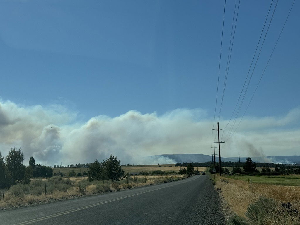
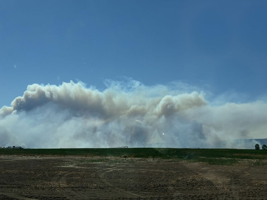
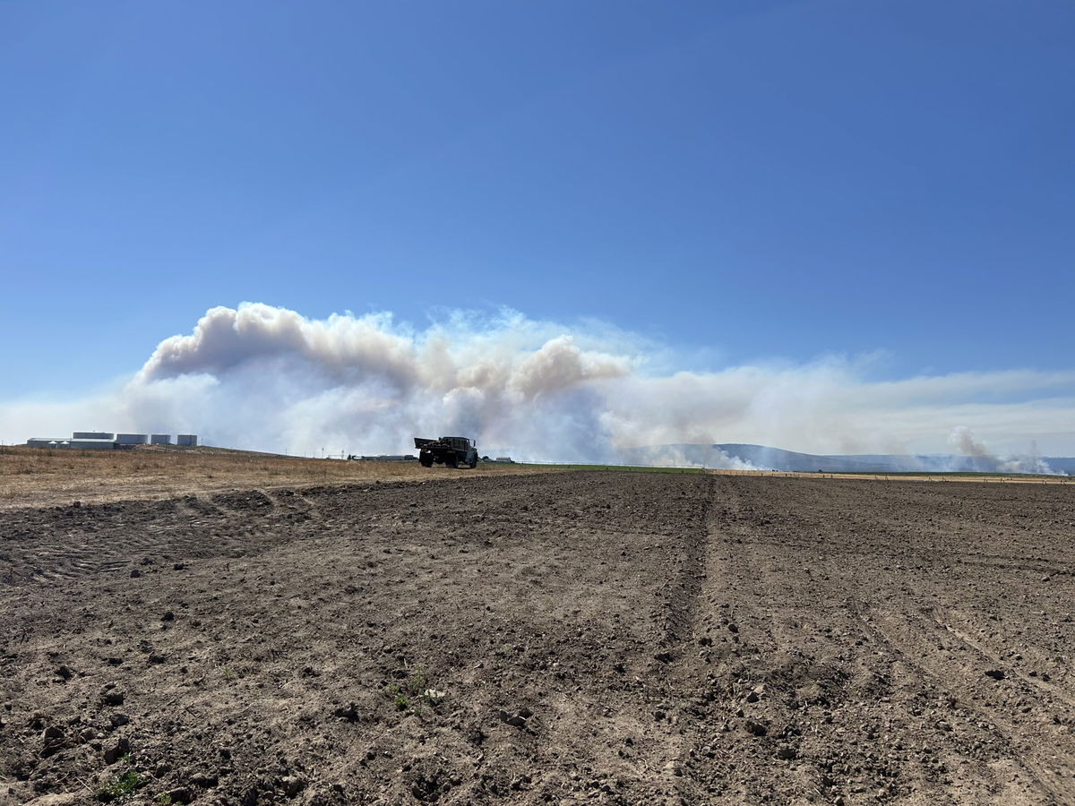
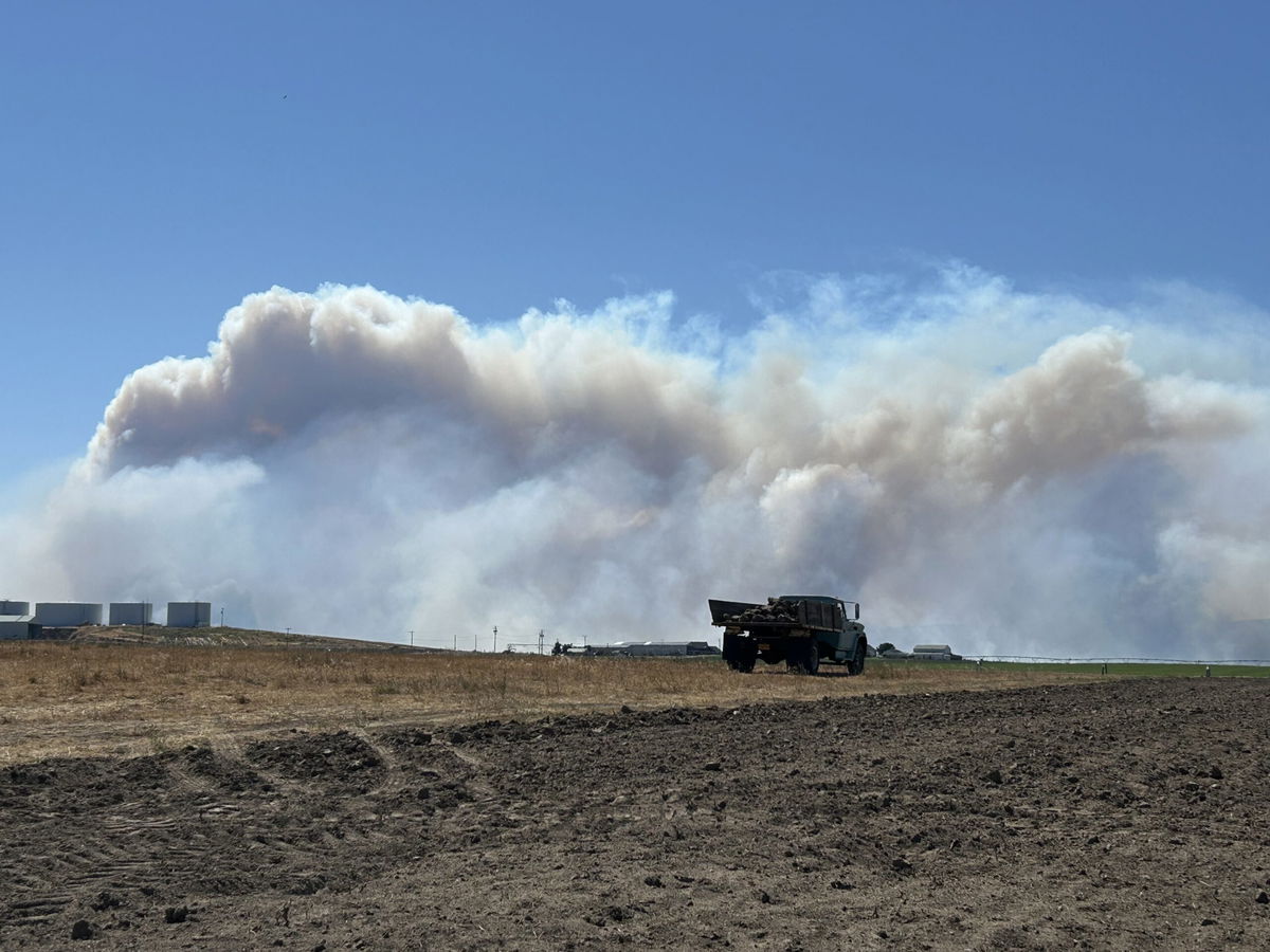
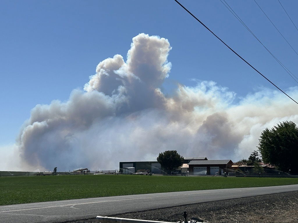
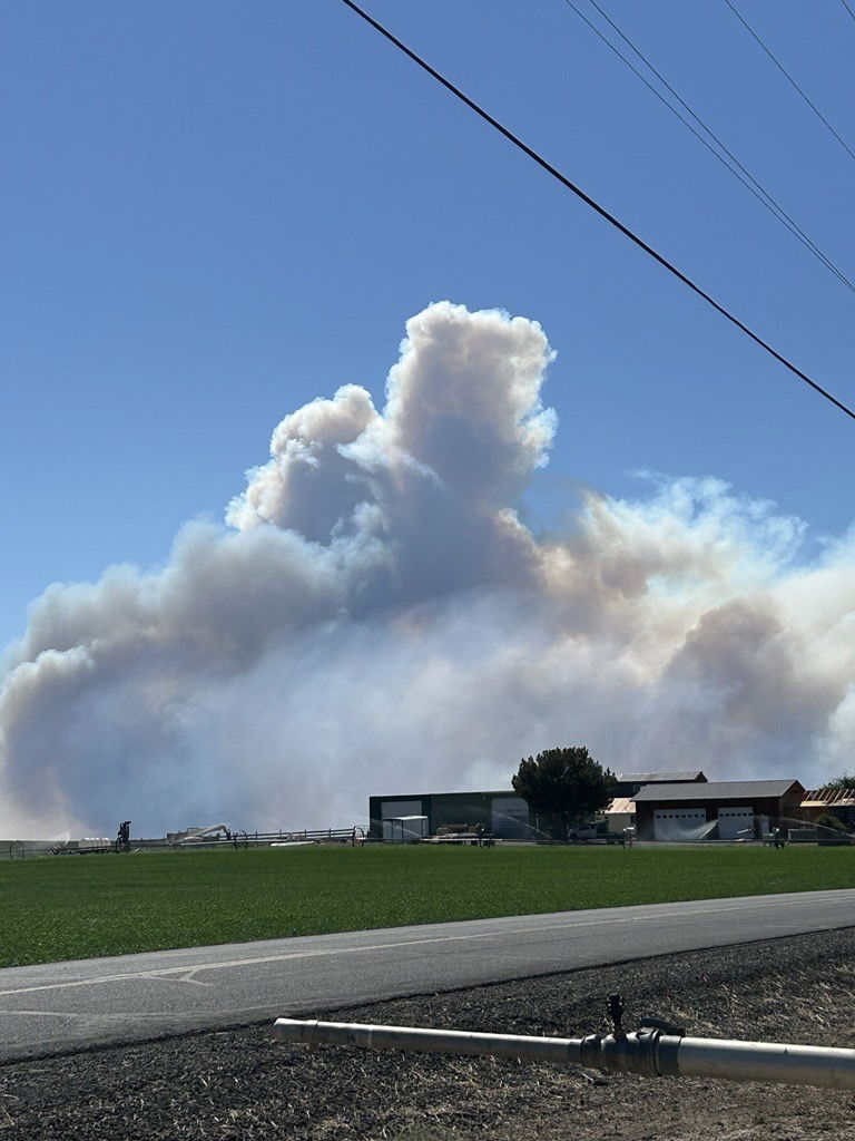
UPDATE: New photos of the Flat Fire from KTVZ News’ Claire Elmer
UPDATE: From Watch Duty:
In Deschutes County Zones SIS-011, SIS-012, SIS-013 and SIS-014 have been upgraded to Level 3 “Go Now”. Sones SIS-022 and SIS-021 have been placed on Level 2 “Be Ready” Per Genasys
In Jefferson County the southern area of Zone LBC Public Lands 3 has been upgraded to Level 3 “Go Now” per RAPTOR evacuation map
Jefferson County evacuation zones will not appear on the Watch Duty map and can be viewed on the RAPTOR evacuation map
UPDATE: Below is a press release from the Deschutes Co. Sheriff’s Office concerning potential evacuations in Deschutes County due to the Flat Fire.
Deschutes County, Ore. – Due to the growth of the Flat Fire overnight and expected fire and wind conditions today, the Deschutes County Sheriff’s Office is recommending Level 1 (Be Ready) evacuation notices for residents in the following area:
Between Whychus Creek West to Steven’s Canyon
Generally, North of the intersection of Wilt Road and Little Buck Road
Includes the far North End of Mountain View Road
Level 1 Means “BE READY“ for potential evacuation. Residents should be aware of the danger in their area and monitor emergency services websites and local media outlets for information. This is the time for preparation and precautionary movements of persons with special needs, mobile property, and (under certain circumstances) pets and livestock. Emergency services personnel may contact you via an emergency notification system if conditions worsen.
The State of Oregon has declared a conflagration for the Flat Fire after significant growth overnight. The fire made a 4-mile run last night and is now approximately four miles from the Deschutes County line.
We will continue to work closely with fire managers and provide updates as the situation develops. Please follow official channels for accurate information. The Deschutes County Sheriff’s Office will provide updates on Twitter and Facebook.
Current maps, including evacuation areas, can be found at: https://deschutes.org/emergency
For fire information, you can visit the Central Oregon Fire Information site at: www.centraloregonfire.org
Make sure you are registered for Deschutes Alerts to receive evacuation and emergency alerts and warnings in your area by going to www.deschutesalerts.org
CULVER, Ore. (KTVZ) — As of Friday morning, the Flat Fire has reached 3,300 acres, according to the Central Oregon Fire Information.
Below is recently released information from the organization:
“A Central Oregon Type 3 Incident Management Team assumed command of the Flat Fire late yesterday evening, bringing additional resources and capacity to support firefighting operations and protect nearby communities. The fire is in Unified Command with Ochoco National Forest, Bureau of Land Management, Oregon Department of Forestry, and Lake Chinook Fire and Rescue.
The fire was active overnight and grew to 3300 acres. Firefighters worked through the night to protect structures and build fire line.
Fire Behavior & Weather
Hot and dry conditions persist across Central Oregon, sustaining active fire behavior on the Flat Fire. Smoke is expected to linger in the area, with impacts varying throughout the day depending on wind direction. These conditions will continue to challenge firefighting efforts and may affect visibility and air quality for nearby residents.
Planned Activities
Firefighters will secure line created last night, continue to build fire line along the east, west, and southern end of the fire, and continue protecting structures. Fire behavior is anticipated to be similar to yesterday with the continued hot, dry and breezy conditions.
Fire Size: Approximately 3,300 acres
Fuels: Grass, brush, juniper
Resources: Aviation, Engines, Dozers, Crews
Evacuations: The Jefferson County Sheriff’s Office has issued the following:
Lake Billy Chinook 5 (Black Zone): Level 3 – GO NOW
Lake Billy Chinook 6 (White Zone): Level 2 – BE SET
Lake Billy Chinook 4 (Blue Zone): Level 1 – BE READY
For the most up to date information on evacuations visit https://www.facebook.com/JeffersonCountyORSheriff.”
EARLIER REPORTING:
Firefighters were rushing Thursday evening to contain a wildfire burning in Jefferson County, seven miles west of Culver, that grew to about 600 acres by 8:30 pm as authorities issued Level 3 evacuation orders and Level 1 and 2 alerts.

According to Central Oregon fire officials and Watch Duty, the wildfire has been named the Flat Fire. As of 5:45 p.m., the fire had grown to an estimated 100 acres, doubling within two hours as the wide smoke plume was visible over a wide area of Central Oregon.
The Jefferson County Sheriff’s Office issued Level 3 GO NOW, Level 2 GET SET and Level 1 GET READY evacuation levels near the fire.
 Evacuation Levels 3 (Red, GO NOW), 2 (GET SET) and 1 (GET READY) were issued Thursday evening for areas near the Flat Fire west of Culver
Initial resources on the fire included two Type 1 helicopters, two single-engine air tankers, six engines and five bulldozers. A Central Oregon Type 3 Incident Management Team has been ordered to help fight the fire.
This is a developing story. Stay with KTVZ News and the digital platforms of KTVZ for urgent updates.