First Alert Weather Alert remains in place for extreme heat in the valley to start the work week
Gavin Nguyen
THOUSAND PALMS, Calif. (KESQ) – It’s been a hot & humid Sunday! The moisture hasn’t dried out as much as we expected this afternoon … our dew points have stubbornly been in the 60s practically all day long. This is helping keep our high temperatures capped today.
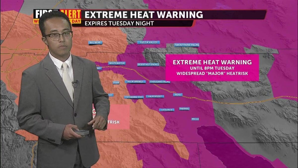
Despite the added moisture and lower air temperatures, much of the valley remains under widespread Moderate to Major HeatRisk. An Extreme Heat Warning remains in place for the Coachella Valley through Tuesday at 8:00 p.m.

We’ve had some slight chances for thunderstorms in our local Santa Rosa Mountains. Plenty of puffy cumulus clouds have returned this afternoon, though these rain chances diminish once we pass 7:00 p.m.

As of 3:30 PM, we’ve had a couple of spots around the valley see some rainfall thanks to these pop-up thunderstorms.

It looks like a very similar setup for tomorrow. Expect very humid conditions to start the day, but our FutureTrack data again tells us we should dry out into the afternoon hours. If not, though, we could see our air temperatures capped like we did on Saturday and today.
 10AM Monday
 4PM Monday
Temperatures near 115° are expected for Monday and Tuesday as the Extreme Heat Warning remains in effect (again, depending on how much moisture we see tomorrow afternoon). Highs gradually cool off as we look ahead towards the later part of the work week. The weekend is the light at the end of the tunnel: relief in the form of seasonal temperatures!
