New mapping tool provides river conditions along Snake River in Teton County, Wyo.
Curtis Jackson
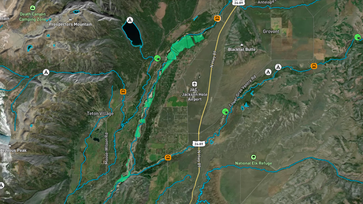
JACKSON, Wyo. (KIFI)—Fishermen and rafters can now use a new tool to identify where public and private land is located along the Snake River in Teton County.
Teton County/Jackson Parks and Recreation, in collaboration with the Snake River Fund, and with support from Community Foundation of Jackson Hole and OnWater, created a new Snake River Map Tool. The free digitized map shows real-time river conditions, highlights access and amenity locations, identifies public lands, and, for the first time, delineates recreational easements and allowable uses in the Snake River Corridor between Moose and South Park.
“It hasn’t always been easy to determine where recreational easements exist along the Snake River,” said Snake River Fund Executive Director Orion Hatch. “This tool helps landowners and the recreating public understand allowable uses in the river corridor. We think that river users will be psyched on the other tools the OnWater map has brought to the table, as well.”
In a news release, Teton County Parks and Recreation stated that Wyoming law permits boaters to float on public waters that flow over private land for recreational purposes. Recreational easements are legal encumbrances on private property titles that allow certain uses by the public.
“There are several dozen recreational easements that have been established on private property within the County-managed portion of the Snake River Corridor,” Hatch said.
Recreation uses are limited to boating, rafting, fishing, hiking, picnicking, and other similar activities. Mining, use of firearms, hunting, construction of facilities or structures, overnight camping and fires are prohibited.In 2015, Teton County adopted the Snake River Management Plan, which includes a directive to develop accurate maps that identify private and public land; and and provide information that helps boaters and landowners coexist. The Snake River Management Plan also outlines the Parks and Recreation Department’s role in regulating commercial use on the Moose to Hoback segments of the Snake River in Teton County. To review the Snake River Management Plan, visit: https://www.tetoncountywy.gov/1352/Snake-River-Management.
The new mapping tool was created with funds from Teton County, Snake River Fund, and the Community Foundation of Jackson Hole Competitive Grant. The map is intended to be used on a smartphone, utilizing GPS on the phone to provide accurate, real-time location information along the river. To download the app with fishing and paddling specific information, please visit: https://www.tetoncountywy.gov/1702/Snake-River-Map.