Wolf Fire near Banning at nearly 2,400 acres with 75% containment; Evacuation Orders downgraded
Bruno Lopez-Vega
Update 7/4/25 7:00 p.m.
CAL FIRE reports containment remains at 75%, with 2,387 acres burned. Crews will continue to strengthen the containment lines, and work on suppression repair continues. Evacuation Orders and Warnings are still in place.
Update 7/4/25 5:30 p.m.
The fire is now 75% contained, CAL FIRE announced.
Update 7/4/25 3:30 p.m.
Evacuation Orders have been changed to Evacuation Warnings for the area North of Old Banning Idyllwild, West of Highway 243, East of Old Banning Idyllwild, and South of Smith Creek, RivCo Ready announced on Social Media Friday.
All previous evacuation warnings have been canceled.
Residents are urged to use caution returning as emergency crews may still be working in the area.
For a map and more information visit: protect.genasys.com
Update 7/3/25 5:30 p.m.
CAL FIRE reports the Wolf Fire is now at 65% contained.
Highway 243 is open, though evacuation orders and warnings in the area west of Highway 243 remain in place.
Residents and travelers are urged to use extreme caution when traveling through the area, as firefighters remain actively engaged in full containment efforts along the highway.
Update 7/3/25 3:30 p.m.
Containment of the Wolf Fire grew to 55 percent Thursday afternoon, CAL FIRE announced.
CAL FIRE announced Highway 243 will reopen at 3 p.m. Thursday.
The area west of Highway 243 remains under an evacuation order.
Residents and travelers are urged to use extreme caution when traveling through the area, as firefighters remain actively engaged in full containment efforts along the highway.
Update 7/2/25 3:00 p.m.
CAL FIRE reports that the wolf fire remains at 2,414 acres and is now 40% contained. All evacuation warnings have been lifted and downgraded from evacuation orders to warnings with the exception of the fire perimeter. Officials tell residents to please use caution when returning to the area as fire crews still continue to work diligently to fully contain the fire.
Update 7/1/25 6:00 a.m.
CAL FIRE reports that evacuation orders and warnings remain in place. The fire is 2,414 acres and 35% contained.
Update 6/30/25 9:30 p.m.
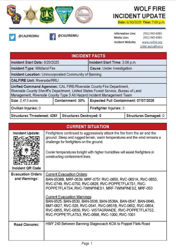
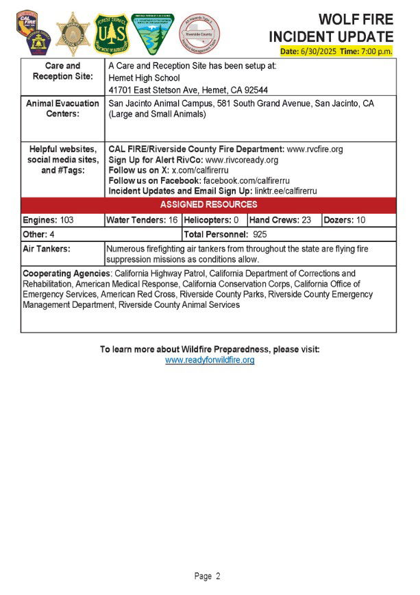
CAL FIRE reports that evacuation orders and warnings remain in place. The fire is 2,414 acres and 30% contained. Firefighters continued to aggressively attack the fire from the air and the ground. Steep, rugged terrain, high temperatures and wind remain challenging factors for firefighters. Cooler temperatures tonight, with higher humidity will assist firefighters in constructing and strengthening containment lines.
Update 6/30/25 2:30 p.m.
The fire has been mapped at 2414.6 acres by CAL FIRE Intel aircraft.
Update 6/30/25 2:00 p.m.
The fire is now 30% contained, per CAL FIRE
Update 6/30/25 11:20 a.m.
Evacuation warnings have been expanded, CAL FIRE announced.
#WolfFIRE [6/30 UPDATE 11 a.m.] EVACUATION WARNINGS have been expanded to include the following zones:
RVC-0652RVC-0528BAN-0538ABAN-0536BAN-0530BAN-0525BAN-0649BAN-0647BMT-0827
Evacuation Map Link: https://t.co/1ihemE7uvr Please be prepared to leave if necessary.…
— CAL FIRE/Riverside County Fire Department (@CALFIRERRU) June 30, 2025
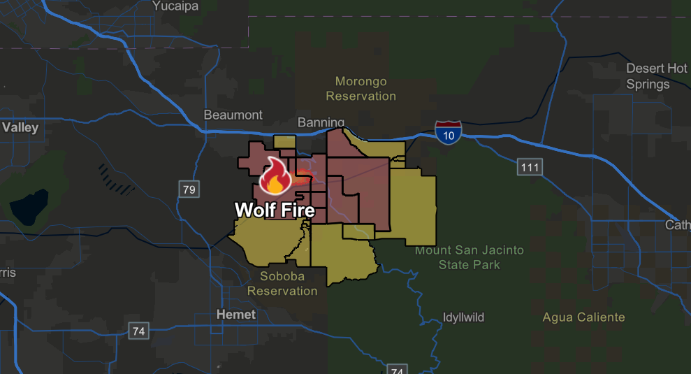
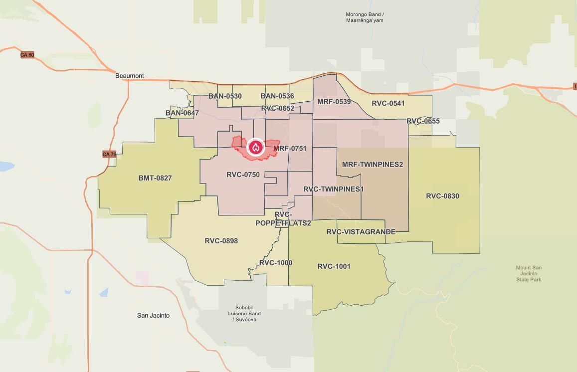 Click the image for an interactive map of evacuation orders/warnings
Update 6/30/25 9:11 a.m.
The Wolf Fire has grown to 1,400 acres scorched, and it’s now 10% contained.
Firefighters made good progress overnight. Multiple aircraft, along with hundreds of firefighters on the ground, will continue to establish containment lines. Overnight, Evacuation orders and warnings were expanded. Those can be found here.
Three firefighters have sustained non-life-threatening injuries. Stay with News Channel 3 for the latest updates.
Update 6/29/25 6:09 p.m.
The Wolf Fire has grown to 1,165 acres burned.
Evacuation orders and warnings are now in place for areas of Banning and Cabazon south of Interstate 10. Those can be found here.
Update 6/29/25 4:23 p.m.
The fire has been mapped at 62 acres and continues to burn at a moderate rate. No evacuations have been ordered.
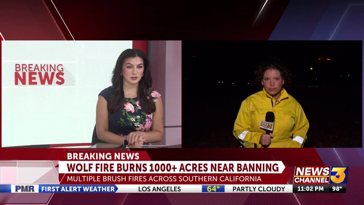
BANNING, Calif. (KESQ) Firefighters are on the scene of an approximately 20 acres vegetation fire, which they say is burning at a moderate rate of spread.
That fire first reported at 3:06 p.m. in the area Old Banning and Idyllwild Roads, near Wolfskill Truck Trail, south of Banning.
They report several air and ground resources have been assigned to aid in the fight, no injuries or evacuations have been reported at this time.
Stay with News Channel 3 for updates.