First Alert Weather Alert for Heavy Rain & Mountain Snow
Katie Boer
Get the umbrella back out we’re looking at rain returning for the second half of Thursday into the start of Saturday with total rain accumulation between 0.25-0.75”.


The First Alert Weather Team has issued a Weather Alert from 4pm Thursday to 7pm Friday — this is the time period we’ll likely see the heaviest rainfall possible.

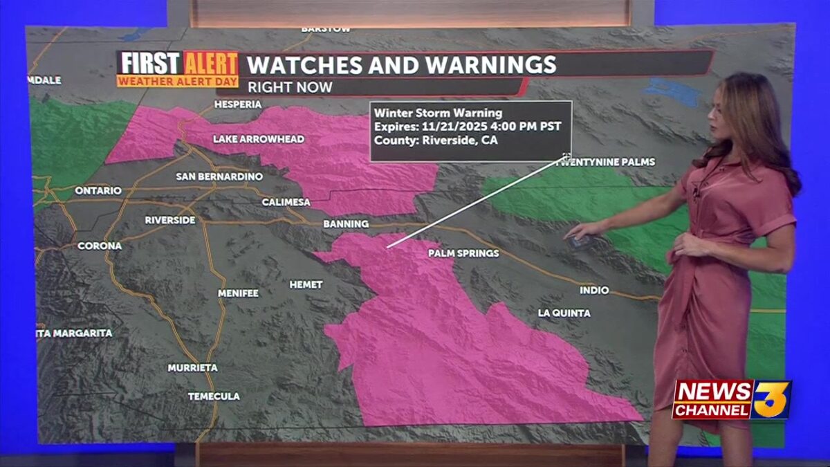
If you’re driving through the mountains at this time watch for travel difficulties. Our Winter Storm Watch has been upgraded to a Winter Storm Warning and is in place until Saturday morning above 6,500’. We could see snow totals between 2-6” at lower elevations around 6,500, 6-12” between 7,000-8,000’ and potentially 12-18” above 8,000’.

Around the valley our wetter weather begins to taper off heading into our Saturday—though a few lingering showers could remain. We’ll dry out more for the second half of the day and the remainder of the weekend looks nice, mild and dry in the 70s.
Looking ahead, we’ll see more sunshine, drier conditions and a slow warmup back to near normal temperatures heading into next week–including Thanksgiving Day.
