Foley Ridge Fire grows to 482 acres; Willamette National Forest expands closure area of trailheads, campgrounds
KTVZ
(Update: Adding video)
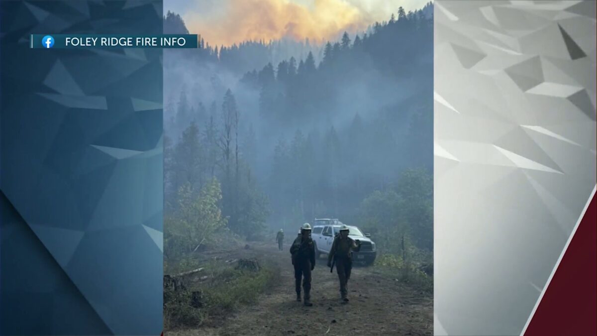
McKENZIE BRIDGE, Ore. (KTVZ) — The Foley Ridge Fire on the Willamette National Forest has grown to 468 acres, bringing the continued closure of state Highway 242 and an expanded forest closure area that includes several trailheads and campgrounds.
Here is the Thursday morning update from Foley Ridge Fire officials:
Start Date: 09/06/2025
Percent Containment: 0%
Size: 468 Acres
Cause: Lightning
Personnel: 381
Following a period of active fire on Tuesday, the Foley Ridge Fire has grown to 468 acres. Most of the activity is concentrated on the western flank, where the fire is spreading laterally down the canyon along Foley Ridge. Fire crews are currently evaluating all flanks for potential direct engagement opportunities.
Operations continue on the eastern flank, where crews are working to establish a secure anchor point. Chipping operations are advancing along Foley Ridge Road, and ground crews are actively extinguishing hot spots along the existing containment line.
The closure of Highway 242 has significantly improved access and efficiency for heavy equipment to reduce ground fuels along the northern containment boundary.
As mechanized crews advance along Foley Ridge, to the south and east of the fire, creating the shaded fuel break, ground crews are laying hose behind them.
To date, more than 30 miles of hose and 400 sprinklers have been installed to support fire suppression and structure protection objectives. An unmanned aircraft system (UAS) module will be on scene temporarily, using infrared (IR) mapping and aerial imaging to support reconnaissance and identify new operational opportunities. Please note: Willamette National Forest has expanded the closure area.
Evacuations- Lane County Sheriff has issued Level 2 (Get Set) evacuation notices for HWY 242, Yale Camp, White Branch Youth Camp, Alder Spring Campground, Scott Lake Campground, and private residences off HWY 242. For more information on evacuation status, please visit the Lane County Evacuations website.
Closures – All areas, roads, and trailheads inside the boundary of this closure area are closed, including Foley Ridge Road (Forest Service Road 2643).
Closed campgrounds include Alder Springs Campground, Scott Lake Campground, Limberlost Group Campground. Closed Trailheads include Benson/Tenas Trailhead, Hand Lake Trailhead, Linton Lake Trailhead, Obsidian Trailhead, Proxy Falls Trailhead, Scott Trailhead, Rainbow Falls Trailhead, and Separation Lake Trailhead. Inaccessible Trailheads include Foley Ridge Trailhead. For the complete Foley Ridge Fire closure order, including a map, visit our website.
Weather- Mostly sunny skies are forecast for the remainder of the week. Temperatures are consistent with the past few days, in the upper 70s, and a slight increase in relative humidity is expected. Winds will be light, 3-5 mph.
McKenzie River Highway (HWY 242)- HWY 242 is closed until further notice from HWY 126 intersection to MP 76. Please use an alternate route and expect delays. Visit Oregon Department of Transportation’s webpage for additional information https://tripcheck.com.
For more information, visit the incident website.
Per the Foley Ridge Fire Information Facebook page.