First Alert Weather Alert: Tracking monsoonal moisture, thunderstorms this weekend
Gavin Nguyen
THOUSAND PALMS, Calif. (KESQ) – Many folks across the Coachella Valley woke up to thunderclaps this morning! The thunderstorm potential we’ve been tracking for the past week has materialized and the valley has seen some rain and lightning on Saturday. Here’s a look at what our radar picked up at 10:30 a.m.

Lots of cloud cover earlier in the day and very high dew point temperatures helped keep our high temperatures suppressed for most of the day. Temperatures in Palm Springs have stayed under 100° so far. Chances for additional t-storms are decreasing and the clouds are starting to dissipate somewhat; most of the rain is to our west (through the San Gorgonio Pass) as of 3:30 p.m.

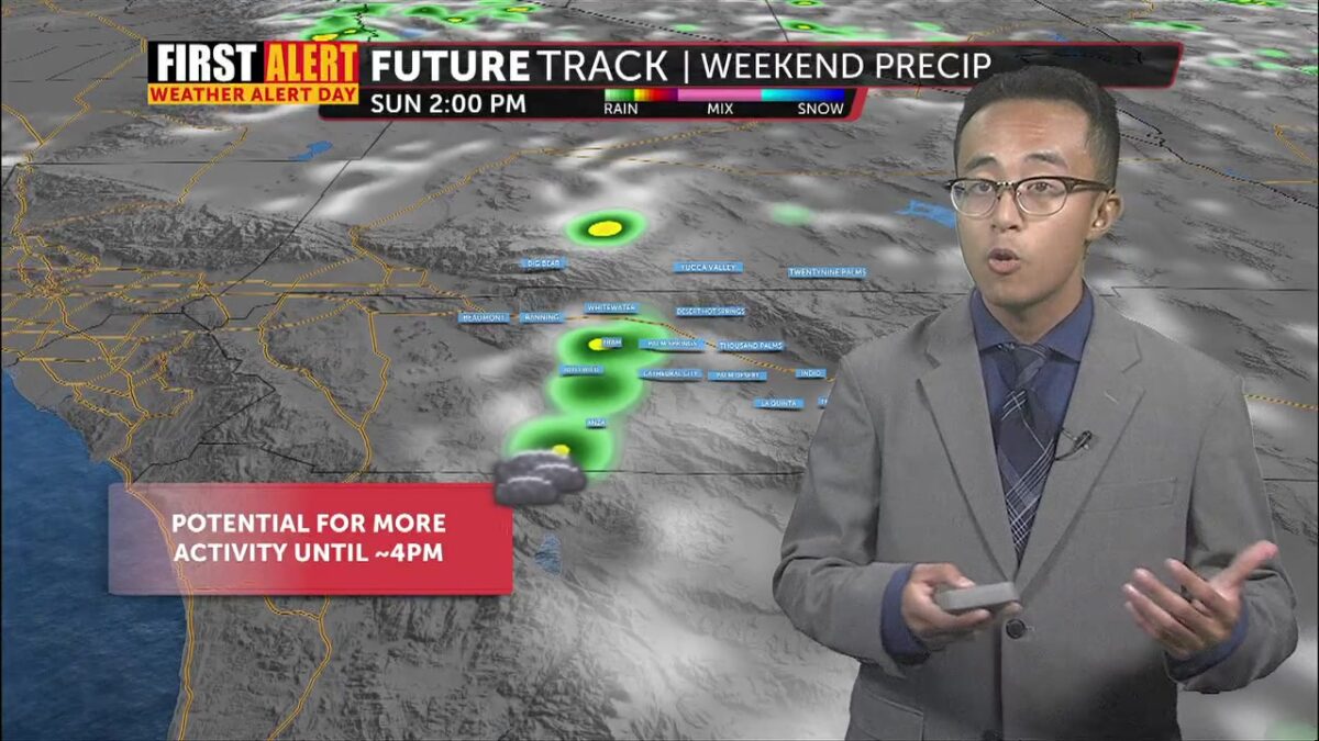
Thunderstorm chances persist as monsoonal moisture lingers through early next week. For Sunday, we’re still seeing thunderstorm potential on our FutureTrack models. The AM hours look quiet, but more clouds + rain pops up starting at noon. That potential lingers into the afternoon before decreasing again overnight. We’re definitely not ruling out more activity tomorrow, so do yourself a favor: keep an umbrella handy, just in case you get stuck in some pop-up precipitation!
 12PM Sunday
 3PM Sunday
Here’s a look at rainfall totals from the National Weather Service’s Weather & Hazards Data Viewer. Most valley cities saw under one-tenth of an inch of rainfall. Some spots in the east valley saw totals closer to one-third of an inch, while Mountain Center collected over four-tenths of an inch.

Highs tomorrow (like today) are heavily dependent on the rain and moisture we see. Right now, we’re expecting the heat to persist with temperatures above 110°, but if more rain prevents us from warming up to our full potential, that number could be closer to 100°.

Humidity sticks around through Wednesday, so we’re still keeping tabs on thunderstorm potential until then. Right now, the greatest chances for more activity are on Tuesday. As we make our way through the work week, temperatures cool off significantly. We’re expecting highs below 110° – below our seasonal average of 107°, for that matter – as we progress towards next weekend.
