First Alert Weather Alert: Extreme heat continues this weekend
Gavin Nguyen
THOUSAND PALMS, Calif. (KESQ) – We remain under an Extreme Heat Warning as an extended stretch of very hot weather continues throughout the Coachella Valley.

We’re also tracking an Air Quality Alert in place through this evening thanks to extra ozone pollution in our air. The hot weather has created more ground-level ozone, leading to smog/haze – and dangerous air quality for those with respiratory issues.

Air temperatures are down today compared to the 119° we experienced on Thursday. Our dew points have stayed elevated, and our temps have been capped by the added moisture. Our water vapor satellite imagery shows less dry air (highlighted in orange) over our region.

Dew points tomorrow morning will be very muggy according to our FutureTrack data. Some portions of the valley could be in the 70s! We dry out a bit into the afternoon, but dew points are expected to remain above 50°. This isn’t great news if you’re using an evaporative cooler to keep cool amid this extreme heat.
 10AM SUNDAY
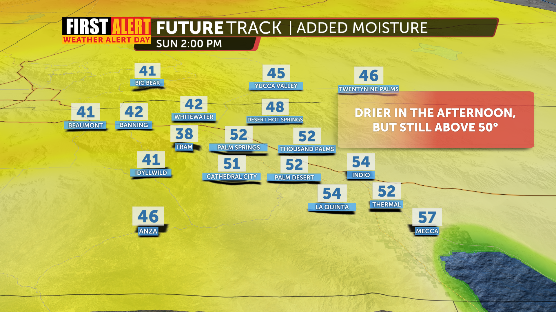 2PM SUNDAY
The extra moisture is lending itself to 10-15% chances for some thunderstorms to pop up over our local mountains and desert slopes both Saturday and Sunday. We’ve certainly seen some very puffy cumulus clouds around the valley today!
While today hasn’t been quite as hot thanks to elevated moisture, our heat indices have still been high. The National Weather Service’s HeatRisk map shows that most of the low desert will see widespread “Moderate” HeatRisk on Sunday, with some pockets of “Major” HeatRisk.

By Monday, widespread “Major” HeatRisk is expected for the valley floor, as temps are expected to climb past 115° once again.

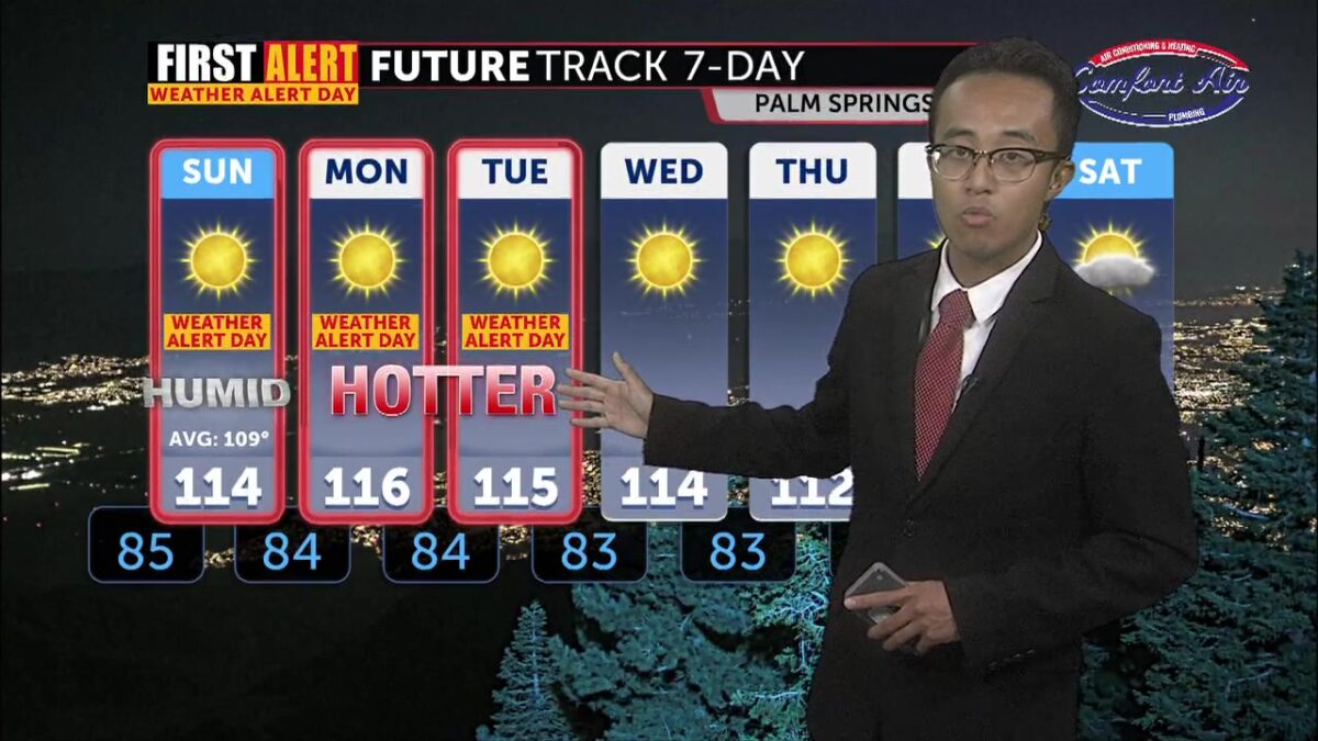
Highs tomorrow could be affected by the extra moisture we’re seeing. Right now, we’re forecasting 114° for Sunday’s high, but our temps could be capped depending on how much we do (or don’t) dry out. Our First Alert Weather Alert stays in place through Tuesday, matching the Extreme Heat Warning still in place for the desert. Highs keep climbing to 115° or beyond Monday and Tuesday, but some relief is on the way: a trough settling along the West Coast by next weekend should drop our highs near seasonal normals.
