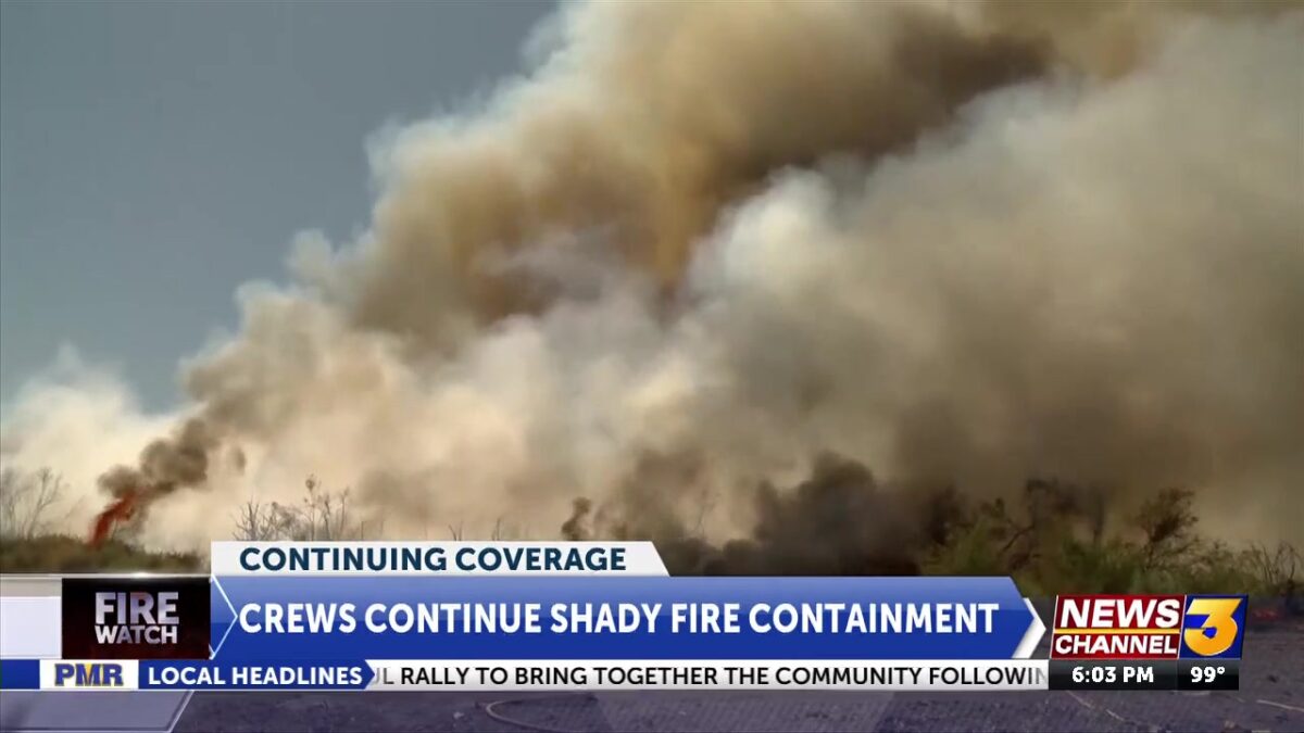
Shady Fire in Coachella burns 52.4 acres with 100% containment, evacuation lifted
Cynthia White
THERMAL, Calif. (KESQ) – 07/27/2025 9:53 PM: The fire is now 100% contained at 52.4 acres.
UPDATE 7/27 8:25 AM: The fire is now 80% contained at 52.4 acres.
UPDATE 7/26 9:00 PM: The evacuation order has been lifted and all roads in the area are now open. Please use caution when returning to the area as firefighters continue working to fully contain the fire.
UPDATE 07/26 6:50 PM: CAL FIRE/Riverside County Fire is now 65% contained at 52.4 acres. The evacuation warnings have been lifted. The evacuation order for the area immediately surrounding the fire perimeter remains in place.
CAL Fire Authorities are still re-evaluating road closures on Shady Lane and Cesar Chavez and will make a decision when heavy equipment is removed from the area.
UPDATE 07/26 7:00AM: – CAL FIRE/Riverside County Fire reports that firefighters worked through the night to build containment lines, and the fire remains 15% contained. Fire personnel will remain on-scene through today mopping up hot spots. The evacuation order and warning areas remain in place and will be re-assessed when conditions allow.
UPDATE 7/25/2025 8:40 P.M. – CAL FIRE/Riverside County Fire has made changes in evacuation orders and warnings.
Evacuation Orders:RVC-1844-A
North of Avenue 55
South of Avenue 54
East of Harrison Street
West of Shady Lane
Evacuation Warnings:RVC-1844-BCOA-1784-ACOA-1786-A
North of Avenue 55
South of Avenue 53
East of Shady Lane
West of Tyler Street
Link for the Genasys Evacuation Map: https://protect.genasys.com/search
Firefighters continue to reinforce containment lines and will monitor throughout the evening for hot spots. Please use caution when moving through the area.
The American Red Cross is currently assisting seven displaced residents.
A care and reception center has been established at Desert Mirage High School, 86-150 66th Avenue, Thermal.
An animal shelter has been established at Coachella Valley Animal Campus, 72-050 Pet Land Place, Thousand Palms.
UPDATE 7/25/2025 7:13 P.M. – CAL FIRE/Riverside County Fire reports that the Shady Fire in Coachella has spread to 50 acres and is 15 percent contained.
An estimated 32 engines with crews are there working on knocking down the flames. No structures have been destroyed, and no injuries have been reported.
Road closures and evacuation orders and warnings remain in effect.
UPDATE 7/25/2025 5:54 P.M. – Riverside County Sheriff’s Office reports that road closures are in effect in the area of the fire:
-Shady Lane is closed from Airport Blvd to Avenue 54.
-Harrison Street is closed from Airport Blvd to Avenue 54.
Desert Mirage High School, located at 86150 Avenue 66 in Thermal is open to all evacuees.


UPDATE 7/25/2025 5:30 P.M. – CAL FIRE/Riverside County Fire reports the “Shady” fire in Coachella has reached 40 acres with zero percent containment.
There is no information yet as to the cause of the fire.

UPDATE 7/25/2025 4:09 P.M. – CAL FIRE/Riverside County Fire reports the fire is now at 10 acres.
Evacuation orders have been issued for the following zones:
COA-1784
COA-1786
RVC-1844
RVC-1842
North of Airport
South of Avenue 52
East of Van Buren
West of Highway 111
Evacuation warnings have been issued for the following zones:
RVC-1783
RVC1920
AIR-1843
North of Airport
South of Avenue 52
West of Van Buren
East of Monroe Street
Link for the Genasys Evacuation Map: https://protect.genasys.com/search
COACHELLA, Calif. (KESQ) – CAL FIRE/Riverside County Fire is reporting a vegetation fire near Avenue 54 and Shady Lane in an unincorporated area near Coachella.
The fire call came in just before 3:00 p.m. Friday afternoon, with firefighters arriving to the vegetation fire with black smoke and heavy fuels. They are reporting that the fire is moving at a slow rate of spread.
Additional resources were requested to assist in knocking down the flames.
Stay with News Channel 3 for updates.