Aguanga Fire: 1,096 acres, 95 percent contained, Highway 371 open, evacuations orders downgraded to warnings
City News Service
UPDATE: 7/21/25 11:30 A.M. – CAL FIRE reports that the Dale Fire remains at 1,096 acres and is now 95% contained. As of Sunday afternoon, the last evacuation order that remained was downgraded to an evacuation warning for the affected areas. CAL FIRE reports, “Crews will continue working through the night extending containment lines, griding the interior of the fire and validating existing lines from anyhidden smoldering pockets.”
UPDATE: 7/18/25 7:00 P.M. – CAL FIRE reports that the fire remains at 1,096 acres and is 45% contained. Crews will continue through the night working hotspots and reinforcing the lines.
UPDATE: 7/18/25 8:36 A.M.- CAL FIRE reports that the Dale Fire is now 34% contained at 1,096 acres. Officials say the cause of the fire is still under investigation and evacuation orders are still in place.
UPDATE: 7/17/25 3:15 P.M. – A five-acre fire triggered by lightning in Anza is being incorporated into the Dale Fire in Aguanga, CAL FIRE announced.
[UPDATE @ 3:00 p.m.]: The fire is being incorporated into the #DaleFIRE. Visit the link below for further updates.👇🔗https://t.co/3uxBz2BXZ7
— CAL FIRE/Riverside County Fire Department (@CALFIRERRU) July 17, 2025
UPDATE: 7/17/25 6:30 A.M. – Highway 371 is back open in all directions. Evacuation orders and warnings remain in place.
UPDATE: 7/16/25 9:54 P.M. – CAL FIRE is mapping the Dale Fire at 1,072 acres, and report that crews are making good progress on the perimeter of the fire. Evacuation orders and warnings remain in place.
Per CAL FIRE:
Evacuation Orders:
CBI-CAHUILLA1
RVC-LAKERIVERSIDEESTATES4
RVC-TABLEMT4
RVC-TABLEMT5
RVC-2327
RVC-TULE1
RVC-TULE2
RVC-TULE4
RVC-TULE6
RVC-TULE7
RVC-TULE8
Evacuation Warnings:
RVC-2280-B
RVC-2369
RVC-TABLEMT3
RVC-TABLEMT6
RVC-TULE3
RVC-TULE5
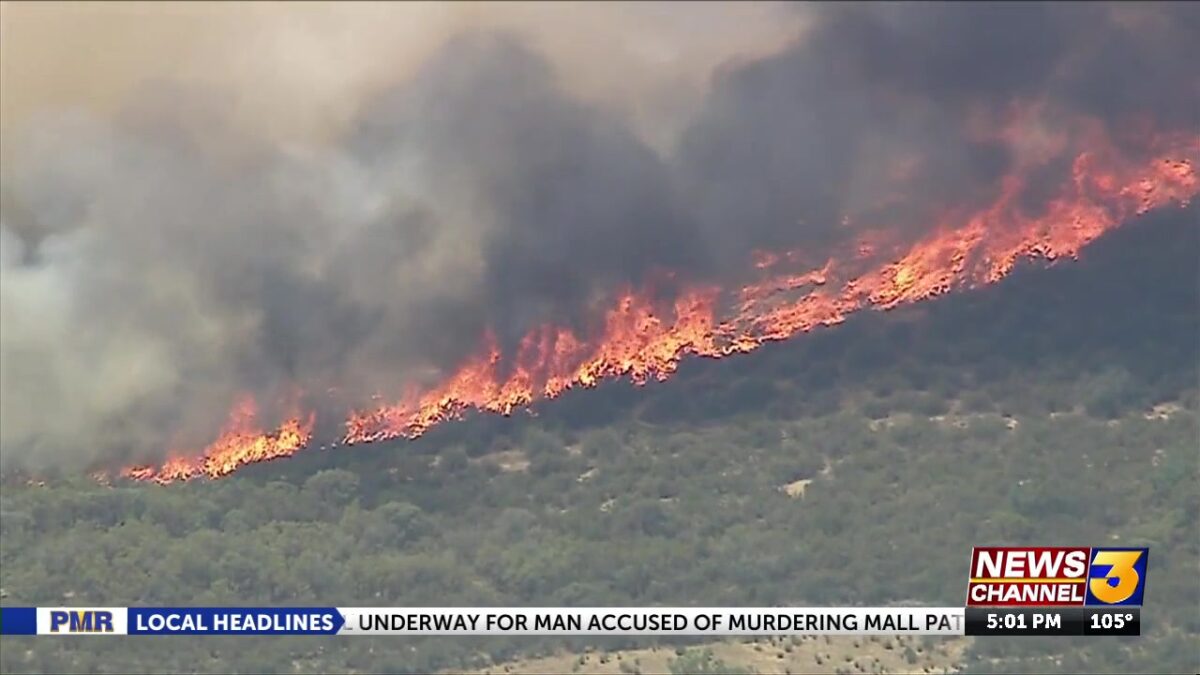
AGUANGA, Calif. (KESQ) – Two brush fires that erupted Wednesday less than a mile apart in Aguanga were combined to be called the Dale Fire, scorching over 1,000 acres, destroying several structures, prompting evacuations and forcing the closure of a highway.
The blazes were reported at 12:35 p.m. Wednesday — the first in the area of Riverdale Drive and Highway 371, the second about three-quarters of a mile to the south at Bradford Road and Gelding Way — according to the Riverside County Fire Department.
The fire was earlier mapped at 330.4 acres by FIRIS Intel 24.
#DaleFIRE [UPDATE 2:30PM]: The fire is now 220 acres.
Evacuations ORDERS are in place for the following zones:RVC-TULE1RVC-TULE2RVC-TULE4RVC-TULE6RVC-TULE7RVC-TULE8RVC-2327RVC-LAKERIVERSIDEESTATES4RVC-TABLEMT4RVC-TABLEMT5CBI-CAHUILLA-1
Evacuation WARNINGS are in… pic.twitter.com/NYH0gLwgsb
— CAL FIRE/Riverside County Fire Department (@CALFIRERRU) July 16, 2025
The agency said multiple engine and hand crews from the county and surrounding agencies were sent to the location and encountered flames moving at a rapid rate at the larger brusher along Riverdale.
At least two structures, possibly vacant outbuildings, were consumed by the flames, according to officials at the scene. The second fire at Bradford was slower but also damaged two to three structures, burning two to three acres, officials said. The forward rate of spread on that blaze was stopped by 1:45 p.m.
Seven Cal Fire air tankers and three water-dropping helicopters initiated runs on the larger fire at 1:10 p.m. The flames continued progressing in the direction of Cahuilla Creek Motocross and the Cahuilla Casino Hotel, both south of Highway 371, about 1.5 miles to the east of the brushed.
Evacuation orders were implemented by sheriff’s deputies for properties southeast of the Lake Riverside Estates. The motocross track, casino and properties along the boundary of the Cahuilla Indian Reservation were under evacuation warnings as of 2 p.m.
Both sides of Highway 371 were shut down for public safety between the casino turnoff at Homestead Road to the east and Barbara Trail to the west, spanning roughly seven miles.
There was no immediate word regarding how the fires started.