Weather Alert Day: Severe threat exits as front sinks south this weekend
John Ross
An ABC 17 Stormtrack Weather Alert Day has come to an end early Saturday morning after a line of strong to severe storms tracked through the area.
Severe storms were most widespread in western Missouri, where 70+ mph wind gusts were reported near Kansas City. The line of storms weakened as it rolled through Mid-MO in the early overnight, but flood alerts were still activated as heavy rain pounded parts of the area.

The weekend ahead will carry more scattered chances of rain, but no severe storms are expected.
SETUP
An upper level trough will drag a surface cold front into northeast Kansas and northwestern Missouri late Friday. We will be hot and humid ahead of this, which will contribute to high levels of instability ahead of the front. The front is not incredibly strong but it will serve as a focus for storm development through the evening. As the evening progresses, the storms will grow and spread to the southeast with access to just enough energy and wind support.
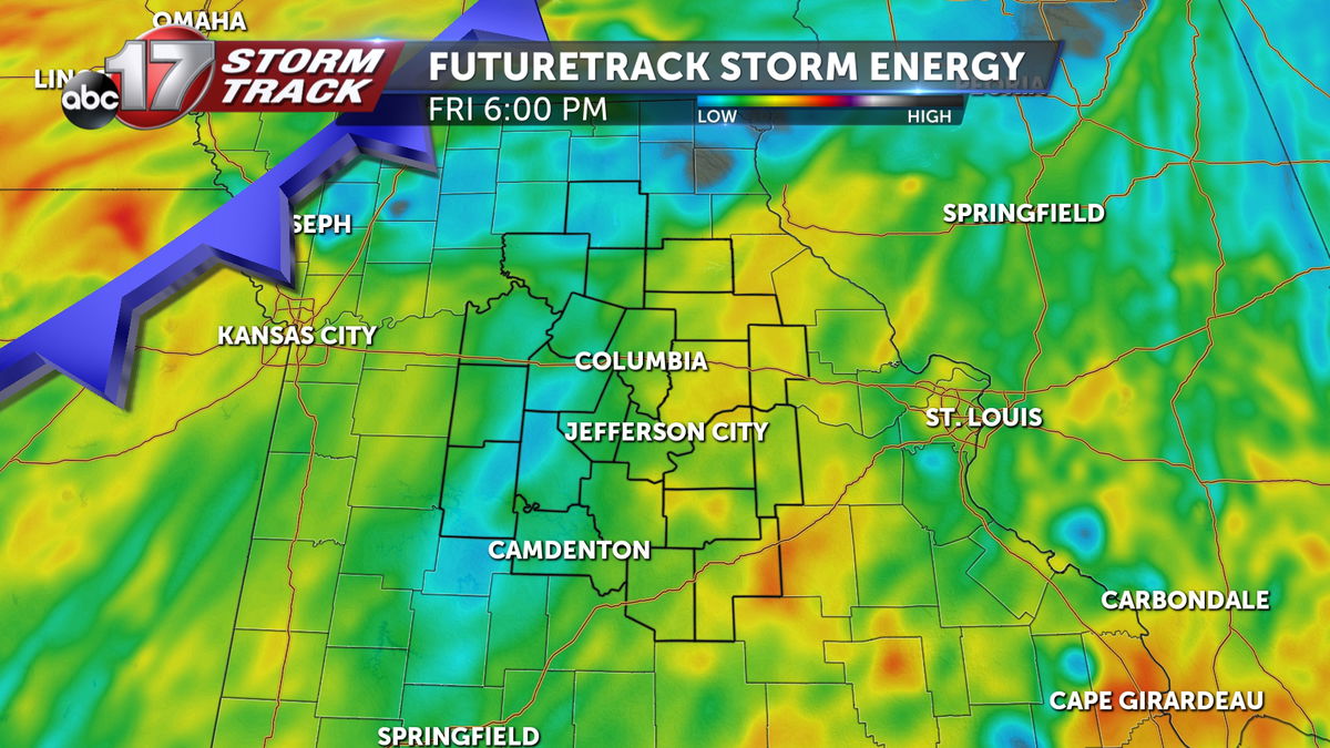
The timing of storms locally will greatly impact the expected hazards. A later arrival gives us a short window of instability (energy) before much of it is lost with sunset. If storms develop closer to mid-Missouri, we can expect them to be stronger.
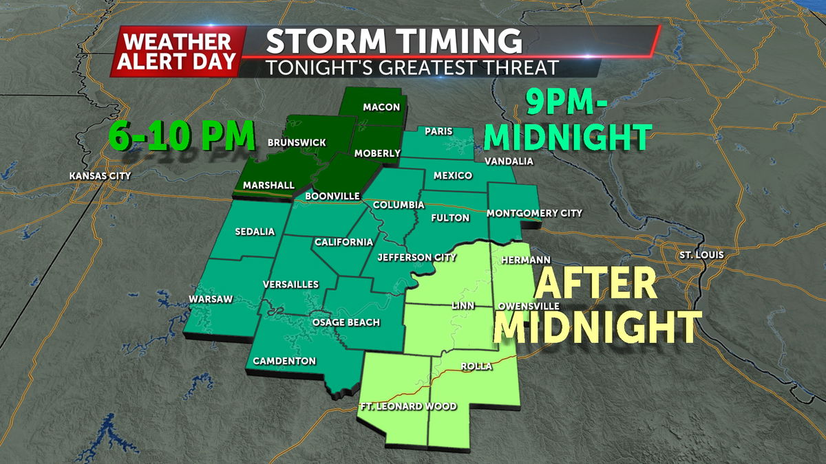
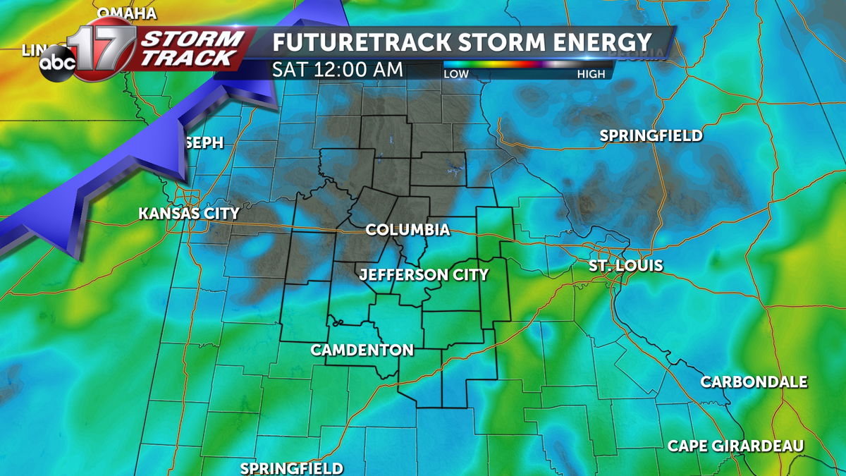
Either way, the storms will be strongest in the northwest, and weaken with time as they spread southeast. Columbia and Jefferson City will have a chance for severe storms, but the main concern will be gusty winds.
FUTURETRACK
HAZARDS
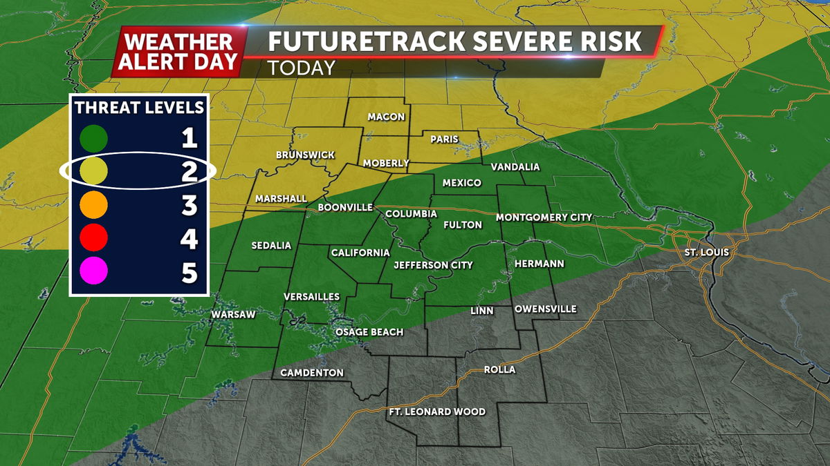
The greatest risk area will be along and north of a line from Marshall to Paris. This is where surface instability, or storm energy, will be greatest near these storms. This is where an isolated tornado will be possible. However, a more likely impact will be localized hail and damaging winds. These are the threats that may linger with the strongest storms as they weaken and push southeast towards Columbia and Jefferson City. The overall threat for severe weather in Columbia and Jefferson City is very low. The severe impacts from Friday’s storms are largely expected north of I-70.
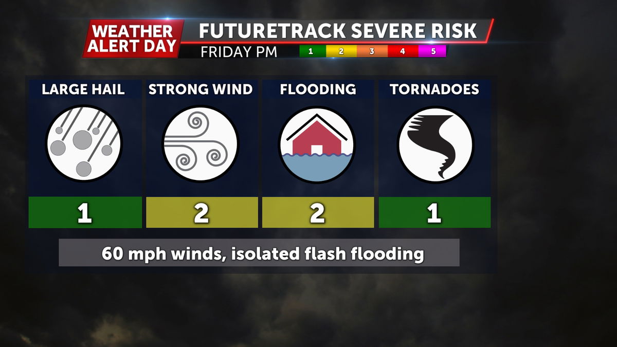
Strong winds are the main concern, but a tornado cannot be ruled out early in the evening. The tornado threat will likely end early and will not require you to stay up all night.
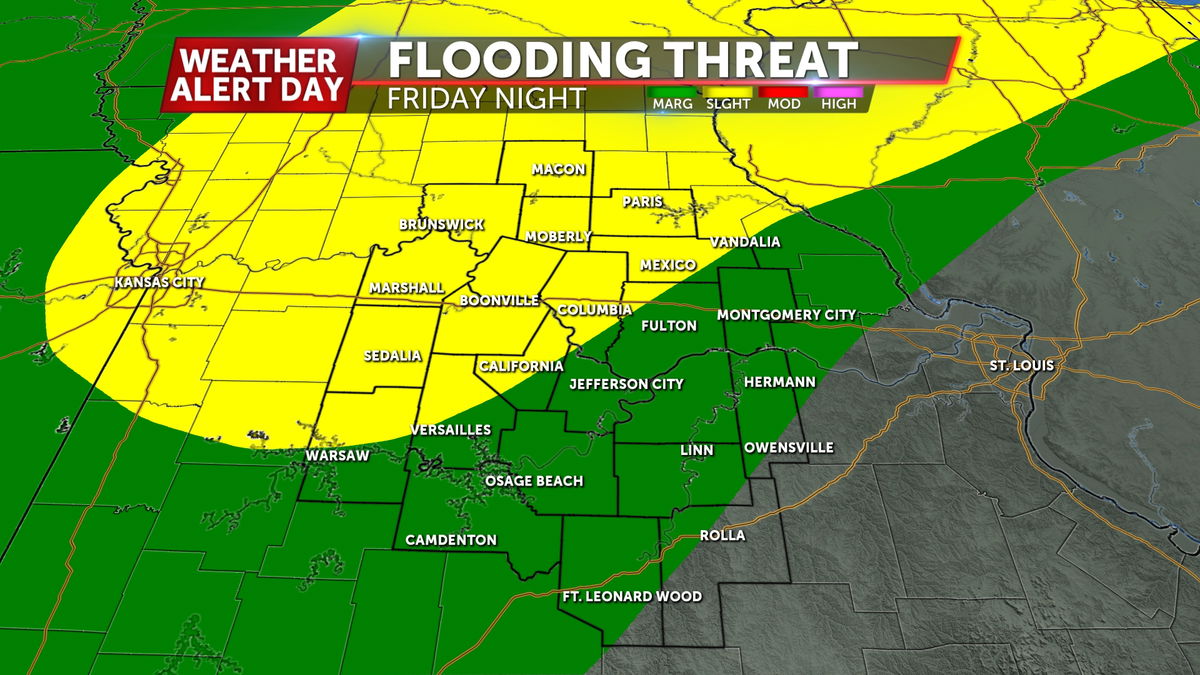
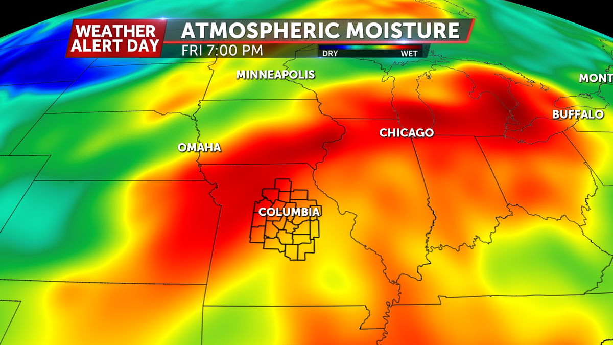
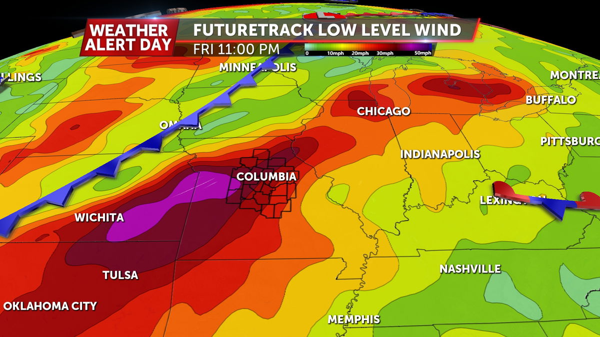
A secondary risk would be the potential for areas of isolated flash flooding as some storms could move over the same areas more than once, and we’ll see strong low level winds coupled with high atmospheric moisture content to aid in higher rainfall rates.
Make sure to have the ABC 17 Stormtrack Weather App downloaded if you have outdoor plans Friday night.