County Air Pollution Control District unveils new interactive map of all permitted sites and real-time air quality updates

Andrew Gillies
SANTA BARBARA COUNTY, Calif. – The Santa Barbara County Air Pollution Control District announced an upgraded version of its Permitted Facilities Map, an interactive online tool of the county’s permitted stationary sources of air pollution.
Upgrades include real-time Air Quality Index updates, enhanced search options, improved graphics, and comprehensive facility data as well as mobile and tablet friendly versions shared the Santa Barbara County Air Pollution Control District in a press release Wednesday.
The county-wide organization first launched its Permitted Facilities Map in 2017 and was designed to be a tool for the public to use to access and visualize stationary sources of pollution the regulator assesses explained the District.
“We are proud to be one of the only air districts in California to provide such a transparent way for thepublic to access facility records,” said Aeron Arlin Genet, Executive Director of the Santa Barbara County Air Pollution Control District. “Whether someone is casually searching for information or looking to do an in-depth search, our map provides a complete picture for all of the sources within our regulatory jurisdiction.”

The image above is taken from the upgraded Permitted Facilities Map. Those diamonds with numbers inside are the Air Pollution Control District’s Air Monitoring Stations that are updated with the latest Air Quality Index information.
Each of the other items on the map are clickable inputs that list important information about each stationary source including permits, annual reports, emissions, and Notices of Violation.
Not pictured in the image above is a universal search box at the top right of the map that can be used to search for the following inputs:
Facility Name
Five-Digit Facility ID Number
Facility Type (A handy drop down menu below the search bar allows users to sort by category)
Company Name (Both Current and Historical)
Four Digit SIC Number
Five Digit Stationary Source ID Number
Facility Street Address
Facility APN (Assessor’s Parcel Number)
Permit Number
Permit Description
Equipment Description
The map below, courtesy of the Santa Barbara County Air Pollution Control District, shows the exact locations of those ambient air monitoring stations.
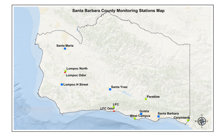
The Santa Barbara County Air Pollution Control District jurisdiction includes the cities of Santa Maria, Guadalupe, Lompoc, Buellton, Solvang, Goleta, Santa Barbara, and Carpinteria; unincorporated areas of the County of Santa Barbara; the Channel Islands of San Miguel, Santa Rosa, Santa Cruz, and Santa Barbara; and offshore oil platforms.
Still have questions?
Visit the Santa Barbara County Air Pollution Control District’s ‘About the Permitted Facilities Map’ webpage.