Officials report ‘good progress’ on human-caused, 3,441-acre Alder Springs Fire; community meeting planned
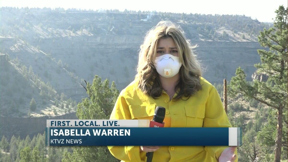
Isabella Warren
CROOKED RIVER RANCH, Ore. (KTVZ) – Officials said Tuesday was a day of good progress on the lines of the day-old Alder Springs Fire, newly mapped at over 3,400 acres.
Officials also announced on the Alder Springs Fire Facebook page that a community meeting will be held Wednesday evening at 7 p.m. at the Terrebonne Community School, located at 1199 B Avenue, to provide the latest fire updates to the community.
Fire officials said late Tuesday: “Firefighters have made good progress today. Air resources provided water & retardant drops, stopping fire progress in many areas around the fire.
“Crews are actively working in the hard-to-access canyons, mopping up & securing perimeters,” they added.
According to the Northwest Coordination Center, the Alder Springs Fire has been determined to be “human-caused” and is estimated to be contained by July 1st.
As of Tuesday afternoon, more than 350 structures, including homes, have been threatened; while 140 firefighters are working to contain the fire.
Earlier story:
CROOKED RIVER RANCH, Ore. (KTVZ) — Firefighters and other resources from across the state were on scene or heading to Jefferson County on Tuesday to help regional crews battling the fast-moving Alder Springs Fire, which grew to 2,500 acres in a matter of hours Monday and prompted evacuations and warnings at Crooked River Ranch and Lake Billy Chinook.
A fire camp was set up at the Sisters Rodeo grounds, with the Oregon State Fire Marshal sending in crews and engines from Southern Oregon, the Willamette Valley and elsewhere to protect homes from the flames.
Officials advised the public Thursday afternoon that a large smoke plume on the south side of the blaze was from a firing operation crews were conducting to tie bulldozer lines to the main fire.
“This will bring the fire perimeter to a place that has been reinforced with fire retardant, where firefighters can secure the perimeter,” they added.
An Alder Springs Fire Facebook page has been created to share official information.
“OSFM Red Incident Management Team briefed this morning and is now in unified command with the Central Oregon Type 3 Team,” a posting there stated Tuesday morning. “Two structural task forces arrived last night, and six more arrived this morning and are currently in the Crooked River Ranch community for structure protection.
“Wildland firefighters are working hard on creating fire lines in an attempt to stop and slow down the fire’s progress,” the update said.
Evacuated Crooked River Ranch resident Susan Strange was among the many who are worried that such a large, early fire means a very troublesome summer ahead.
“I’m no expert, but that seems unusual,” Strange told us Monday evening.
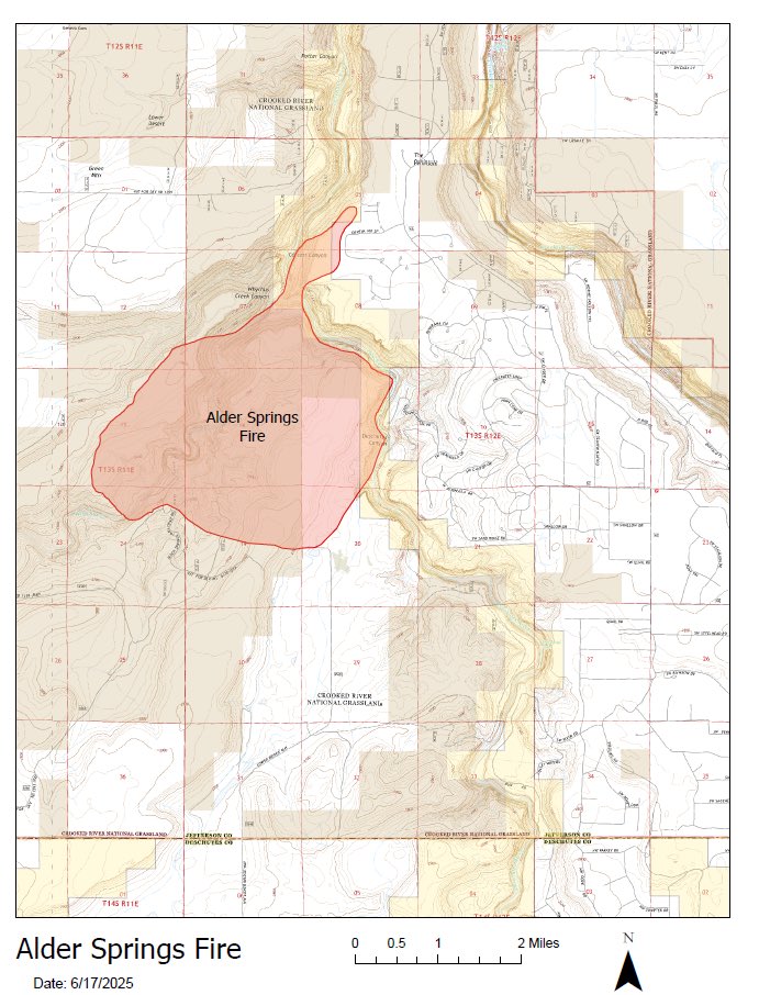 Tuesday’s general map of the Alder Springs Fire; officials say they’ll have a more detailed map later
—
Here’s the full Tuesday morning update from Central Oregon fire officials:
Firefighters, dozers and engines worked into the night on the Alder Springs Fire burning in steep and rugged terrain on the Crooked River National Grassland, Prineville District BLM-managed lands, and private land protected by the Oregon Department of Forestry and Lower Bridge Rangeland Fire Protection Association (RFPA).
The Alder Springs Fire is estimated to be 2,500 acres and is 0% contained.
Fire activity moderated with lower temperatures and higher relative humidities last night and crews staying engaged with structure protection through the night, with no damages to homes or outbuildings. Today, firefighters will be working to secure the perimeter where accessible and safe to engage. The highest priority will be accessing Carcass Canyon to prevent additional spotting to the east, across the Deschutes River. Firefighters will work, along with the support of aerial resources, to secure the fire east of the Deschutes River that is threatening Crooked River Ranch.
The Central Oregon Type 3 Incident Management Team has taken command of the fire alongside resources that have been engaged since yesterday to contain the blaze. The Oregon State Fire Marshal (OSFM) Red Team under the command of Ian Yocum has been mobilized and will join the two task forces of structure protection resources in place and the six more coming in today. They will be in unified command of the incident alongside the Central Oregon Type 3 team as of 9:00 a.m. today.
Weather conditions will be similar to yesterday, creating challenging conditions for firefighters with hot, dry weather with westerly winds pushing the fire towards values at risk. Crews, engines, dozers, skidgen and structure protection task forces will be actively working to suppress the fire and secure the perimeter with continued help from air tankers, helicopters and single-engine scoopers to cool hot spots and slow the spread of the fire from the air.
All evacuations issued by the Jefferson County Sheriff’s Office and the Deschutes County Sheriff’s Office remain in place today.
Evacuations: Jefferson and Deschutes County Sheriff’s Office have issued the following evacuations: A Level 3 (GO) evacuation order for CR06, CR07, CRR8, CR10N, CR10S, CR11, CR12, CRPL2; a Level 2 (SET) evacuation warning for zones CR02M, CR02N, CR02NW, CR02SW and CR09, as well as Deschutes Campground at Cove Palisades, along the river and campground; and a Level 1 (READY) evacuation advisory for CR02E, CR02NE, CR02SE, CR03M, CR03N, Lake Billy Chinook Public Lands 3, RED-101, RED-91, RED-92 and SIS-016. For more information on evacuation notices, visit:Deschutes County Evacuation Map: https://tinyurl.com/DeschutesCountyEmergencyJefferson County Evacuation Map: https://tinyurl.com/JeffersonCountyEmergencyMap
A temporary evacuation point has been established at Highland Baptist Church: 3100 SW Highland Avenue, Redmond, OR. A large animal shelter has been established at the Deschutes County Fairgrounds at 3800 SW Airport Way, Redmond, OR.